Discover the
Peak District
With its soaring valleys, windswept moors and jaw-dropping views, the Peak District is a walker’s playground, with long-distance and day routes for all abilities. Here’s everything you need to plan an enjoyable hike and take in the scenery in England’s oldest national park

What and where is the Peak District?
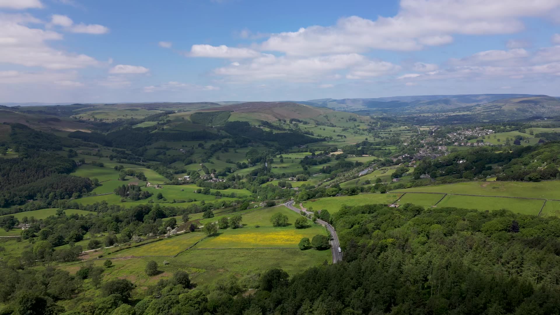
Covering an area of 1,438 square kilometres/555 square miles at the southern end of the Pennines, the Peak District includes parts of Derbyshire, Cheshire, Staffordshire and Yorkshire. Designated as the UK’s first national park in 1951, it remains one of the most accessible, with major cities including Manchester and Sheffield just a short drive or train ride away.
While the northern half of the Peak District is dominated by high gritstone moorlands and blanket bogs (Dark Peak), the central and southern limestone plateau (White Peak) features rolling hills and scenic valleys, flanked by the rivers Dove to the west and Derwent to the east.
For the millions of visitors who come to the Peak District every year, it’s not just wilderness, it’s a living landscape with farms, homes and rich cultural heritage. This is a place where you can combine challenging trails, stunning landscapes, pretty villages and cosy country pubs in a single day.

Planning a walk
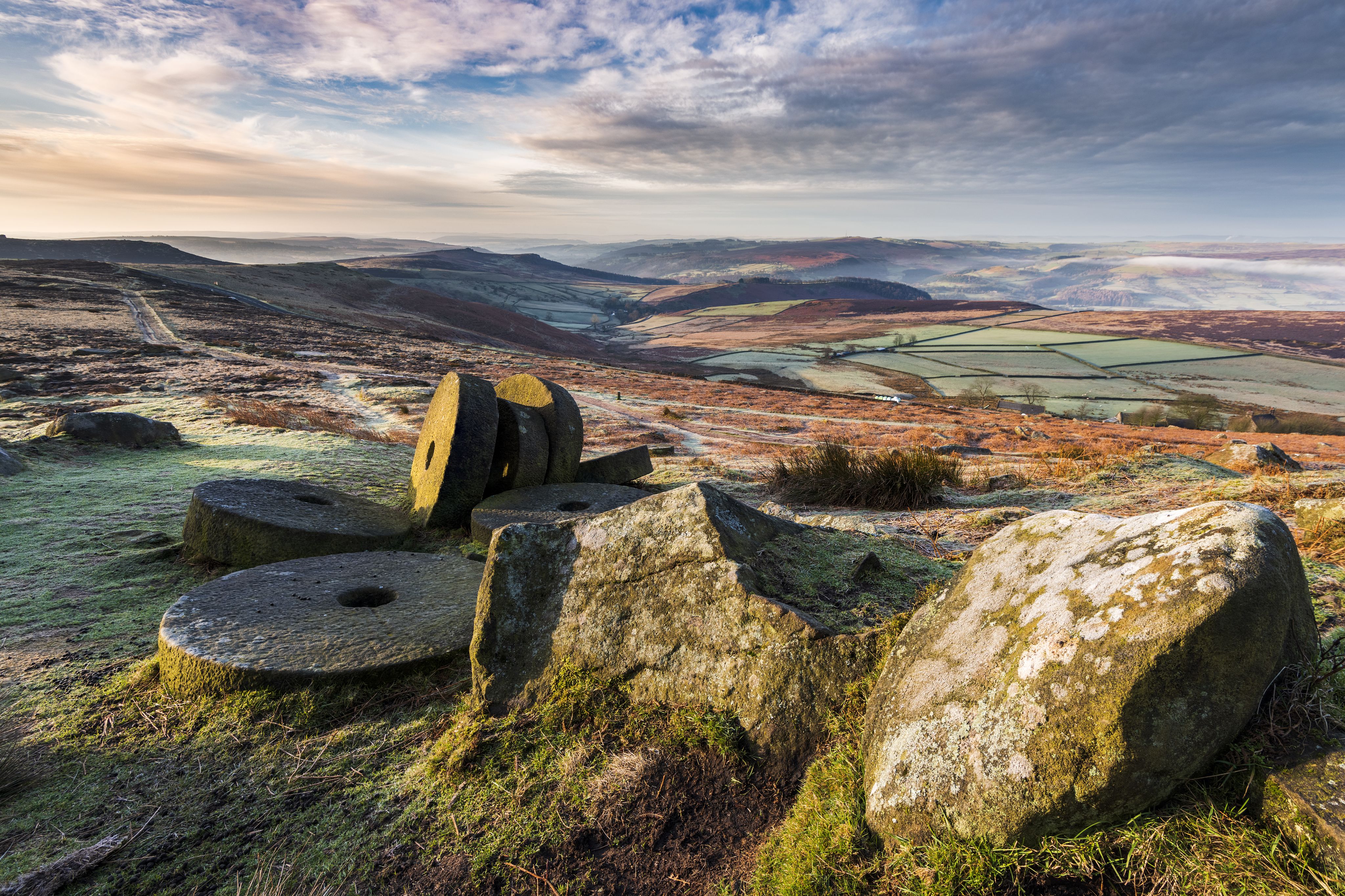
The Peak District’s varied landscape of sweeping limestone dales, majestic moors, ancient forests and photogenic villages has made it a playground for walkers, who come to conquer its summits and soak up the views. Whether you want a challenging hike or a shorter stroll, there’s something for everyone.
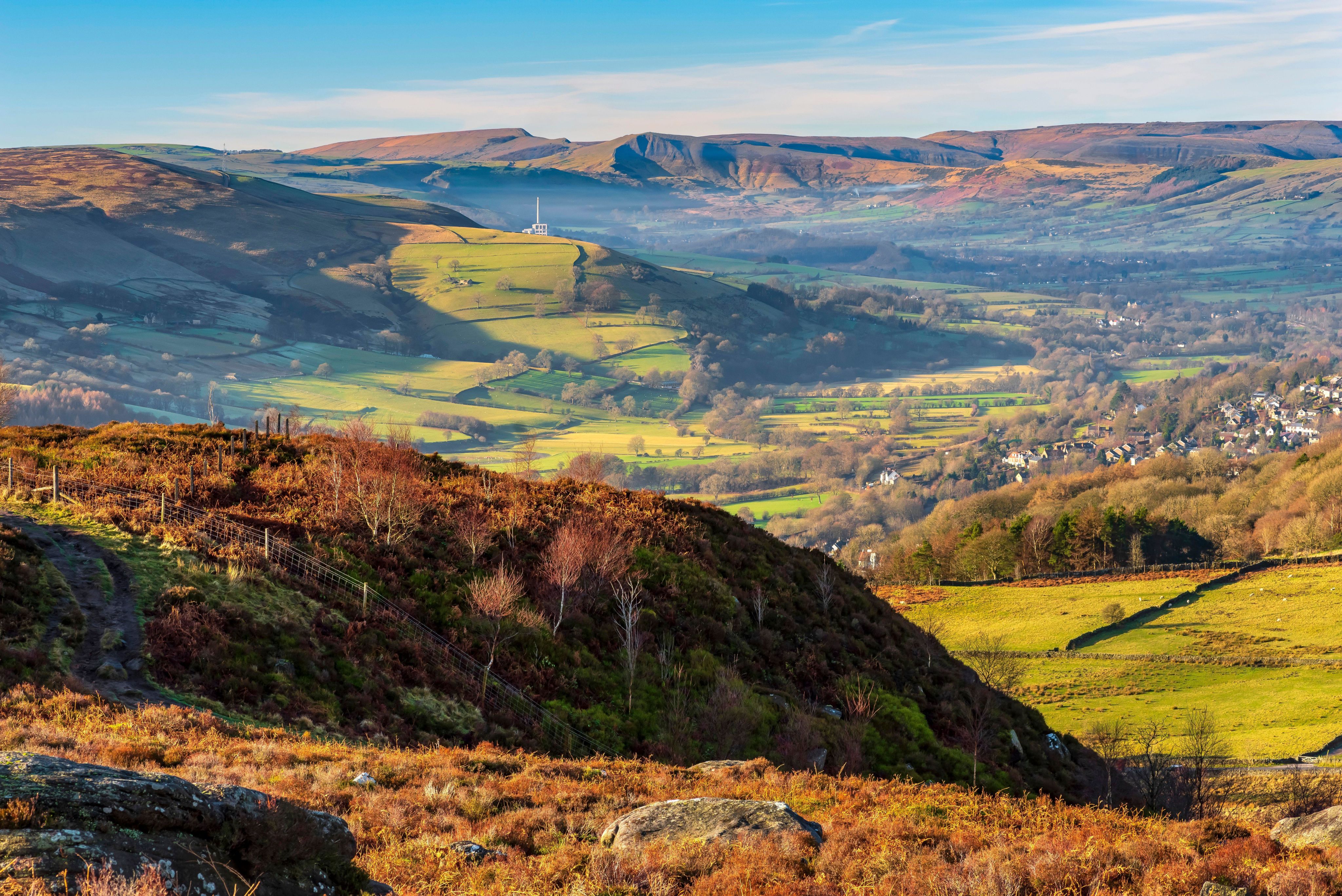
For experienced walkers, the long-distance 431km/268-mile Pennine Way National Trail follows the Pennine chain along the ‘backbone of England’, from Edale in Derbyshire to Kirk Yetholm in the Scottish Borders. This was England’s first National Trail, opened to walkers in 1965, and remains one of its most challenging, crossing Kinder Scout – the highest point in the Peak District at 636m/2,087ft.
Another well-trodden, long-distance route is the Trans Pennine Trail, a 346km/215-mile-long coast-to-coast route linking the North and Irish Seas between Southport in Lancashire and Hornsea in Yorkshire.
Then there’s The Limestone Way, a superb 74km/46-mile walk across the White Peak landscape of the National Park, starting at Castleton in the Hope Valley and passing through dramatic dales and pretty villages on the way to Rocester in Staffordshire.
For day walkers, the most popular walk is The Great Ridge route, a 10.5km/6.5-mile circuit from Castleton in Derbyshire, via the summit of Mam Tor, known as the ‘Shivering Mountain’. However, its popularity also makes it one of the most crowded. If you have already conquered Mam Tor or are looking for a quieter alternative, consider one of the five routes listed below.

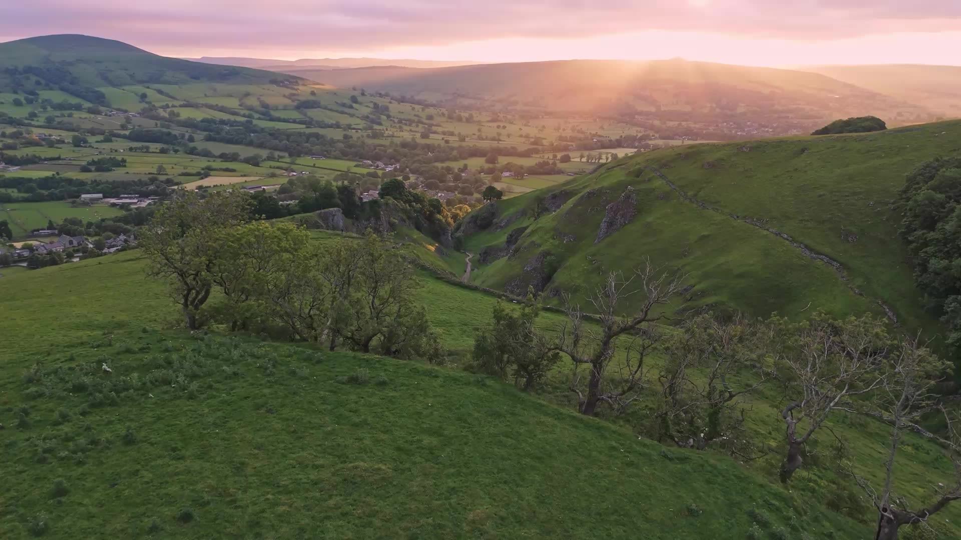
Castleton
Castleton

The view towards Edale on the Pennine Way
The view towards Edale on the Pennine Way

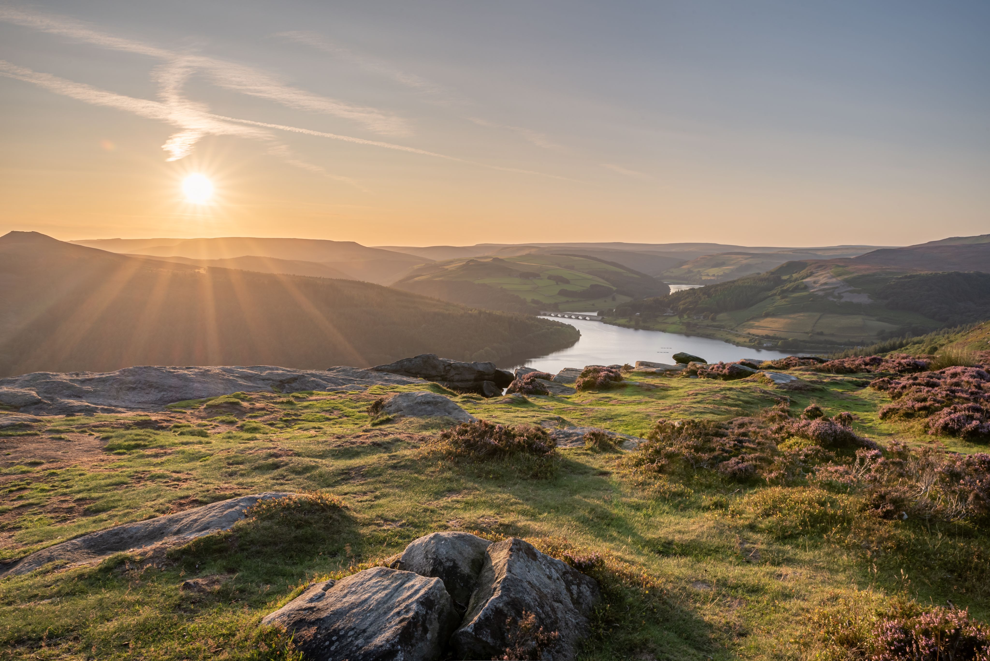
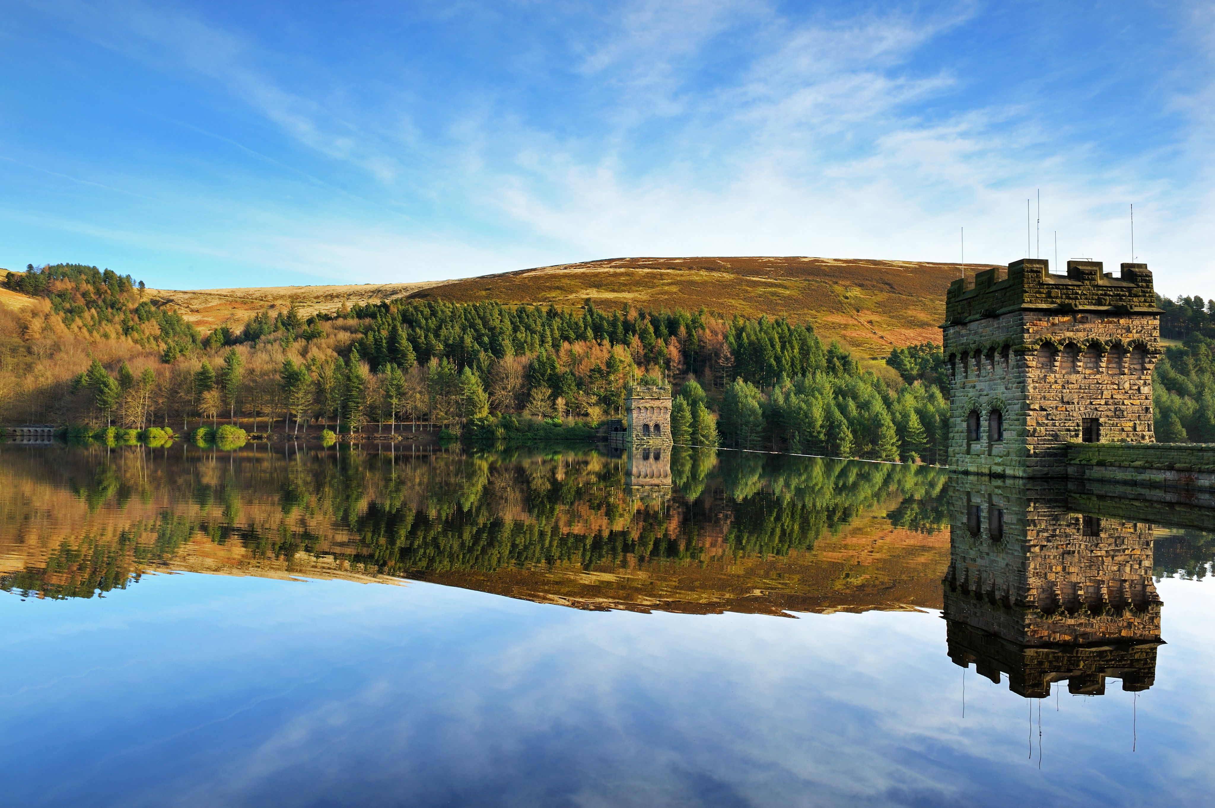
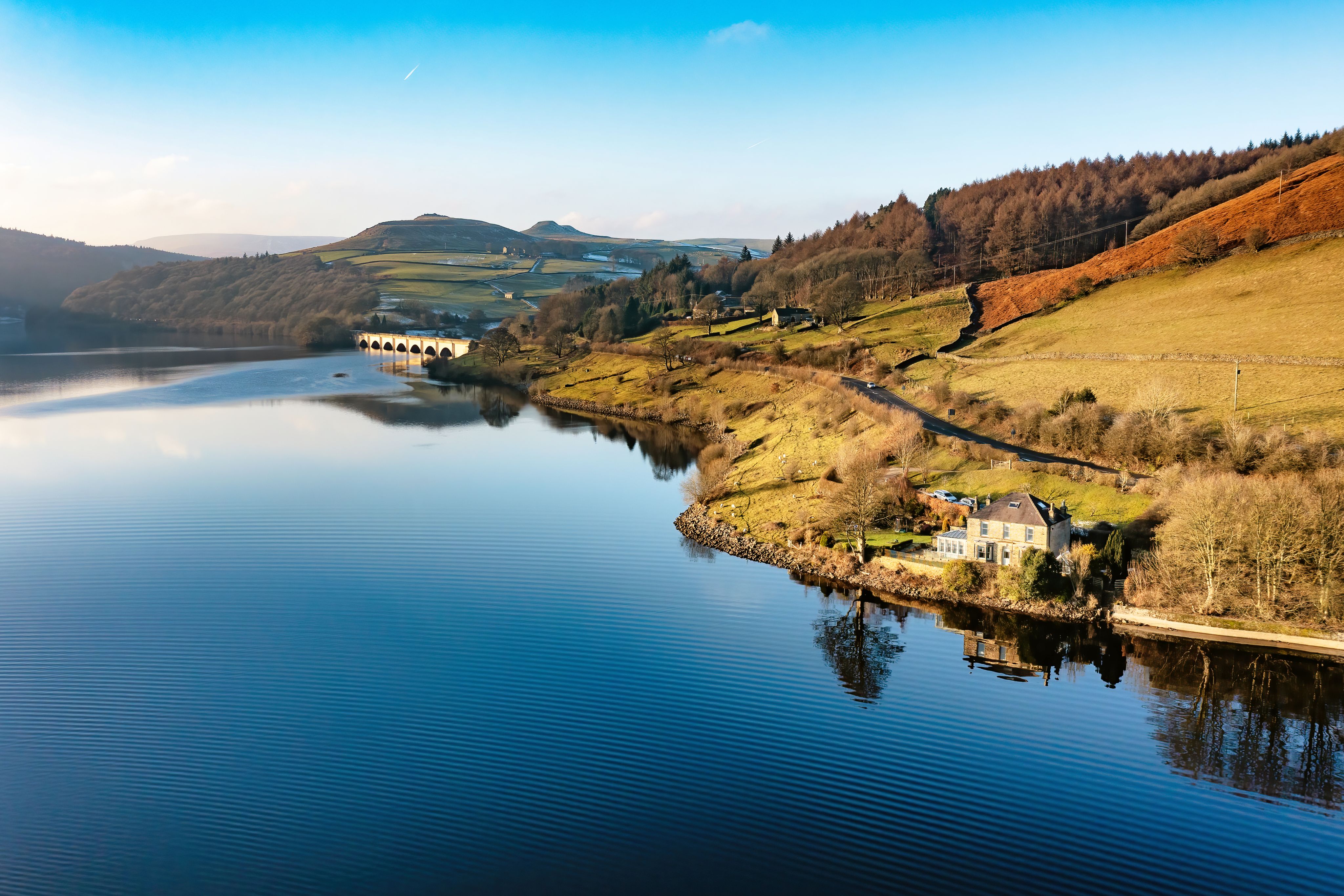
Ladybower Reservoir and Ashopton Viaduct
Ladybower Reservoir and Ashopton Viaduct
Planning a walk
The Peak District’s varied landscape of sweeping limestone dales, majestic moors, ancient forests and photogenic villages has made it a playground for walkers, who come to conquer its summits and soak up the views. Whether you want a challenging hike or a shorter stroll, there’s something for everyone.
For experienced walkers, the long-distance 431km/268-mile Pennine Way National Trail follows the Pennine chain along the ‘backbone of England’, from Edale in Derbyshire to Kirk Yetholm in the Scottish Borders. This was England’s first National Trail, opened to walkers in 1965, and remains one of its most challenging, crossing Kinder Scout – the highest point in the Peak District at 636m/2,087ft.
The view towards Edale on the Pennine Way
The view towards Edale on the Pennine Way
Another well-trodden, long-distance route is the Trans Pennine Trail, a 346km/215-mile-long coast-to-coast route linking the North and Irish Seas between Southport in Lancashire and Hornsea in Yorkshire.
Then there’s The Limestone Way, a superb 74km/46-mile walk across the White Peak landscape of the National Park, starting at Castleton in the Hope Valley and passing through dramatic dales and pretty villages on the way to Rocester in Staffordshire.
Castleton
Castleton
Ladybower Reservoir and Ashopton Viaduct
Ladybower Reservoir and Ashopton Viaduct
For day walkers, the most popular walk is The Great Ridge route, a 10.5km/6.5-mile circuit from Castleton in Derbyshire, via the summit of Mam Tor, known as the ‘Shivering Mountain’. However, its popularity also makes it one of the most crowded. If you have already conquered Mam Tor or are looking for a quieter alternative, consider one of the five routes listed below.

Travelling to the Peak District
Both the Peak District and Derbyshire are easily accessed by road or rail from across Britain.
If you’re travelling by train from the south, it’s under two hours to Derby from London St Pancras International, with routes continuing onwards to Chesterfield and Sheffield to the east. To the west, the main line north from London Euston stops at Stoke-on-Trent, Macclesfield, Stockport and Manchester – all of which have excellent public transport links into the Peak District National Park on the branch lines.
The Hope Valley Line, operated by Northern Rail, connects Manchester and Sheffield, providing access to the Peak District stations of Grindleford, Hathersage, Bamford, Hope and Edale.
To the west is the Manchester to Glossop line, for access to the Dark Peak moors and the Longdendale Valley. Northern Rail’s line between Manchester and Buxton ends at the iconic spa town, where you can use the local bus services to reach the White Peak villages and Staffordshire moorlands.
To the south is East Midland Railway's Derwent Valley line, which runs hourly between Nottingham, Derby and Matlock. You can use this to explore the Derwent Valley Mills World Heritage Site from stops including Cromford and Belper. At Matlock, you can catch a bus to the White Peak villages and the market town of Bakewell.


The Roaches
The Roaches
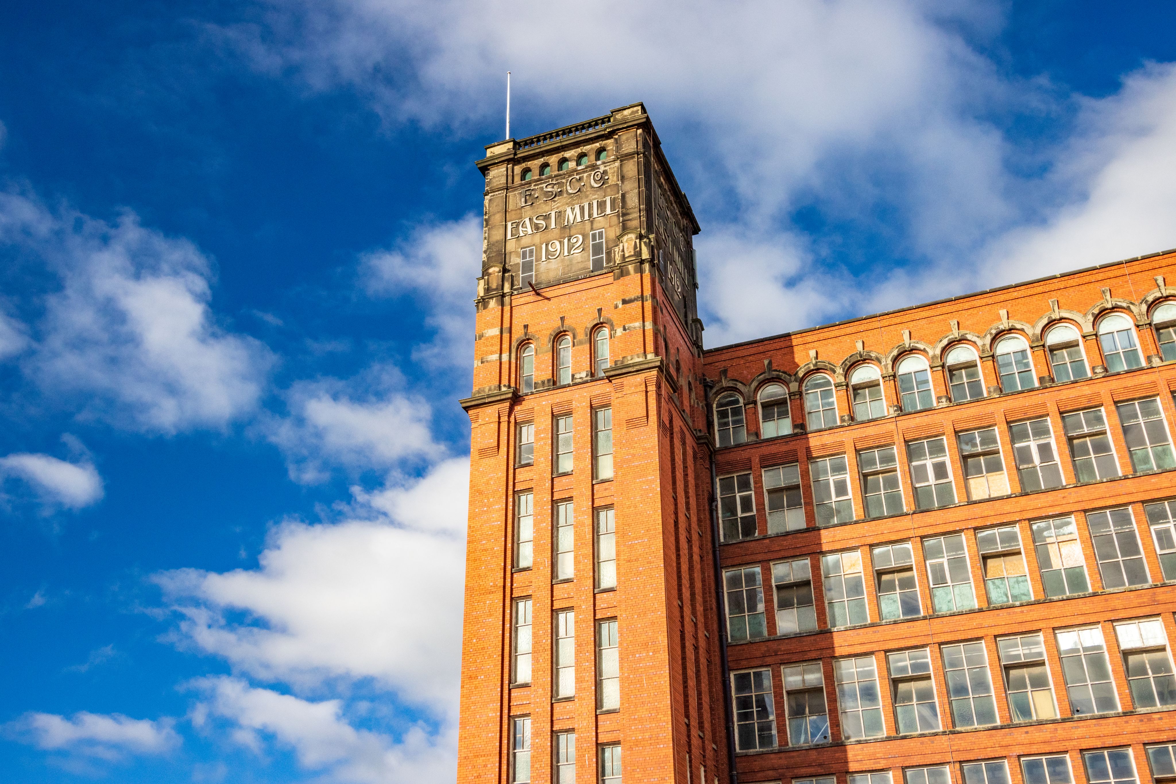
East Mill, Belper, part of the Derwent Valley Mills
East Mill, Belper, part of the Derwent Valley Mills
To the west, CrossCountry Trains provides a direct link from Bristol to Chesterfield or Sheffield, stopping at Derby. From here, you can connect to local bus services to many of the Peak District’s most popular destinations.
To the north is the TransPennine Express line between Manchester and Huddersfield, stopping at Greenfield and Marsden for access to Dove Stone and the Wessenden Moors.
If you’re planning to drive, the Peak District is within reach of Britain’s main motorway network, with both the M1 and M6 providing access from both the north and south. Other motorways serving the area from different directions include the M42, M56, M60, M62, M67 and M18.
Travelling to the Peak District
Both the Peak District and Derbyshire are easily accessed by road or rail from across Britain.
If you’re travelling by train from the south, it’s under two hours to Derby from London St Pancras International, with routes continuing onwards to Chesterfield and Sheffield to the east. To the west, the main line north from London Euston stops at Stoke-on-Trent, Macclesfield, Stockport and Manchester – all of which have excellent public transport links into the Peak District National Park on the branch lines.
The Hope Valley Line, operated by Northern Rail, connects Manchester and Sheffield, providing access to the Peak District stations of Grindleford, Hathersage, Bamford, Hope and Edale.
To the west is the Manchester to Glossop line, for access to the Dark Peak moors and the Longdendale Valley. Northern Rail’s line between Manchester and Buxton ends at the iconic spa town, where you can use the local bus services to reach the White Peak villages and Staffordshire moorlands.
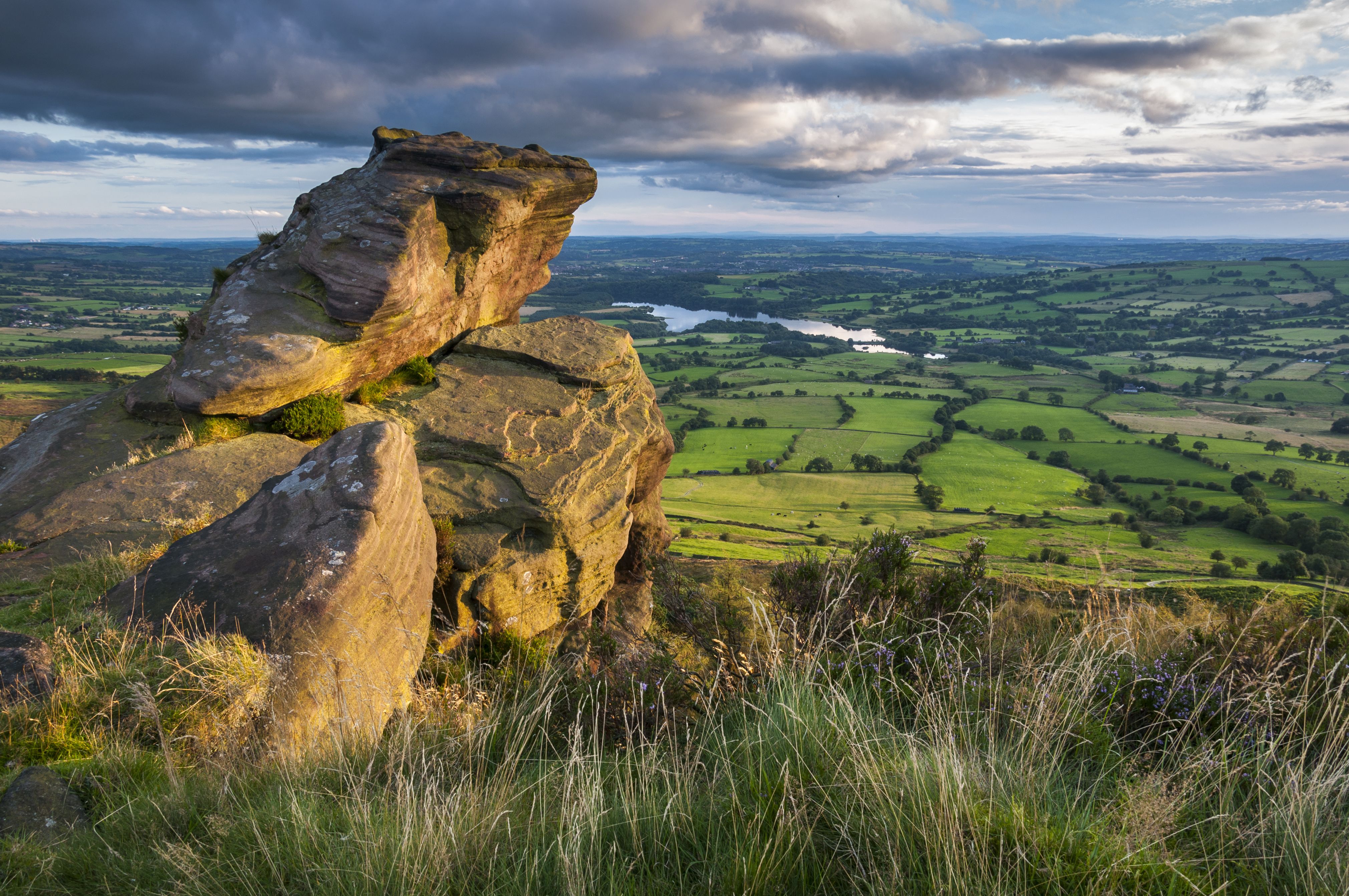
The Roaches
The Roaches
To the south is East Midland Railway’s Derwent Valley line, which runs hourly between Nottingham, Derby and Matlock. You can use this to explore the Derwent Valley Mills World Heritage Site from stops including Cromford and Belper. At Matlock, you can catch a bus to the White Peak villages and the market town of Bakewell.
East Mill, Belper, part of the Derwent Valley Mills
East Mill, Belper, part of the Derwent Valley Mills
To the west, CrossCountry Trains provide a direct link from Bristol to Chesterfield or Sheffield, stopping at Derby. From here, you can connect to local bus services to many of the Peak District’s most popular destinations.
To the north is the TransPennine Express line between Manchester and Huddersfield, stopping at Greenfield and Marsden for access to Dove Stone and the Wessenden Moors.
If you’re planning to drive, the Peak District is within reach of Britain’s main motorway network, with both the M1 and M6 providing access from both the north and south. Other motorways serving the area from different directions include the M42, M56, M60, M62, M67 and M18.


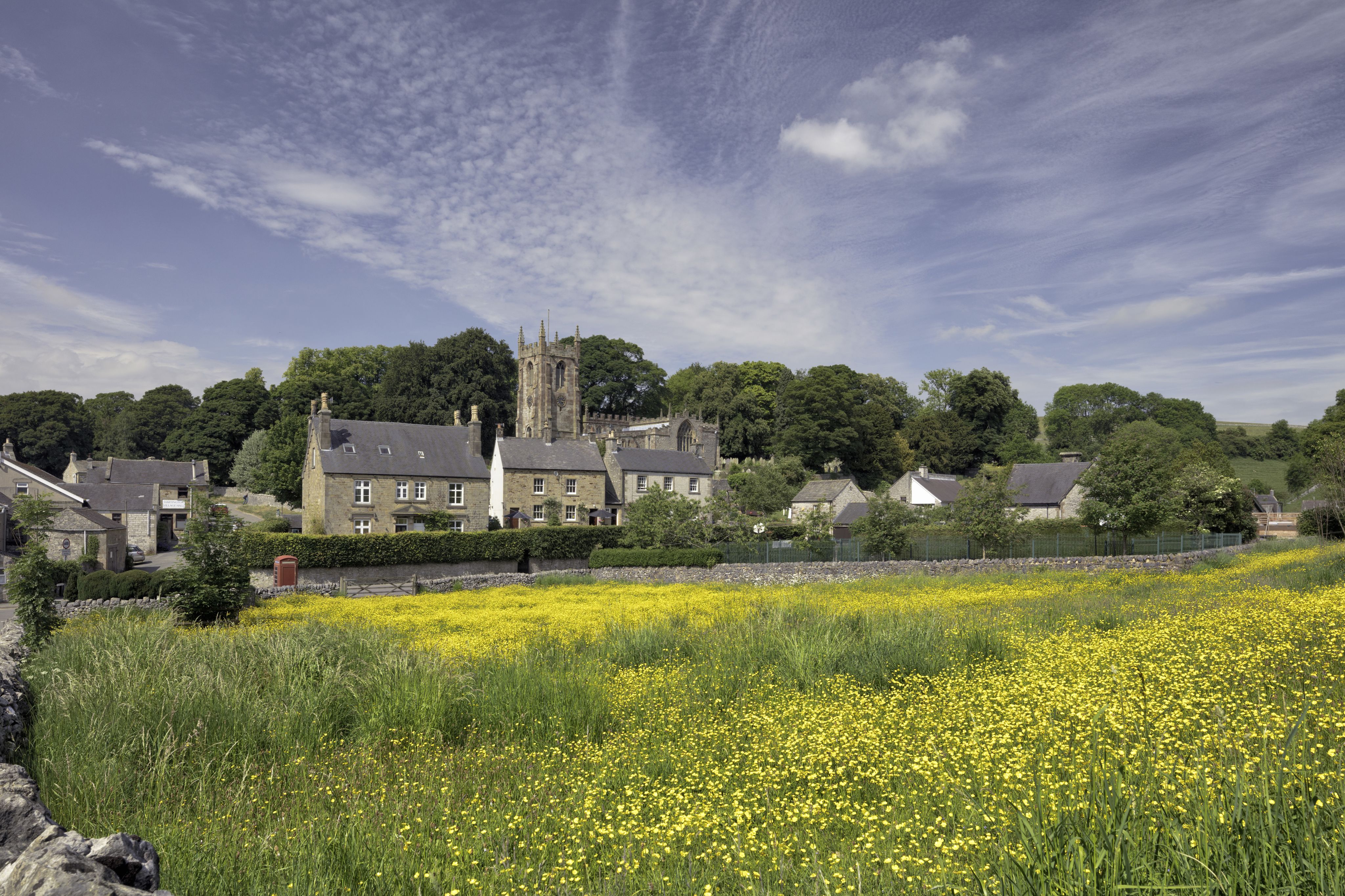
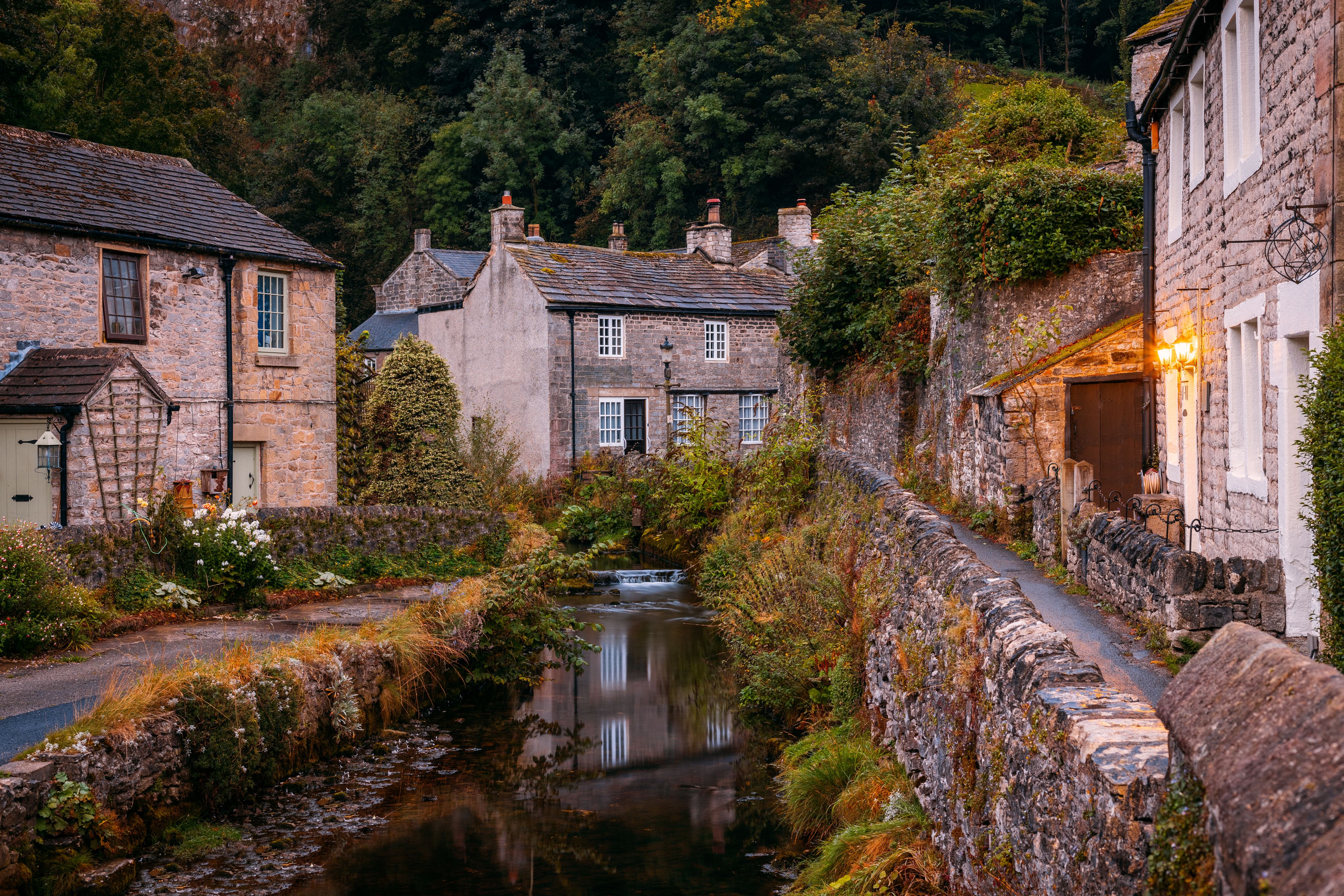
Hartington
Hartington
Where to stay
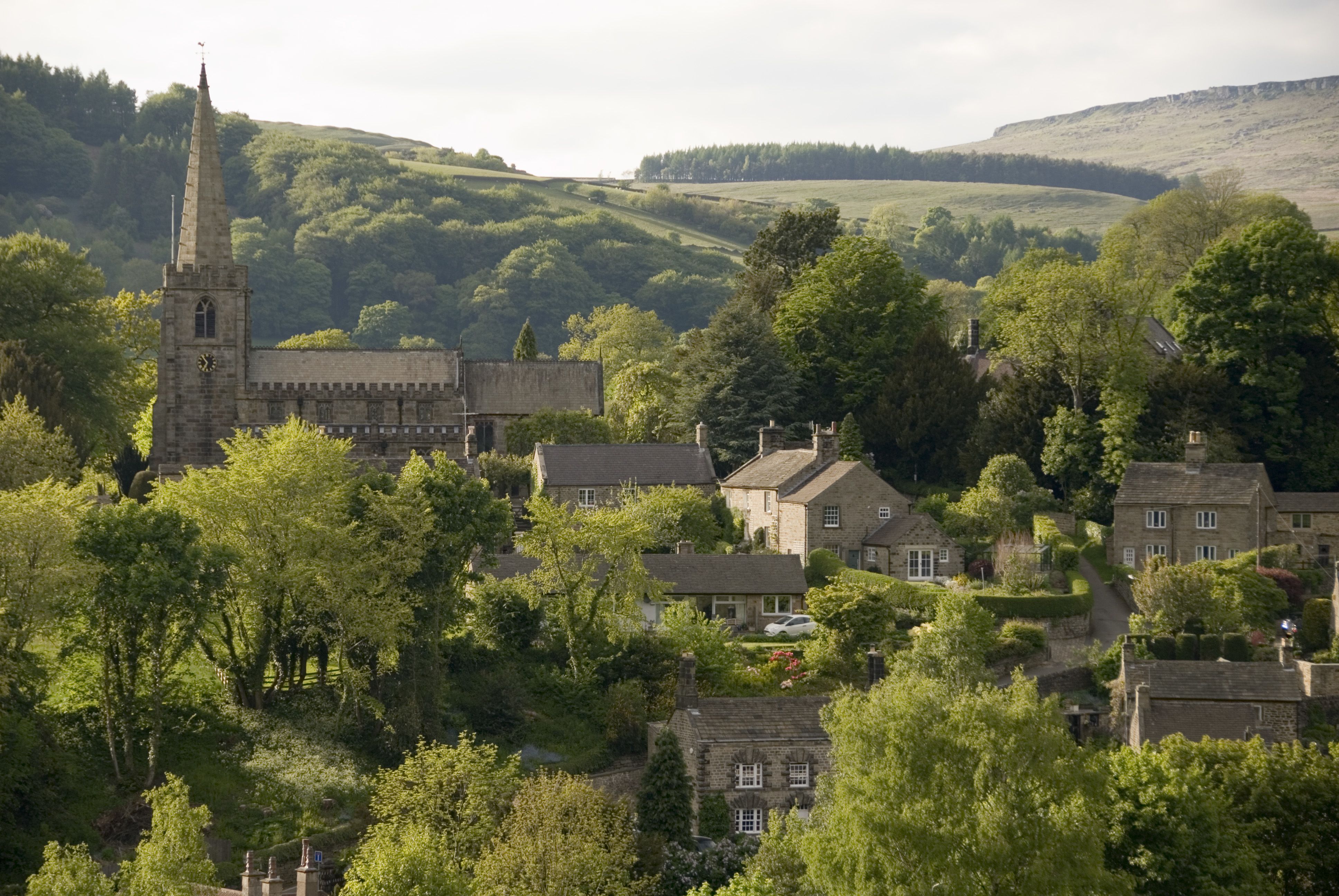
Dotted across the Peak District and Derbyshire are vibrant market towns and an array of picture-postcard villages, giving you a wide choice of places to stay in traditional pubs or idyllic cottages. Among these are Bakewell, home of the famous Bakewell Pudding, and the elegant spa town of Buxton. Notable villages include the historic ‘plague village’ of Eyam, along with Castleton, known for its caves used to mine Blue John stone, and the charming village of Hartington in the heart of the national park. Further north is Flash, the highest village in the UK at an altitude of 463m/1,519 feet.
If you want to combine a day trip to the national park with a city break, Manchester, Sheffield and Derby are all just a short drive or train ride away.
Need to know
While the Peak District is undeniably beautiful, it’s not known for its tropical climate, so it’s important to be prepared for all weather conditions before you head into the hills and valleys. Walking boots are a must, along with waterproofs, lots of layers and a hat and gloves. Other essentials you should pack include an adequate amount of food and water for your hike, a small torch or headlamp and sun protection. You should also carry a small emergency medical kit and a physical map for those GPS black spots.
If you are heading off on one of the longer walks, make sure you’ve let someone know your route and expected return time. Some routes in the Peak District can be quite physically demanding with steep climbs up to the finest viewpoints, so make sure you choose a route that matches your fitness level.

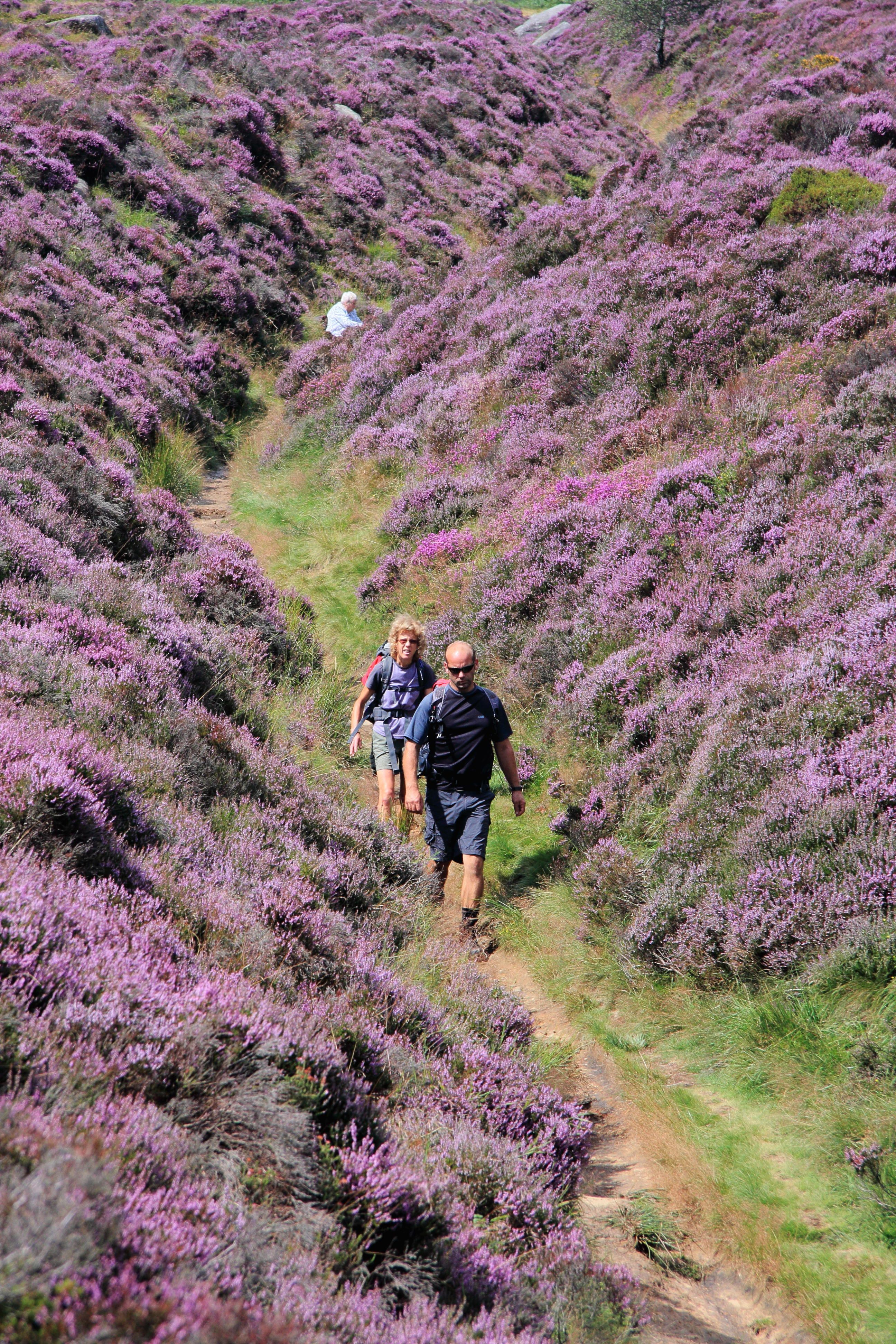
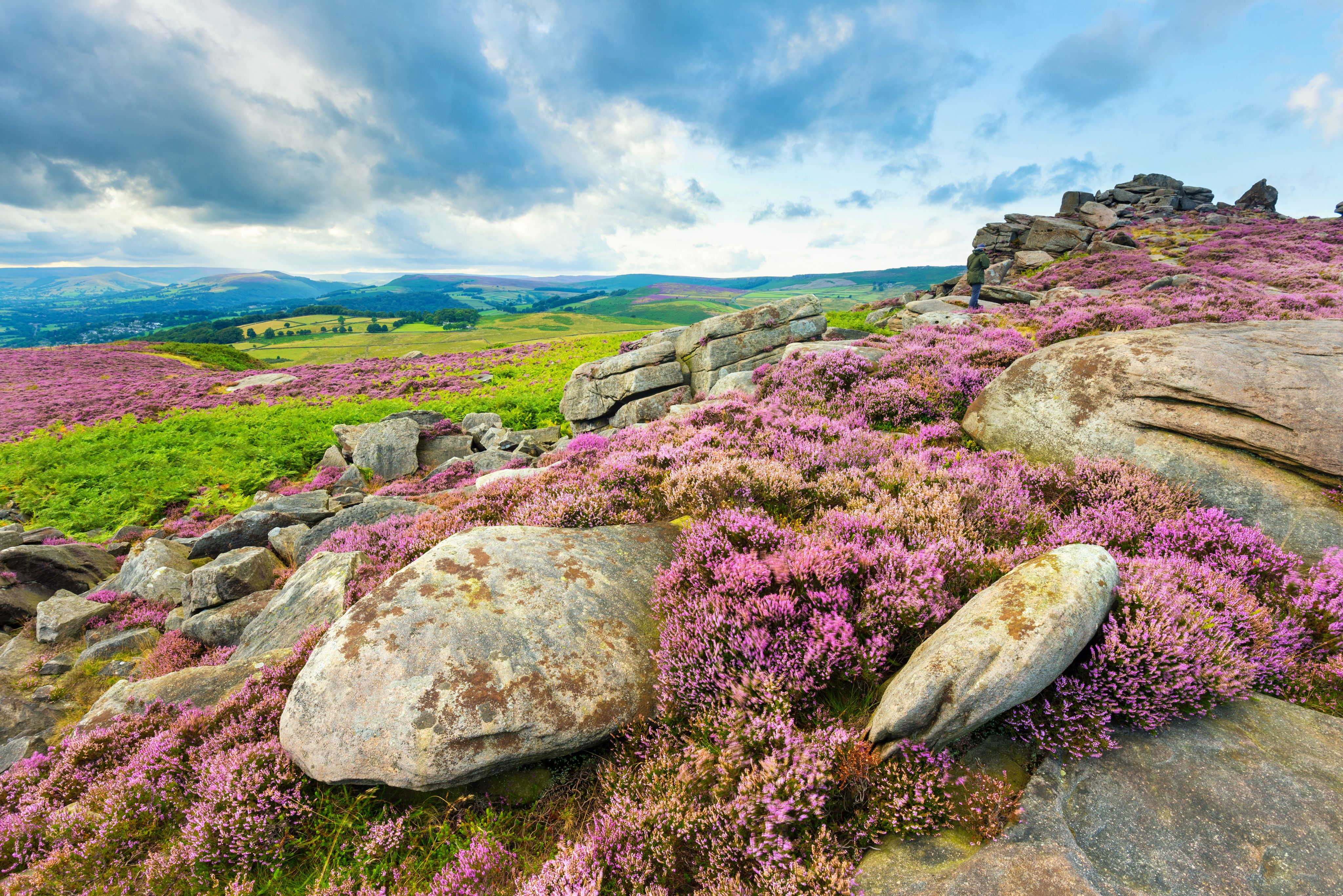
Purple heather is a common sight in the Peaks
Purple heather is a common sight in the Peaks
Where to stay
Dotted across the Peak District and Derbyshire are vibrant market towns and an array of picture-postcard villages, giving you a wide choice of places to stay in traditional pubs or idyllic cottages. Among these are Bakewell, home of the famous Bakewell Pudding, and the elegant spa town of Buxton. Notable villages include the historic ‘plague village’ of Eyam, along with Castleton, known for its caves used to mine Blue John stone, and the charming village of Hartington in the heart of the national park. Further north is Flash, the highest village in the UK at an altitude of 463m/1,519 feet.
Hartington
Hartington
If you want to combine a day trip to the national park with a city break, Manchester, Sheffield and Derby are all just a short drive or train ride away.
Need to know
While the Peak District is undeniably beautiful, it’s not known for its tropical climate, so it’s important to be prepared for all weather conditions before you head into the hills and valleys. Walking boots are a must, along with waterproofs, lots of layers and a hat and gloves. Other essentials you should pack include an adequate amount of food and water for your hike, a small torch or headlamp and sun protection. You should also carry a small emergency medical kit and a physical map for those GPS black spots.
If you are heading off on one of the longer walks, make sure you’ve let someone know your route and expected return time. Some routes in the Peak District can be quite physically demanding with steep climbs up to the finest viewpoints, so make sure you choose a route that matches your fitness level.
Purple heather is a common sight in the Peaks
Purple heather is a common sight in the Peaks

Five quieter walks to try
Want to experience the nature, landscapes and scenery of the Peak District National Park while avoiding the crowds that come to conquer the Great Ridge and Mam Tor? Here are five alternative routes that offer valleys and views
Lud’s Church Trail
Distance: 3km/2 miles (can be extended)
Duration: 1 hour
Difficulty: Easy
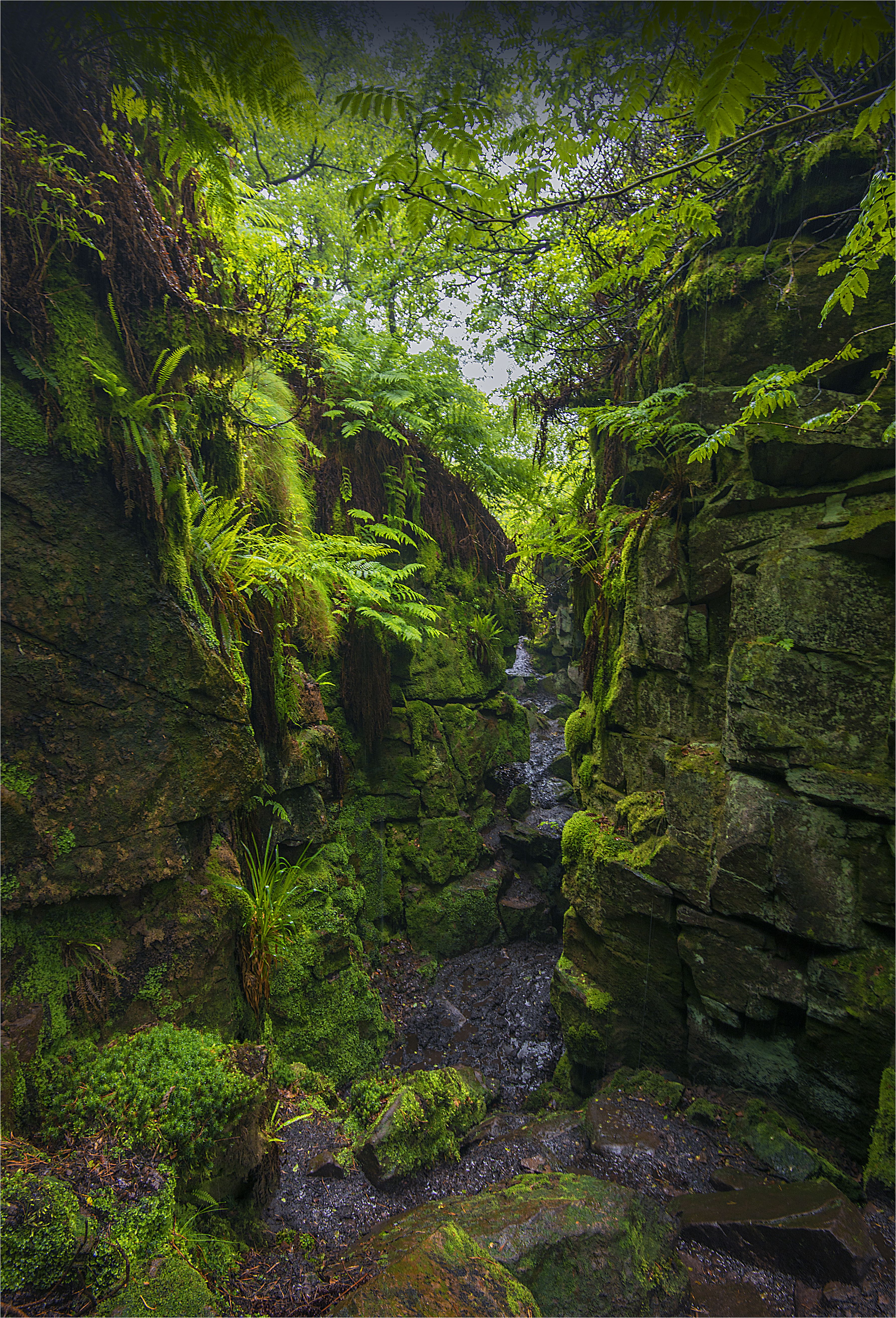
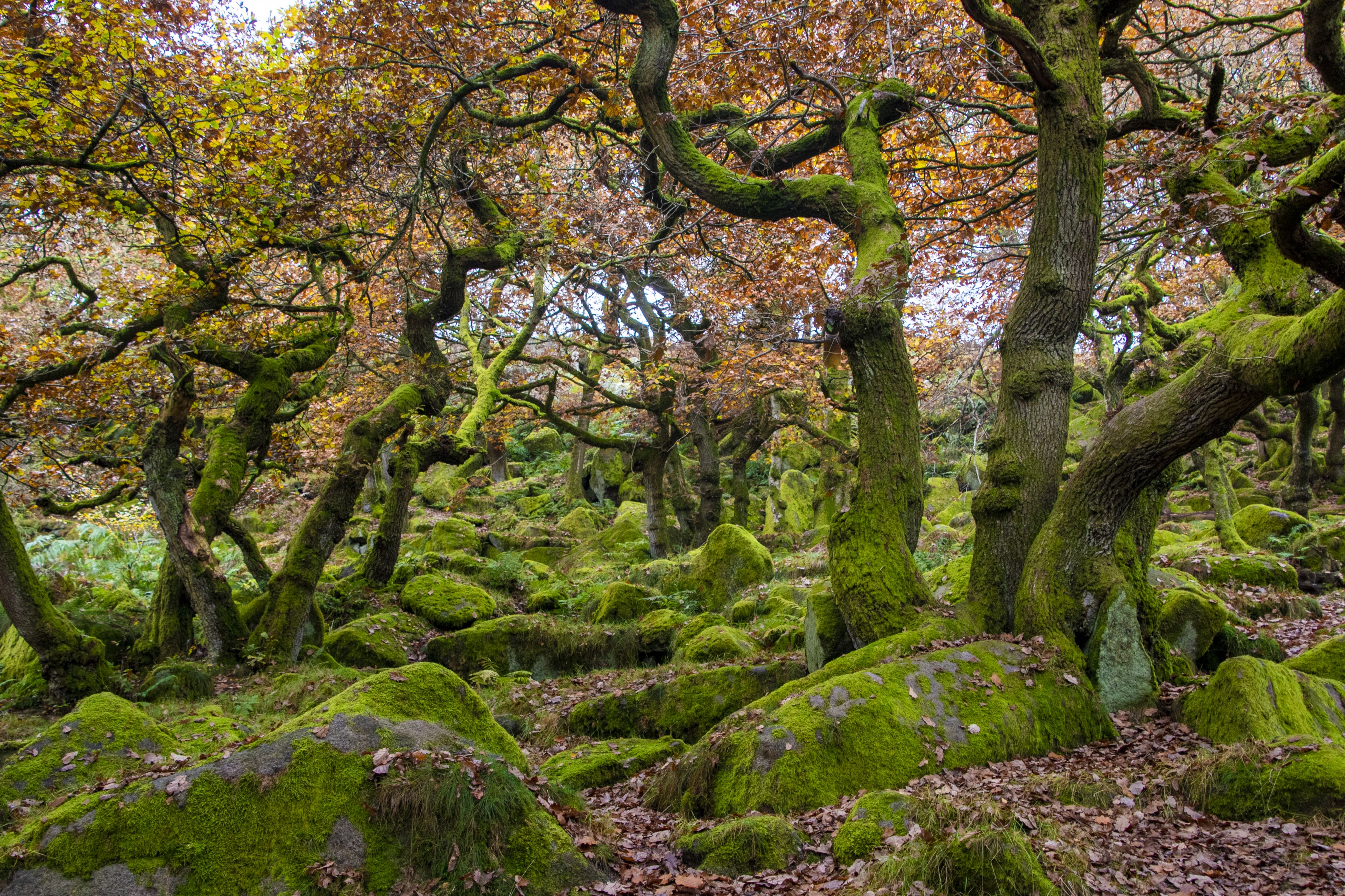
Although it might sound like a quaint village chapel, Lud’s Church is not your conventional place of worship. This deep, moss-covered chasm in Staffordshire, which was formed by a landslip in the local gritstone, is known for its historical and legendary significance. It once served as a secret meeting place for the persecuted Lollards, a proto-Protestant Christian movement, in the 15th century, and is also thought to be the possible location for the ‘Green Chapel’ in the medieval poem Sir Gawain and the Green Knight.

The Roaches
The Roaches
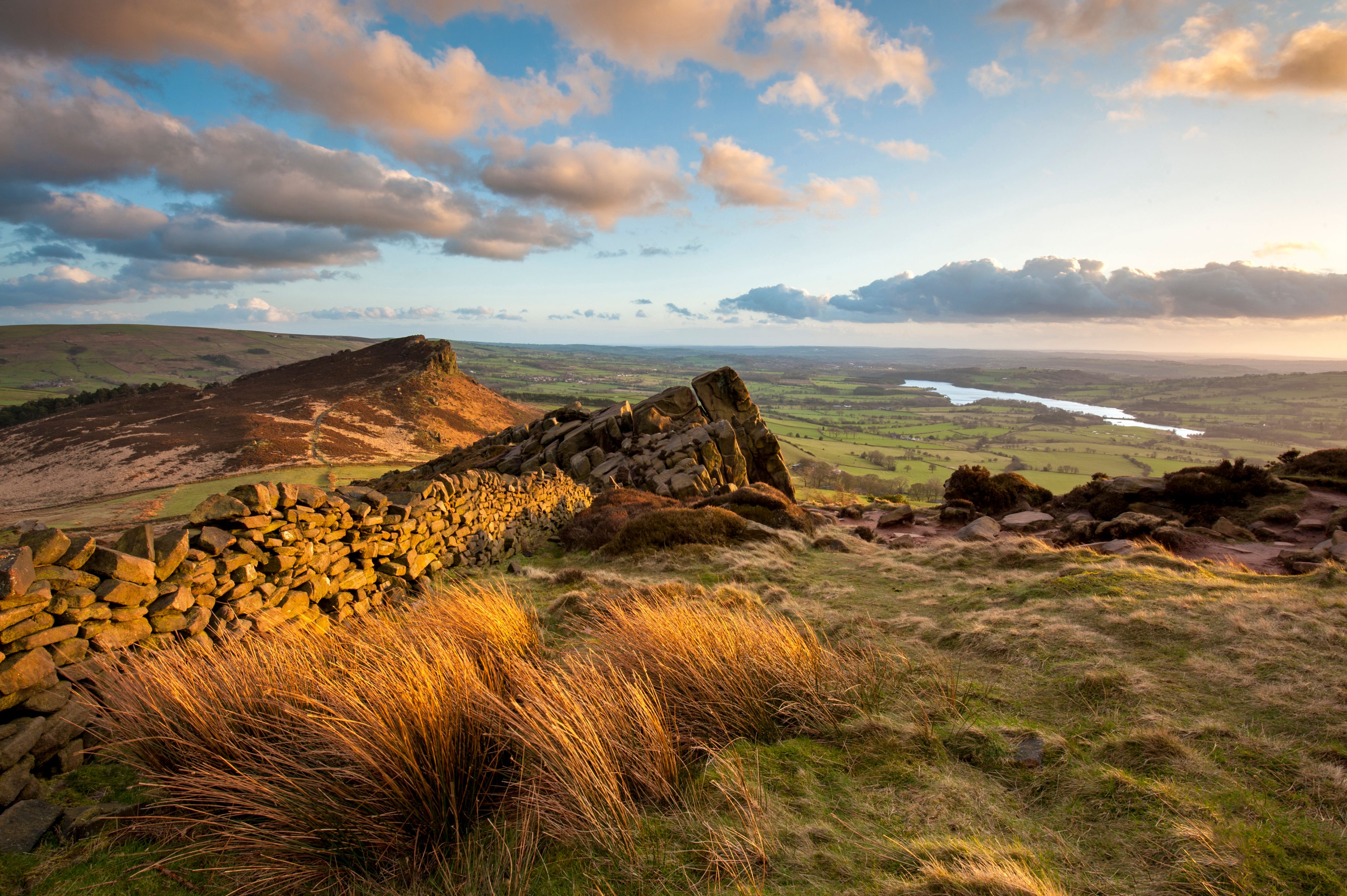
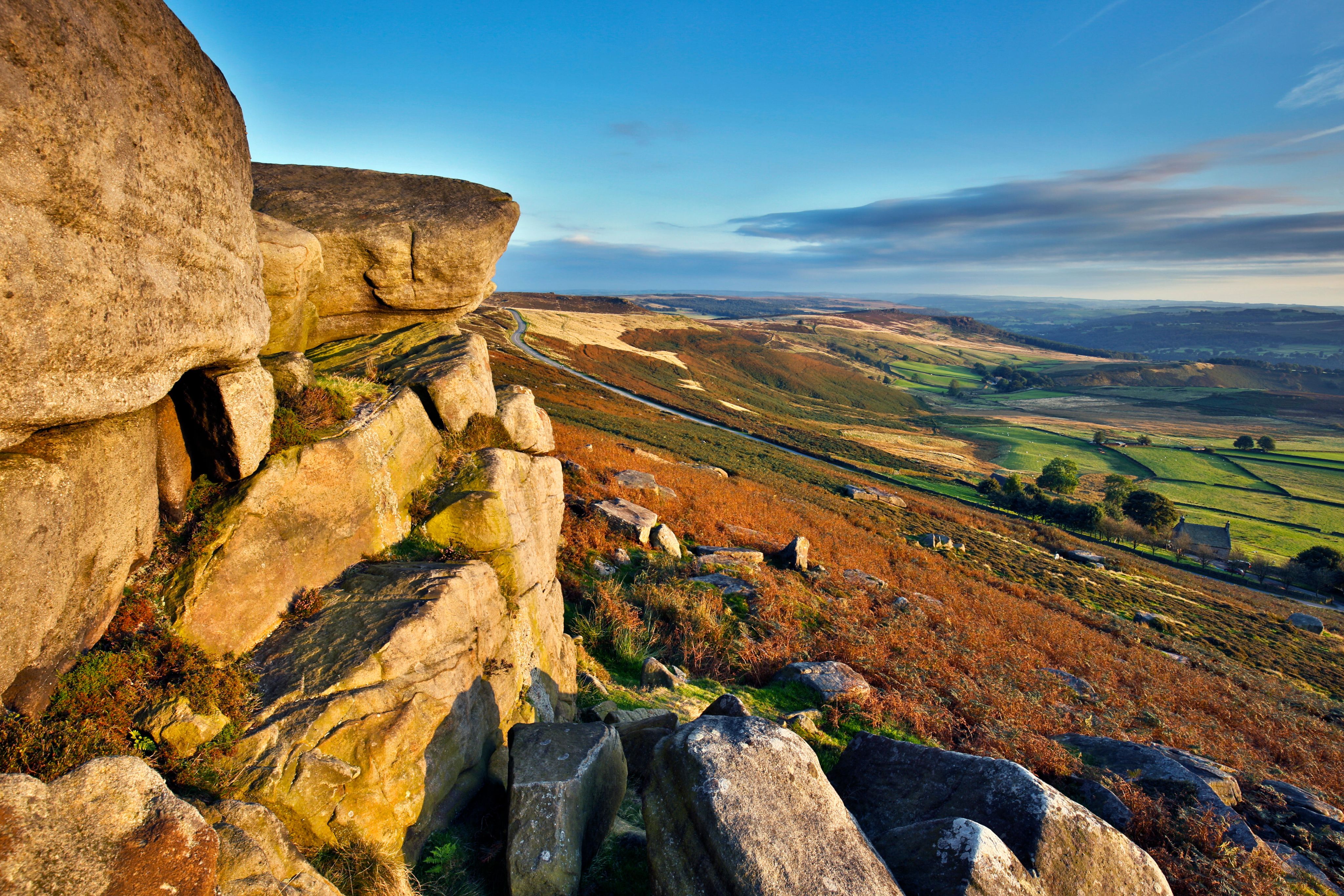
The closest and easiest starting point for the walk is the car park at Gradbach, with a short, 3km/2-mile linear route through woodlands and back to explore this remarkable rocky labyrinth. If you want to extend the return leg, you can continue to The Roaches, a cluster of two gritstone outcrops offering panoramic views. If you’re lucky, you might even spot one of the wild wallabies that have called this area home since escaping from a private zoo in the 1930s.

View at Stanage Edge
View at Stanage Edge
Stanage Edge Circular
Distance: 7km/4.3 miles
Duration: 2–3 hours
Difficulty: Moderate
From the Hollin Bank Car Park, it’s a swift, steep climb up through woods to the top of Stanage Edge, a 6.5km/4-mile-long gritstone escarpment. On your way, you’ll likely encounter groups of rock climbers, who come to scale the 2,000-plus routes up its craggy face and surrounding boulders.
Reaching the top of the edge, you’ll be rewarded with stunning views of the Dark Peak moorlands and Hope Valley beyond – weather permitting! From here, you’ll follow the ridgeline to High Neb, identified by its white trig point, flanked by a vast swathe of purple heather-topped moorland. At 458m/1,503ft above sea level, this is the highest point of Stanage Edge, and a popular place to stop for photos before following the trail down below the cliffs and looping back to the beginning.
If you want to extend your walk, you can also visit nearby Robin Hood’s Cave or plan a detour to the historic village of Hathersage, which once inspired author Charlotte Brontë while writing her 1847 novel Jane Eyre.

The historical village of Hathersage
The historical village of Hathersage
View at Stanage Edge
View at Stanage Edge
Stanage Edge Circular
Distance: 7km/4.3 miles
Duration: 2–3 hours
Difficulty: Moderate
From the Hollin Bank Car Park, it’s a swift, steep climb up through woods to the top of Stanage Edge, a 6.5km/4-mile-long gritstone escarpment. On your way, you’ll likely encounter groups of rock climbers, who come to scale the 2,000-plus routes up its craggy face and surrounding boulders.
Reaching the top of the edge, you’ll be rewarded with stunning views of the Dark Peak moorlands and Hope Valley beyond. From here, you’ll follow the ridgeline to High Neb, identified by its white trig point, flanked by a vast swathe of purple heather-topped moorland. At 458m/1,503ft above sea level, this is the highest point of Stanage Edge, and a popular place to stop for photos before following the trail down below the cliffs and looping back to the beginning.
The historical village of Hathersage
The historical village of Hathersage
If you want to extend your walk, you can also visit nearby Robin Hood’s Cave or plan a detour to the historic village of Hathersage, which once inspired author Charlotte Brontë while writing her 1847 novel Jane Eyre.
Longshaw Woodland Explorer Walk
Distance: 4.8km/3 miles
Duration: 2 hours
Difficulty: Moderate
This undulating circular route in the eastern Peak District near Sheffield starts and ends at the National Trust’s Longshaw Visitor Centre, transporting you through ancient woodlands and past the tumbling waters of Padley Gorge. You’ll also follow an old packhorse route up and over Owler Tor, where you can enjoy far-reaching views of this corner of the Peak District.
Owler Tor
Owler Tor
The Longshaw Estate is a great place to see a variety of wildlife species, including majestic red deer, northern hairy wood ants and a variety of woodland birds. While walking through Padley Gorge, look out for the nest boxes set up to provide sanctuary for the migratory pied flycatchers who return here every April from the Ivory Coast and Liberia in West Africa.

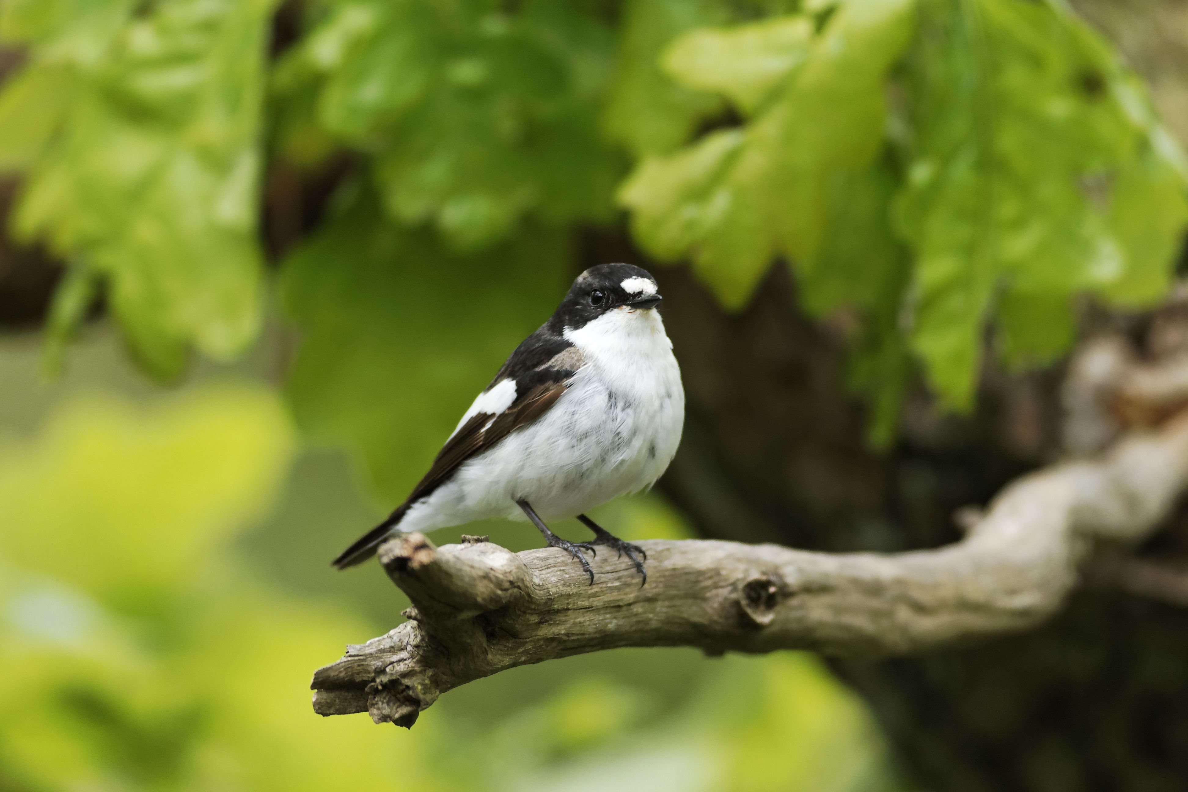
Pied flycatcher
Pied flycatcher
To find out more about the history and wildlife of the estate, be sure to call in to see the displays in Granby Discovery Barn, on the edge of Granby Wood, before stopping to refuel at the end of your walk at the Visitor Centre tea room.

Longshaw Woodland Explorer Walk
Distance: 4.8km/3 miles
Duration: 2 hours
Difficulty: Moderate
This undulating circular route in the eastern Peak District near Sheffield starts and ends at the National Trust’s Longshaw Visitor Centre, transporting you through ancient woodlands and past the tumbling waters of Padley Gorge. You'll also follow an old packhorse route up and over Owler Tor, where you can enjoy far-reaching views of this corner of the Peak District.
Owler Tor
Owler Tor
The Longshaw Estate is a great place to see a variety of wildlife species, including majestic red deer, northern hairy wood ants and a variety of woodland birds. While walking through Padley Gorge, look out for the nest boxes set up to provide sanctuary for the migratory pied flycatchers who return here every April from the Ivory Coast and Liberia in West Africa.
Pied flycatcher
Pied flycatcher
To find out more about the history and wildlife of the estate, be sure to call in to see the displays in Granby Discovery Barn, on the edge of Granby Wood, before stopping to refuel at the end of your walk at the Visitor Centre tea room.
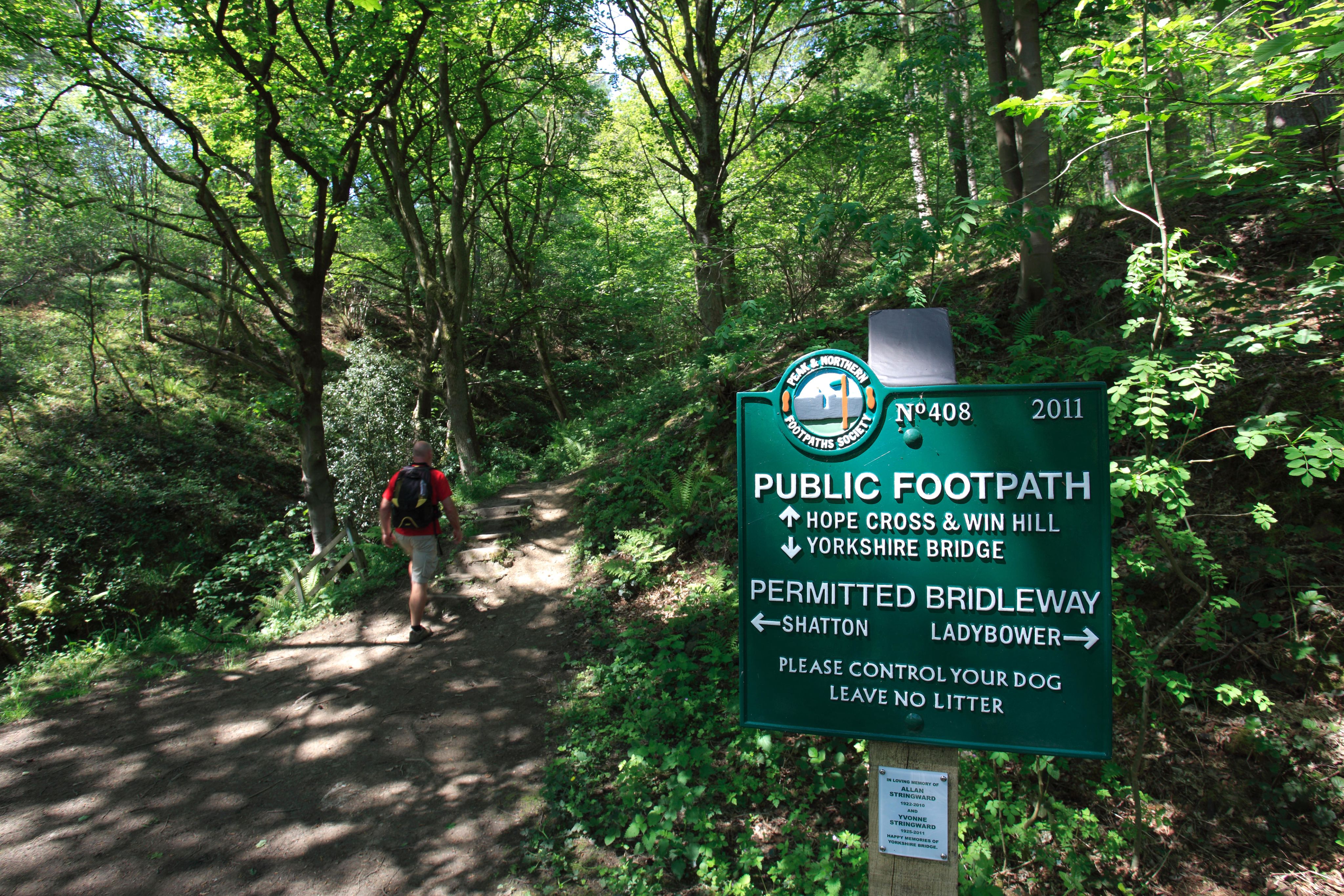
Ladybower Reservoir Walk
Distance: 8km/5 miles
Duration: 2 hours
Difficulty: Easy to moderate
This gentle circular walk on well-made paths offers photo-worthy views for minimal effort. Starting at Fairholmes car park, the route follows the banks of the Ladybower Reservoir, which sits between the Derwent Reservoir to the north and the confluence of the rivers Ashop and Derwent to the south. Along the way, you’ll pass the awe-inspiring Derwent Dam, scene of the practice flights for the famous dam buster raids by the 617 Squadron of the RAF during the Second World War. The 1954 film The Dam Busters was filmed here, and the reservoirs see regular flypasts involving Lancaster and Spitfire bombers from the RAF Battle of Britain Memorial Flight.

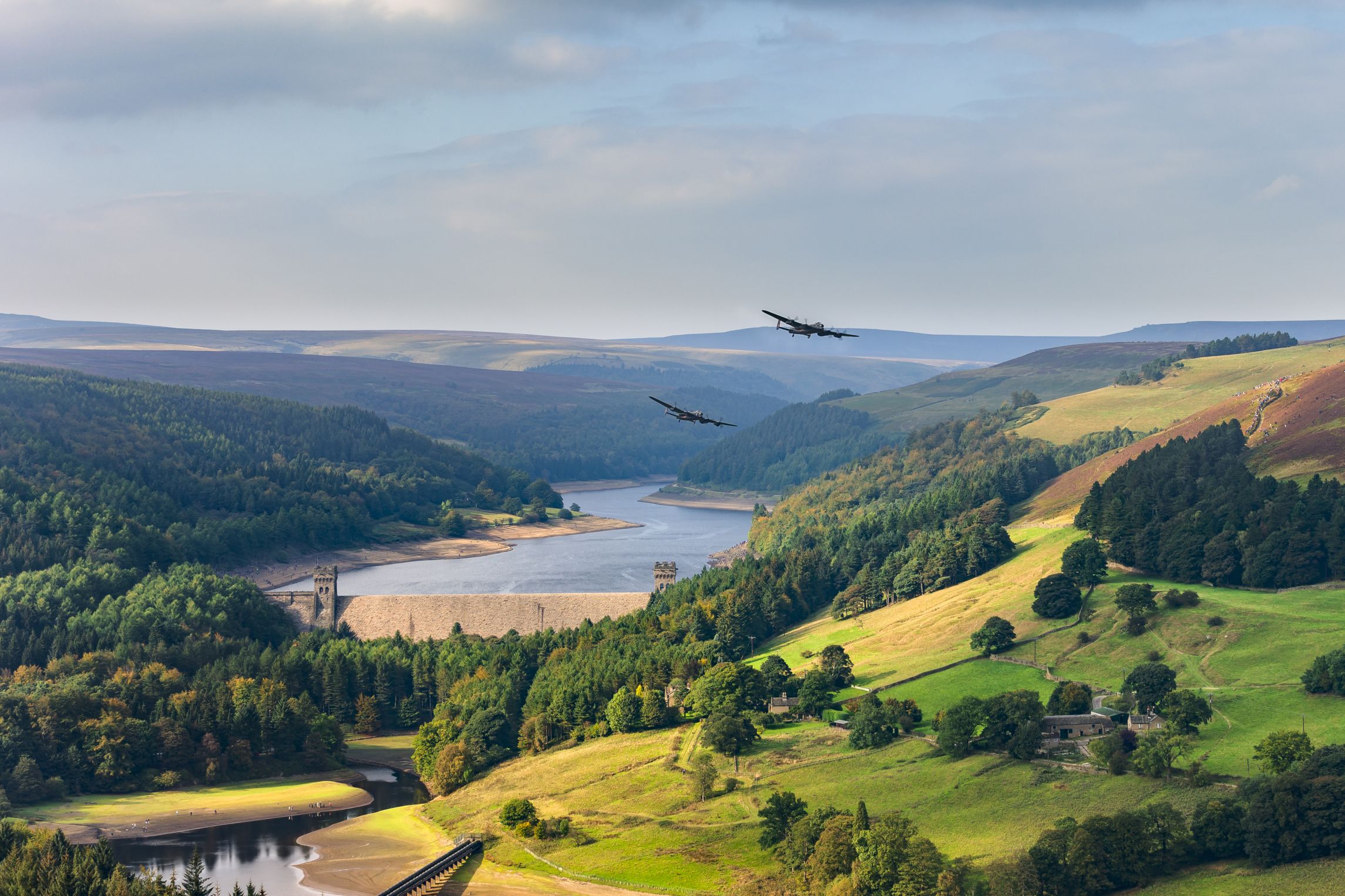
Two Lancaster Bombers passing the Derwent Dam
Two Lancaster Bombers passing the Derwent Dam
Other sights to look out for along the route include the elegant Ashopton Viaduct, which was built in the 1940s, and the surviving houses from Derwent village, which was flooded, along with neighbouring Ashopton, to create Ladybower Reservoir.
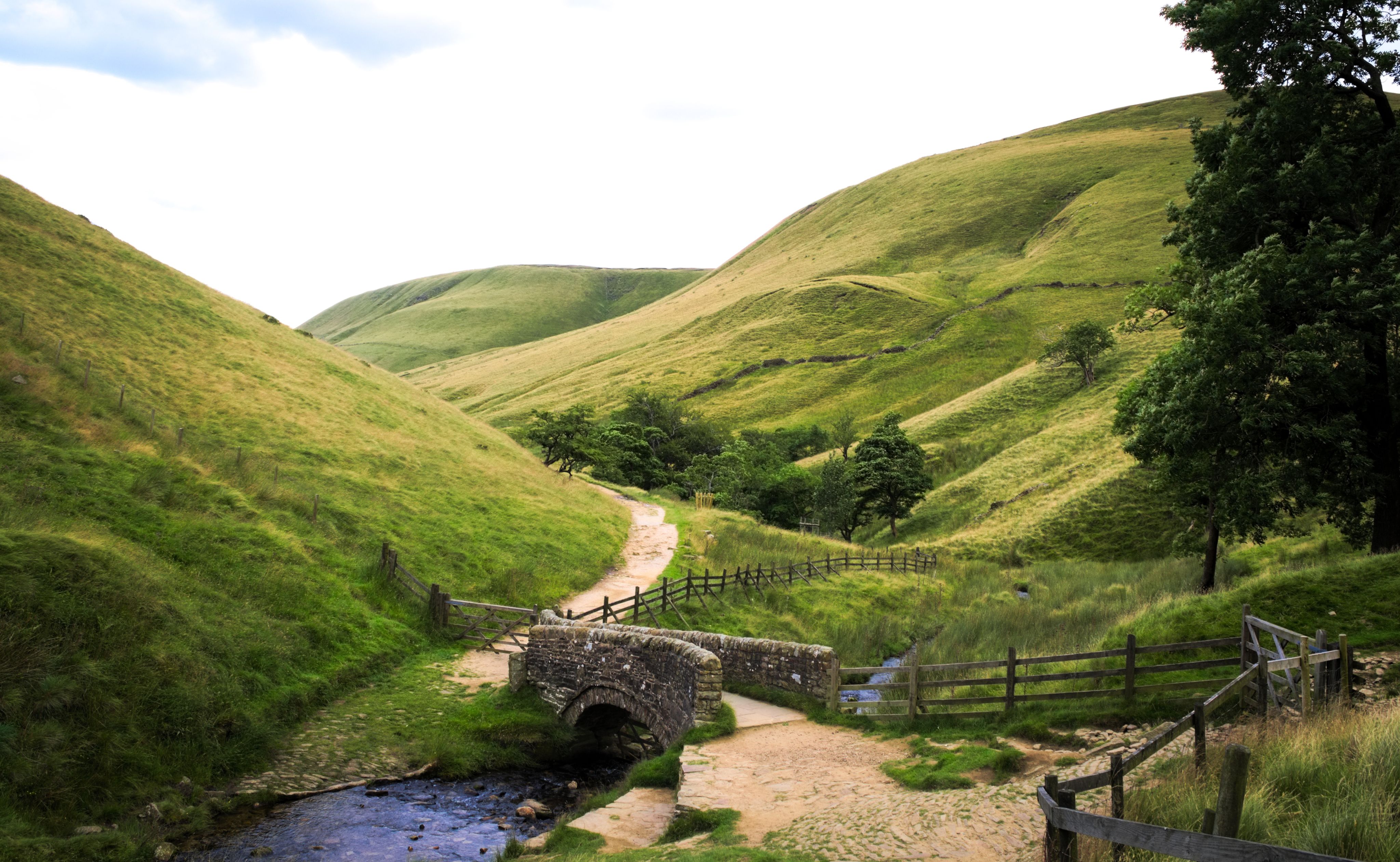
On the way to Win Hill
On the way to Win Hill
If you are feeling energetic and want to extend the walk, there is the possibility of taking a detour to make the sharp ascent up nearby Win Hill, where you can enjoy spectacular views back over the reservoir. It’s a 3.5-hour climb from Yorkshire Bridge.

Ladybower Reservoir Walk
Distance: 8km/5 miles
Duration: 2 hours
Difficulty: Easy to moderate
This gentle circular walk on well-made paths offers photo-worthy views for minimal effort. Starting at Fairholmes car park, the route follows the banks of the Ladybower Reservoir, which sits between the Derwent Reservoir to the north and the confluence of the rivers Ashop and Derwent to the south. Along the way, you’ll pass the awe-inspiring Derwent Dam, scene of the practice flights for the famous dam buster raids by the 617 Squadron of the RAF during the Second World War. The 1954 film The Dambusters was filmed here, and the reservoirs see regular flypasts involving Lancaster and Spitfire bombers from the RAF Battle of Britain Memorial Flight.
Two Lancaster Bombers passing the Derwent Dam
Two Lancaster Bombers passing the Derwent Dam
Other sights to look out for along the route include the elegant Ashopton Viaduct, which was built in the 1940s, and the surviving houses from Derwent village, which was flooded, along with neighbouring Ashopton, to create Ladybower Reservoir.
On the way to Win Hill
On the way to Win Hill
If you are feeling energetic and want to extend the walk, there is the possibility of taking a detour to make the sharp ascent up nearby Win Hill, where you can enjoy spectacular views back over the reservoir. It’s a 3.5-hour climb from Yorkshire Bridge.
Bakewell to Chatsworth
Distance: 9.7km/6 miles (can be extended to 8 miles)
Duration: 2–4 hours (plus visiting time)
Difficulty: Moderate
Ideal for lovers of history and heritage, this circular walk transports you between the charming market town of Bakewell, with its mellow, honey-hued buildings, and Chatsworth, the palatial country home of the Duke and Duchess of Devonshire.
Situated on the banks of the River Wye, Bakewell is the only town within the boundaries of the Peak District National Park, famed for its Bakewell Pudding, which can be sampled in its bakeries and cafés. Arrive on a Monday and you can explore the stalls lining its streets for its popular weekly farmers’ market.
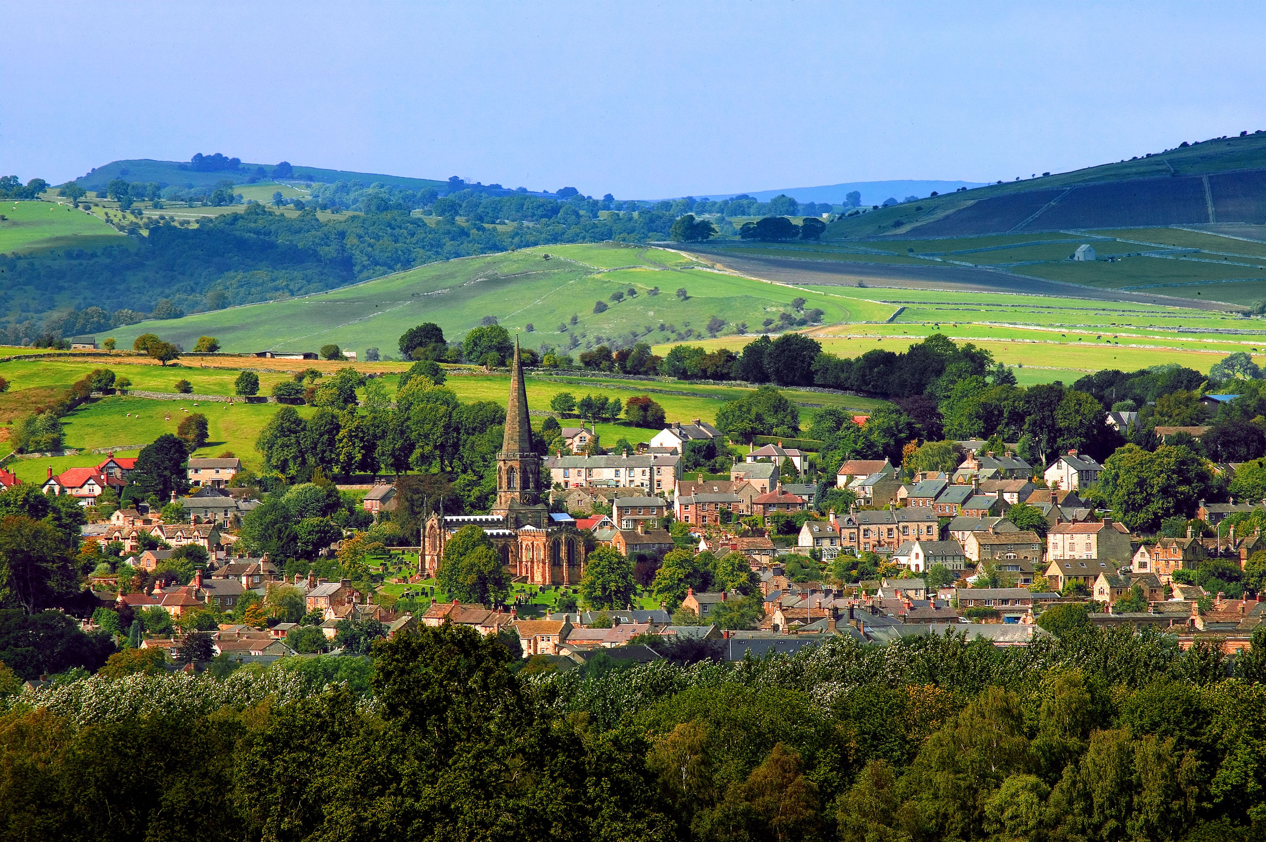
Bakewell
Bakewell
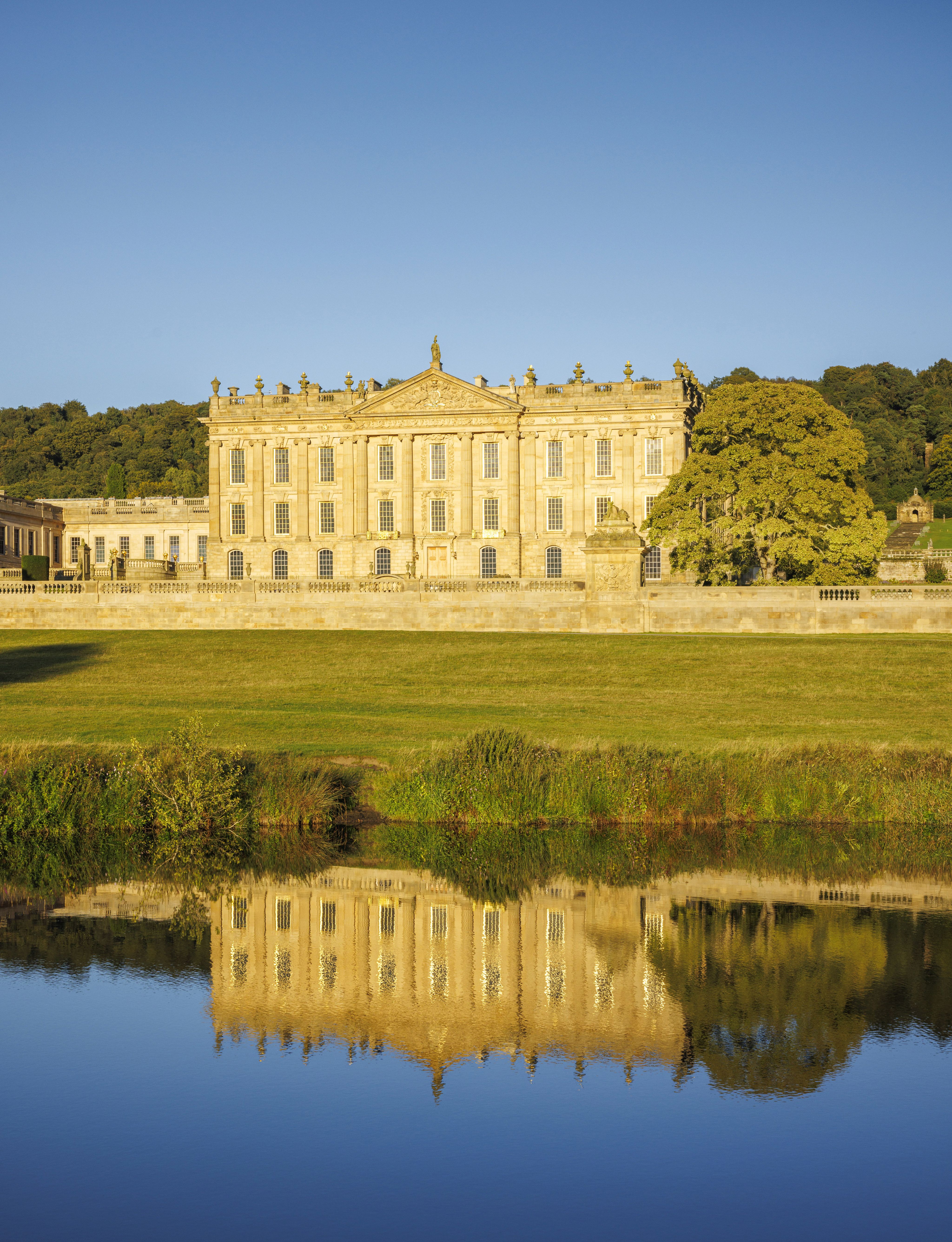
From Bakewell, you make your way through woods and fields to the picturesque village of Edensor, before arriving at Chatsworth – the imposing Peak District seat of 17 generations of the Devonshire family since the 16th century. Now run by the Chatsworth House Trust, it is open to the public and has become one of Britain’s most popular stately houses. Allow a few hours to explore its rooms and admire its collection of fine paintings, sculptures and furnishings, before stepping outside to lose yourself in its 105-acre gardens, with water features, sculptures and rare trees to discover.


Chatsworth House interior
Chatsworth House interior
On the return walk to Bakewell, you have the choice of taking the shorter route via Edensor or a longer route, following the River Derwent.
Photography and video: Getty Images, Alamy, 4Corners, Plain Pictures

Bakewell to Chatsworth
Distance: 9.7km/6 miles (can be extended to 8 miles)
Duration: 2–4 hours (plus visiting time)
Difficulty: Moderate
Ideal for lovers of history and heritage, this circular walk transports you between the charming market town of Bakewell, with its mellow, honey-hued buildings, and Chatsworth, the palatial country home of the Duke and Duchess of Devonshire.
Situated on the banks of the River Wye, Bakewell is the only town within the boundaries of the Peak District National Park, famed for its Bakewell Pudding, which can be sampled in its bakeries and cafés. Arrive on a Monday and you can explore the stalls lining its streets for its popular weekly farmers’ market.
Bakewell
Bakewell
From Bakewell, you make your way through woods and fields to the picturesque village of Edensor, before arriving at Chatsworth – the imposing Peak District seat of 17 generations of the Devonshire family since the 16th century. Now run by the Chatsworth House Trust, it is open to the public and has become one of Britain’s most popular stately houses. Allow a few hours to explore its rooms and admire its collection of fine paintings, sculptures and furnishings, before stepping outside to lose yourself in its 105-acre gardens, with water features, sculptures and rare trees to discover.
Chatsworth House interior
Chatsworth House interior
On the return walk to Bakewell, you have the choice of taking the shorter route via Edensor or a longer route, following the River Derwent.
Photography and video: Getty Images, Alamy, 4Corners, Plain Pictures

We are the Ramblers, Britain’s walking charity. We open the way for everyone to enjoy the simple pleasures of walking. And we step up to protect the places we all love to wander. Click to find out more.

The Ramblers’ Association is a company limited by guarantee, registered in England and Wales. Company registration no. 4458492. Registered charity, England & Wales no. 1093577, Scotland no. SCO39799.
© Ramblers 2026