Top ten
Dartmoor walks


Top ten
Dartmoor walks
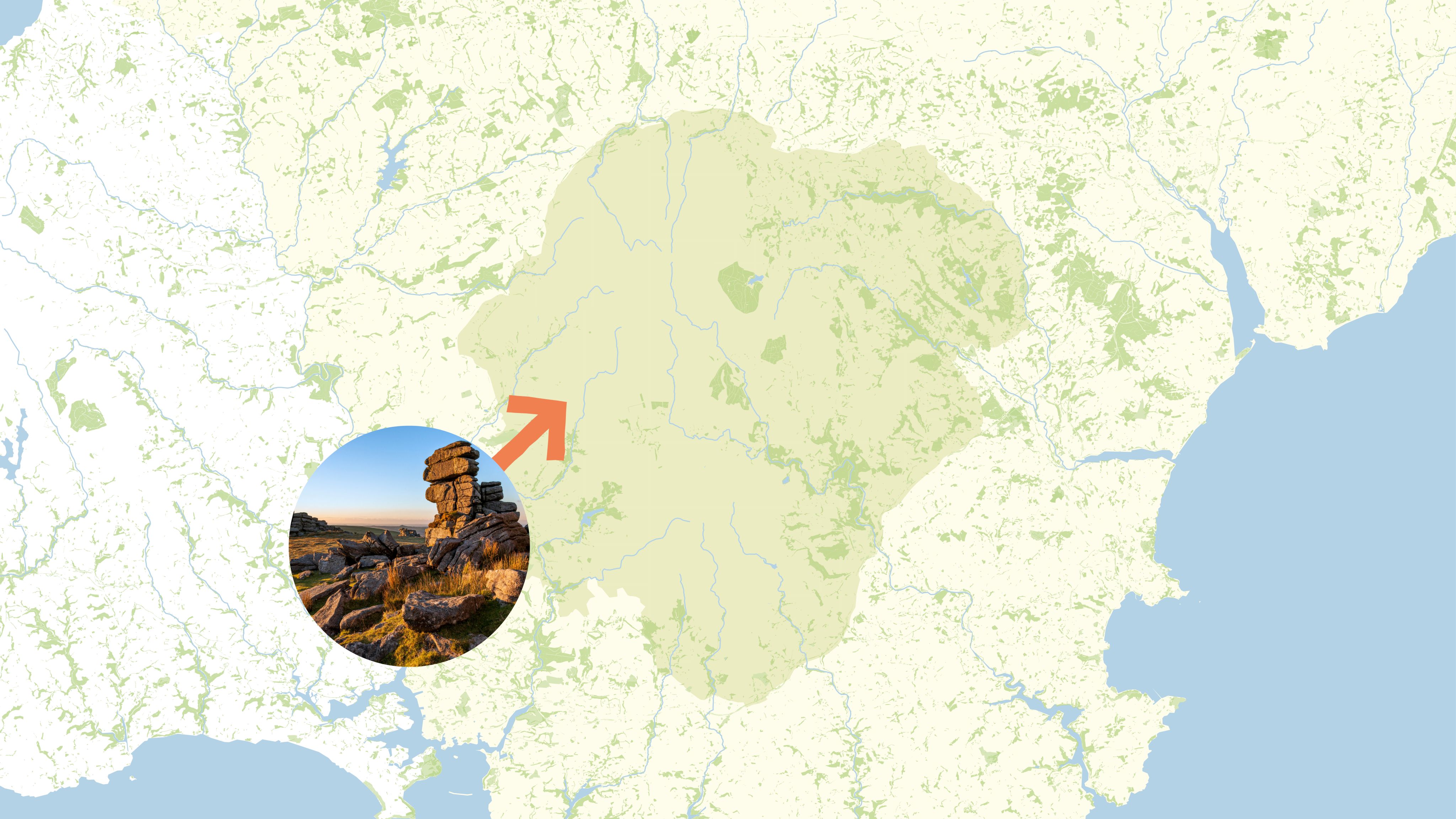
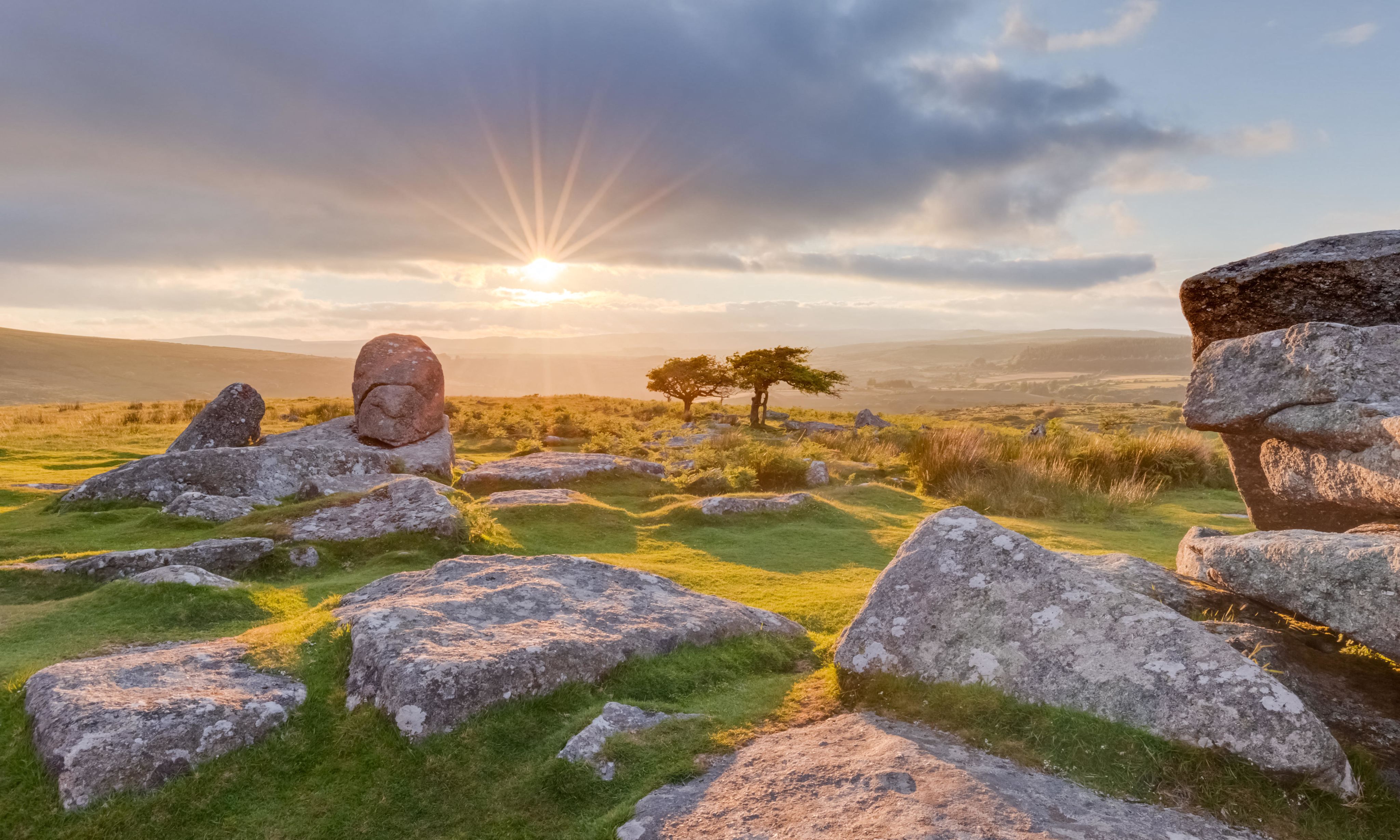
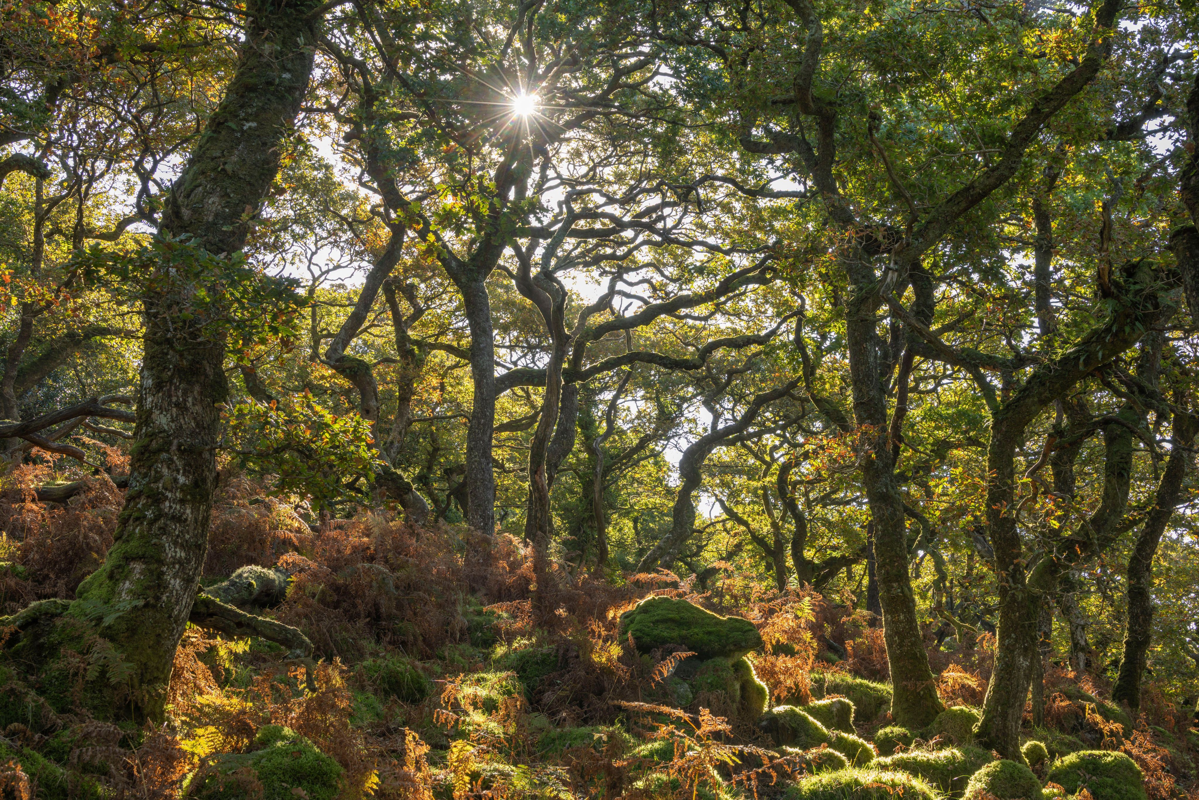
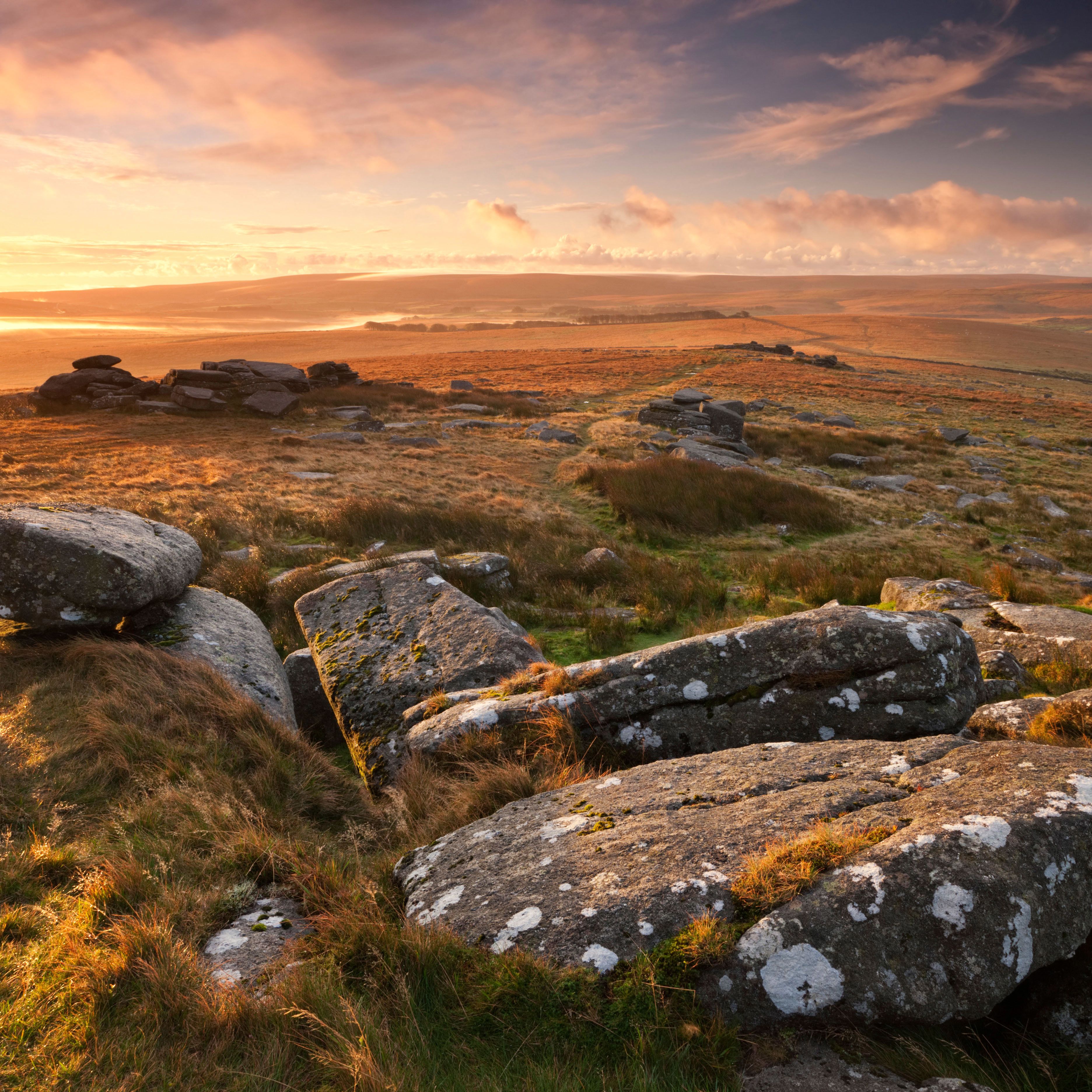
With its windswept moorland, ancient woods and towering granite tors, Dartmoor National Park in Devon, England, offers the chance to embark on an adventure in one of Britain’s wildest landscapes. Here’s everything you need to know before you visit, along with ten of the best walks to escape the crowds and find photo-worthy views
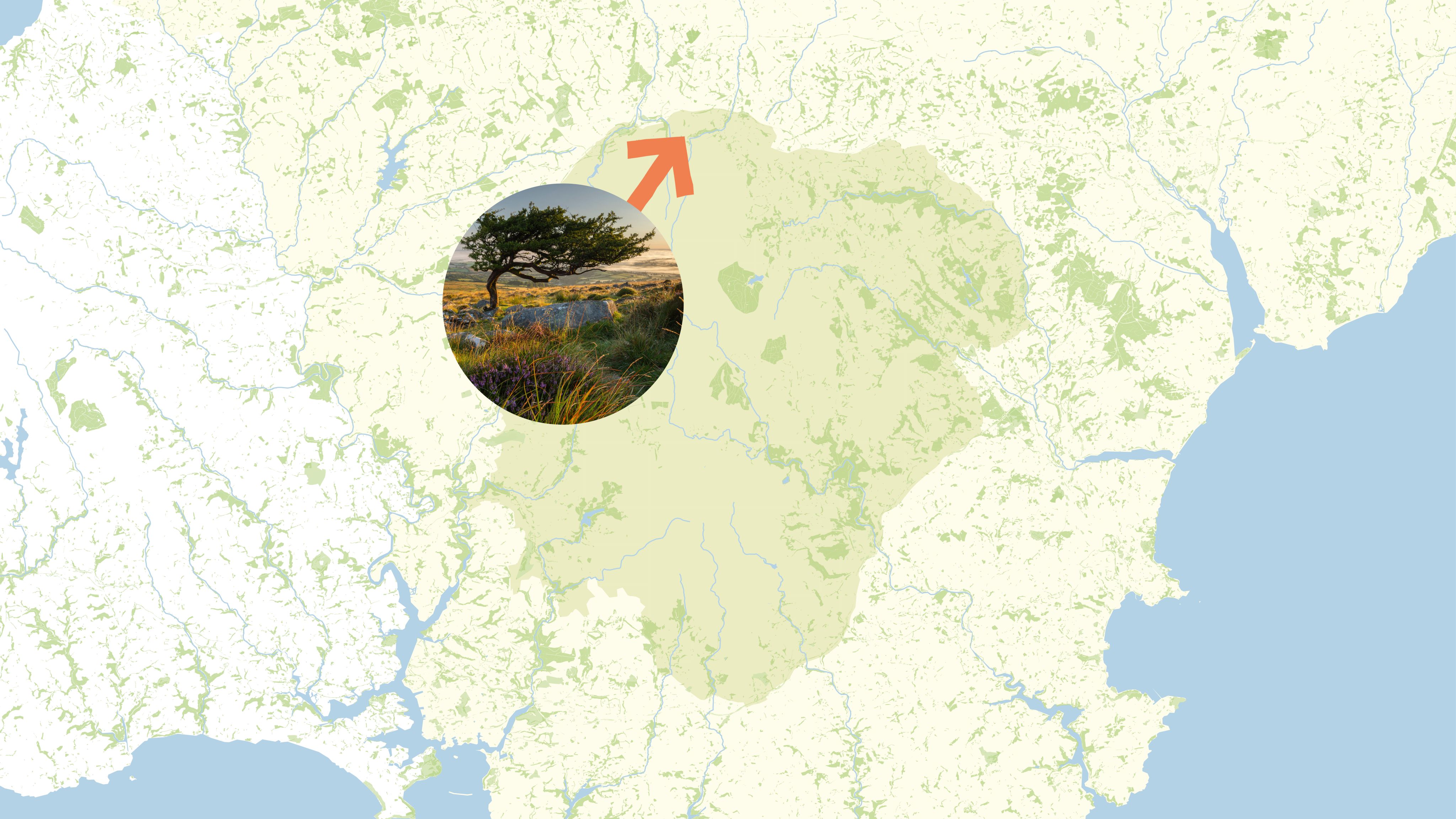
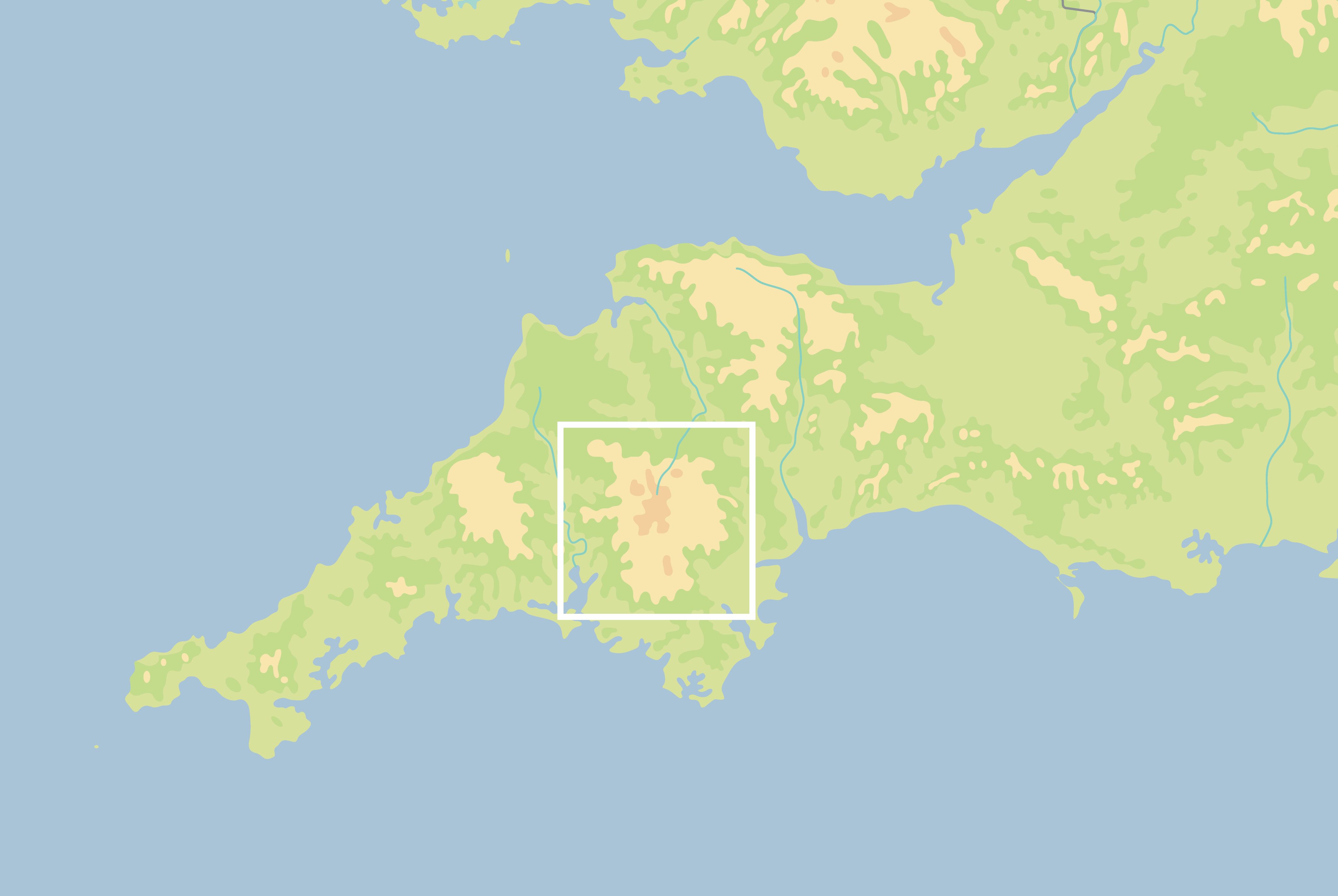
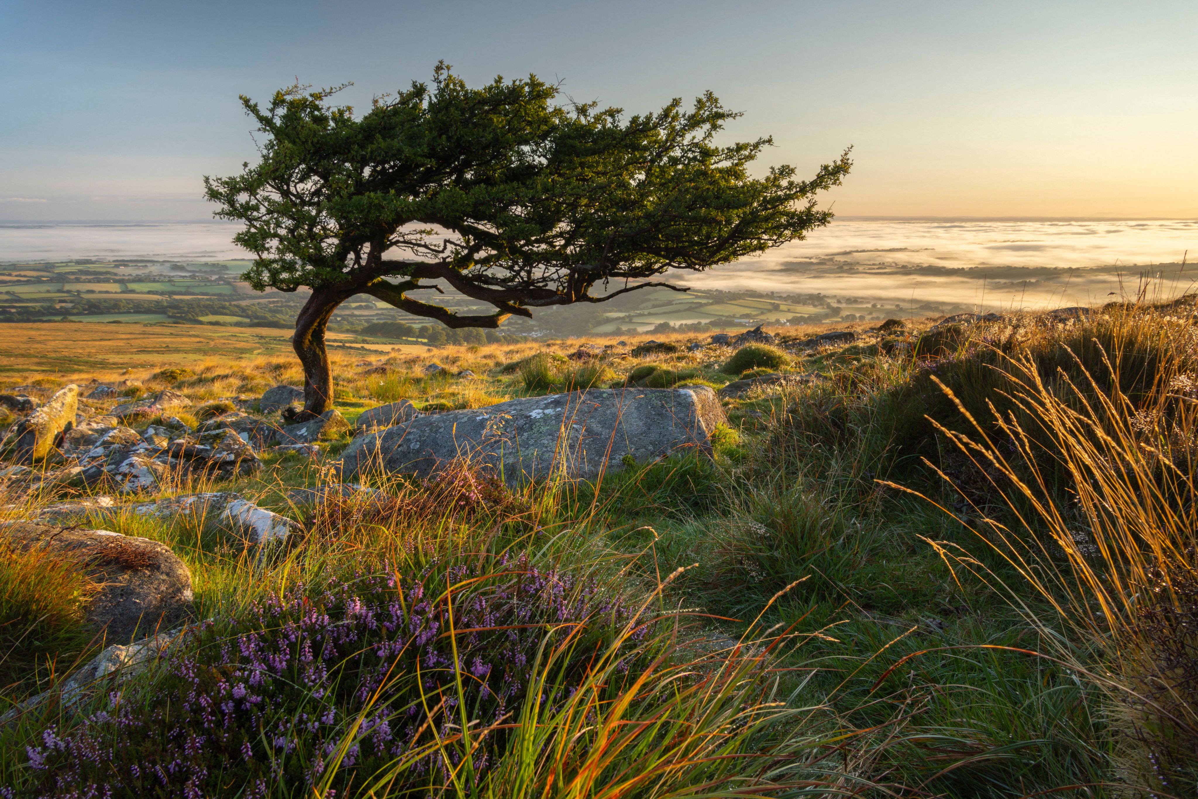
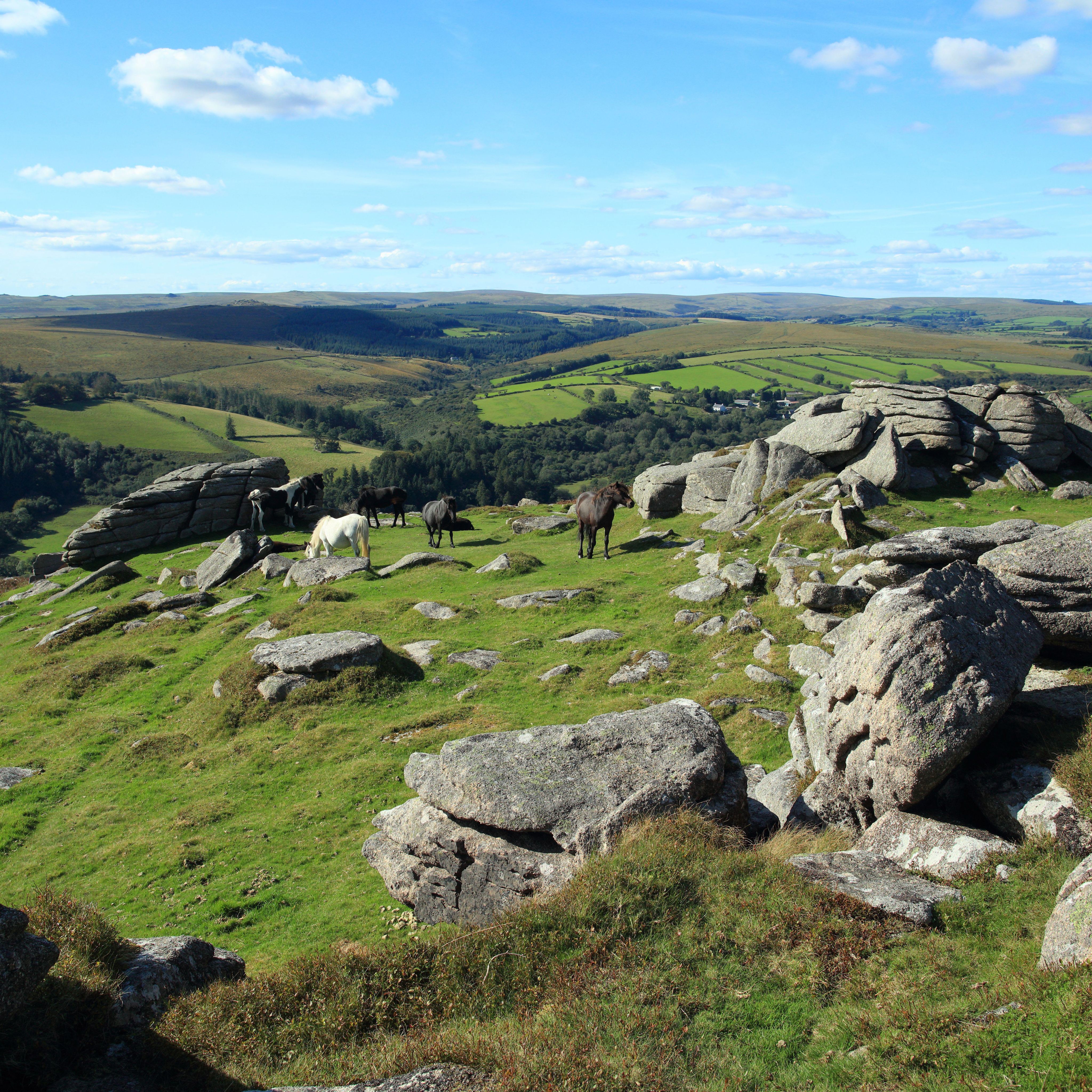
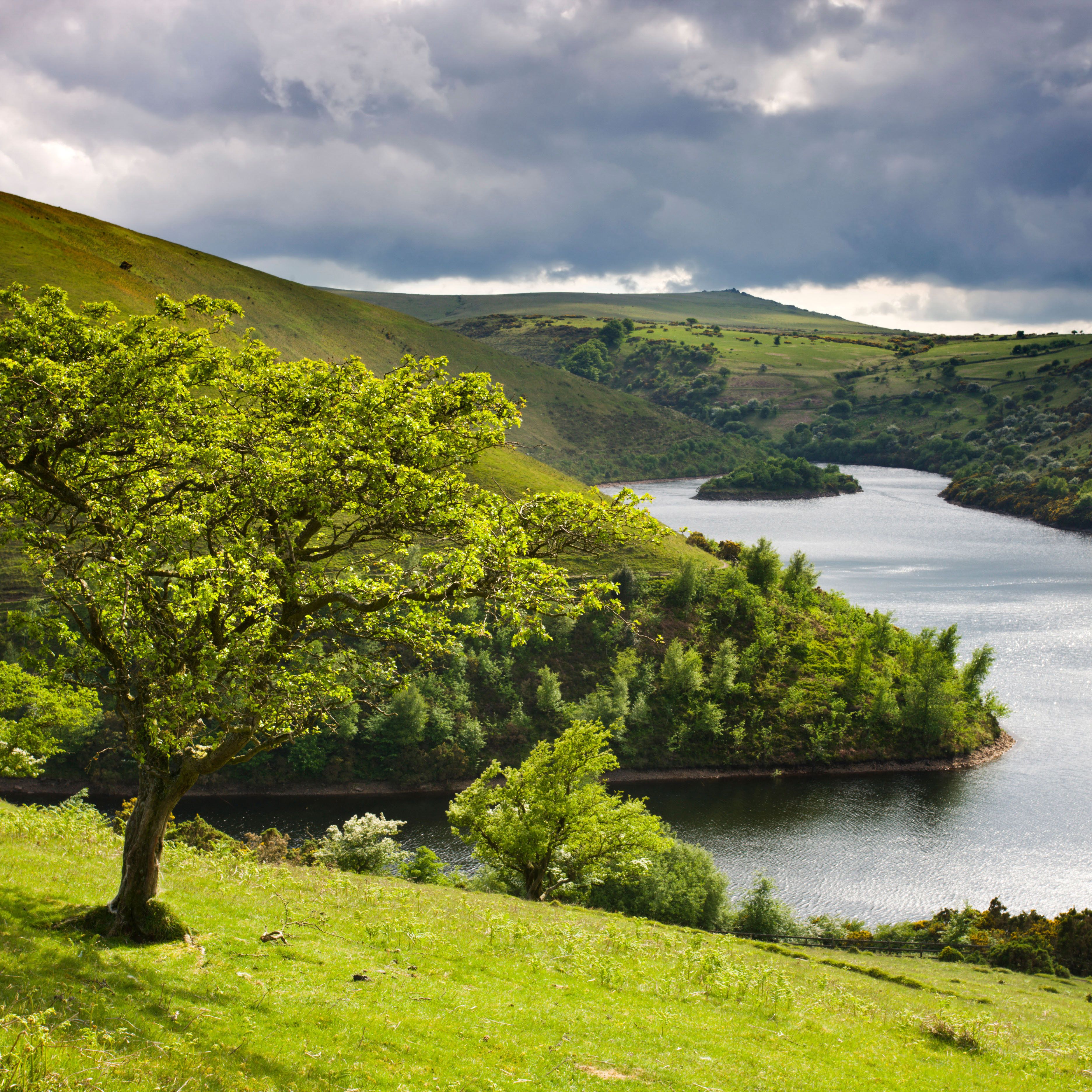
Dartmoor is a wild and mythical place, with rugged moorland, deep river valleys, rich history and rare wildlife, spread over 954 square kilometres/368 square miles and spanning about 32km/20 miles from north to south and from east to west. Designated a national park in 1951, it incorporates land owned by the Duchy of Cornwall, the Dartmoor National Park Authority, the Ministry of Defence and the National Trust, along with other private landowners.
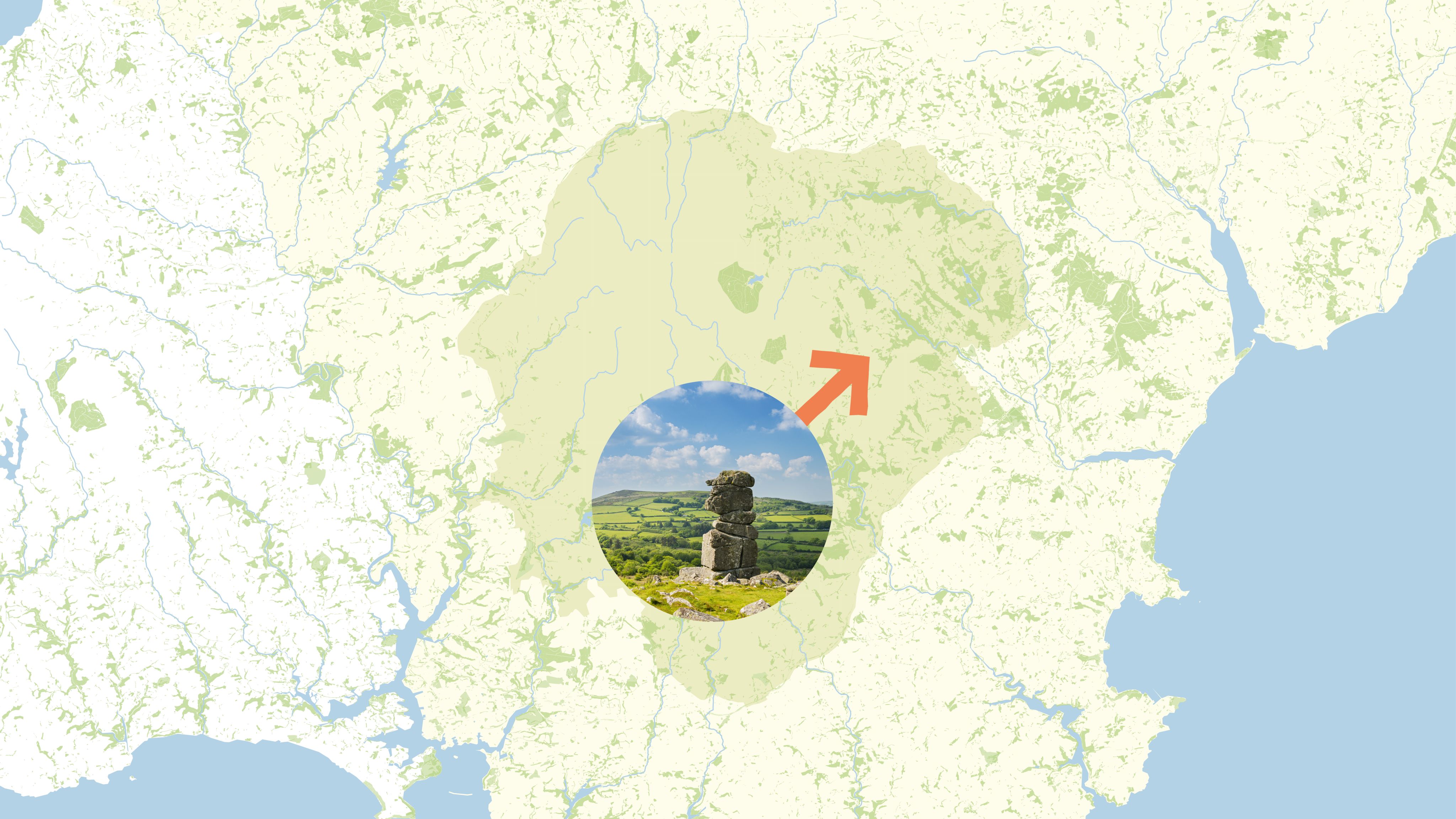
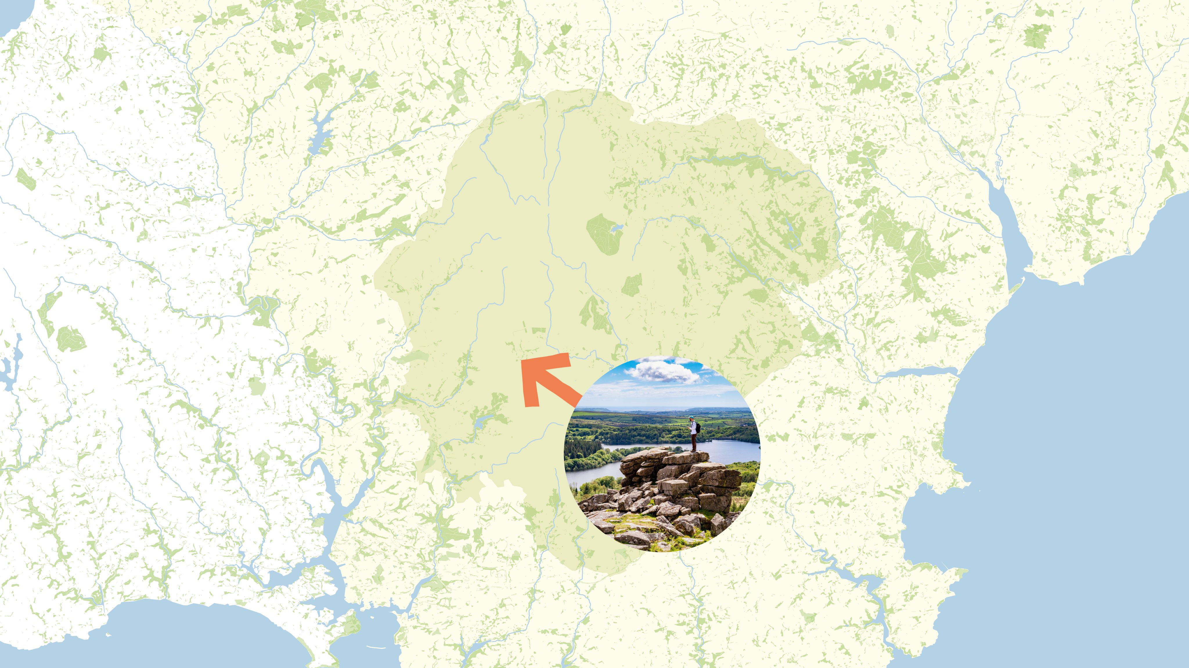
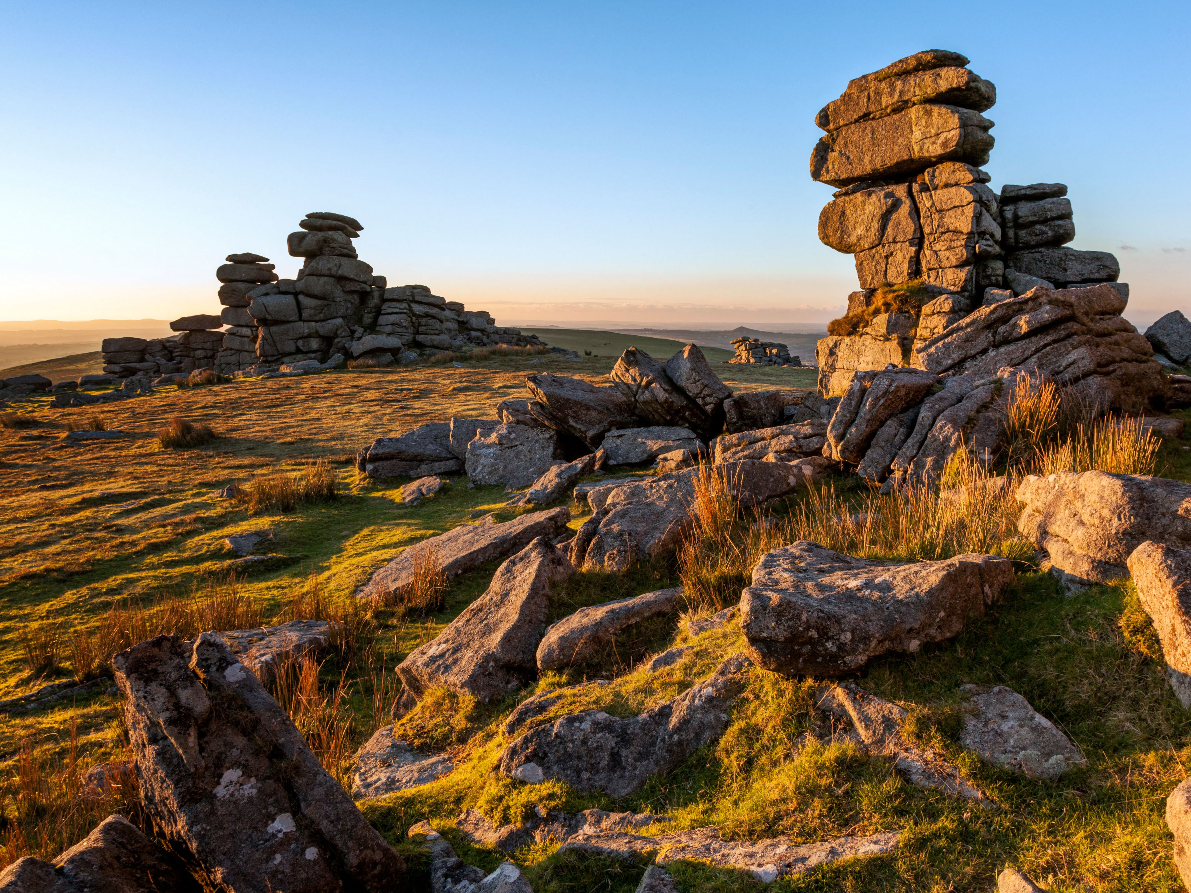
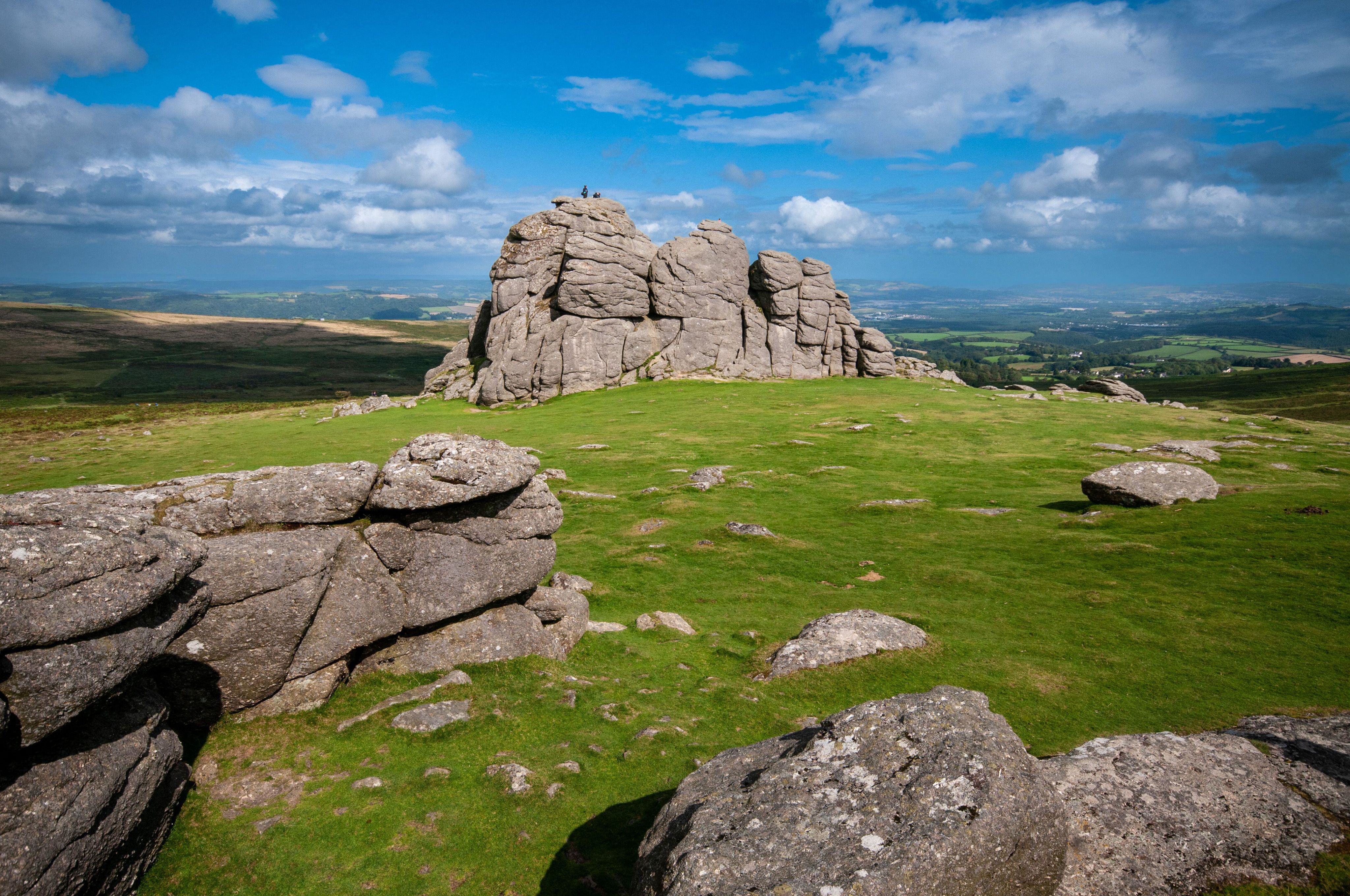
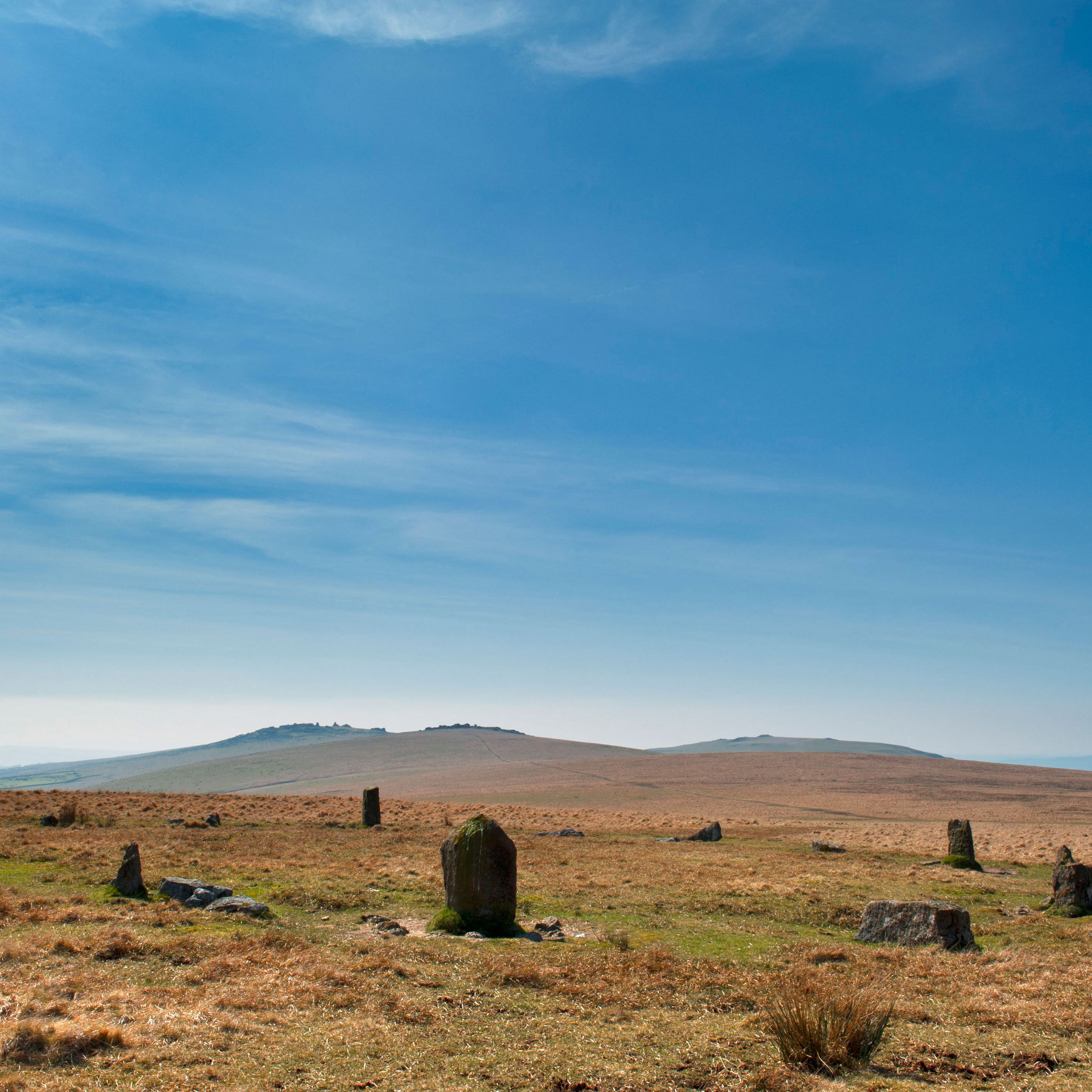
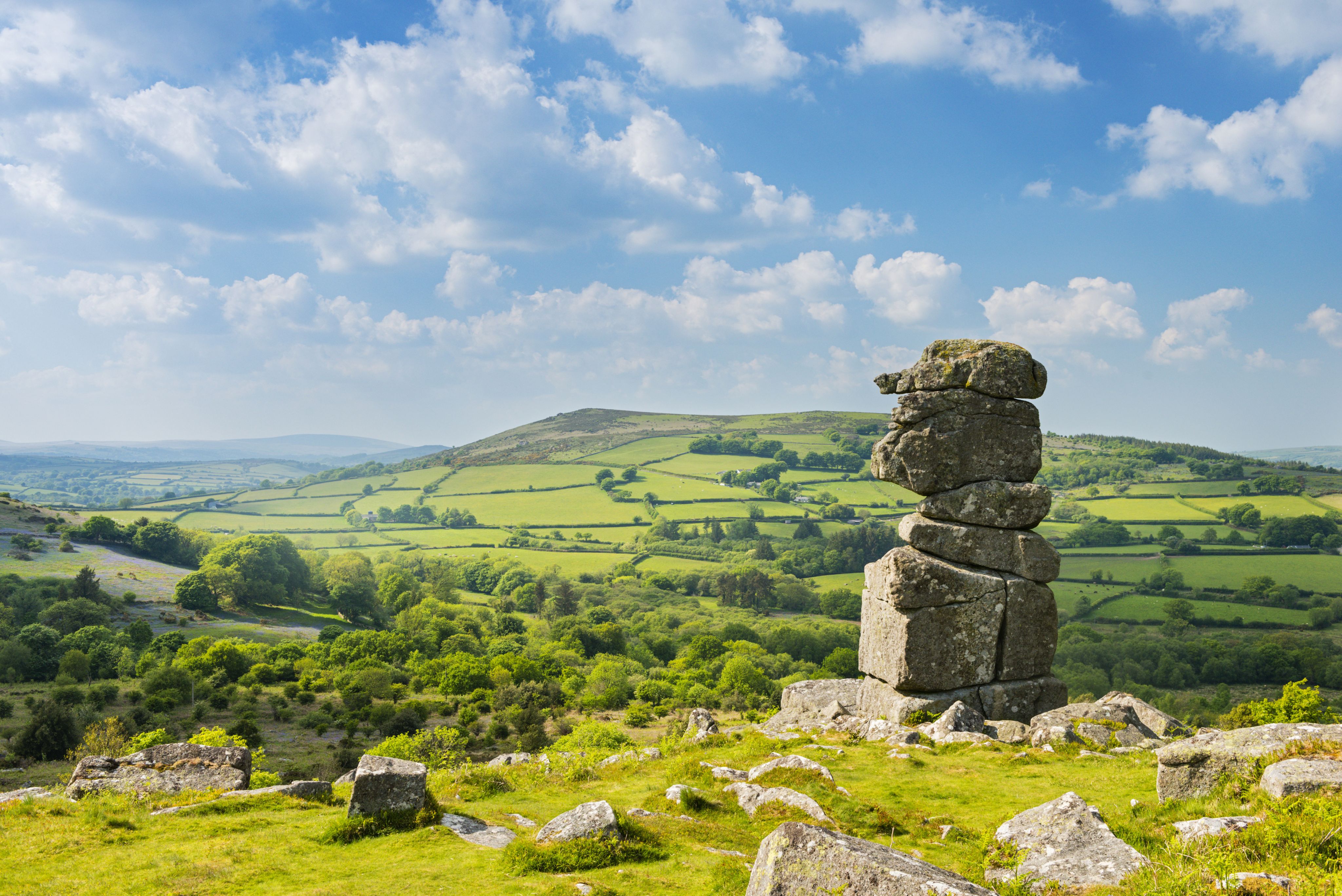
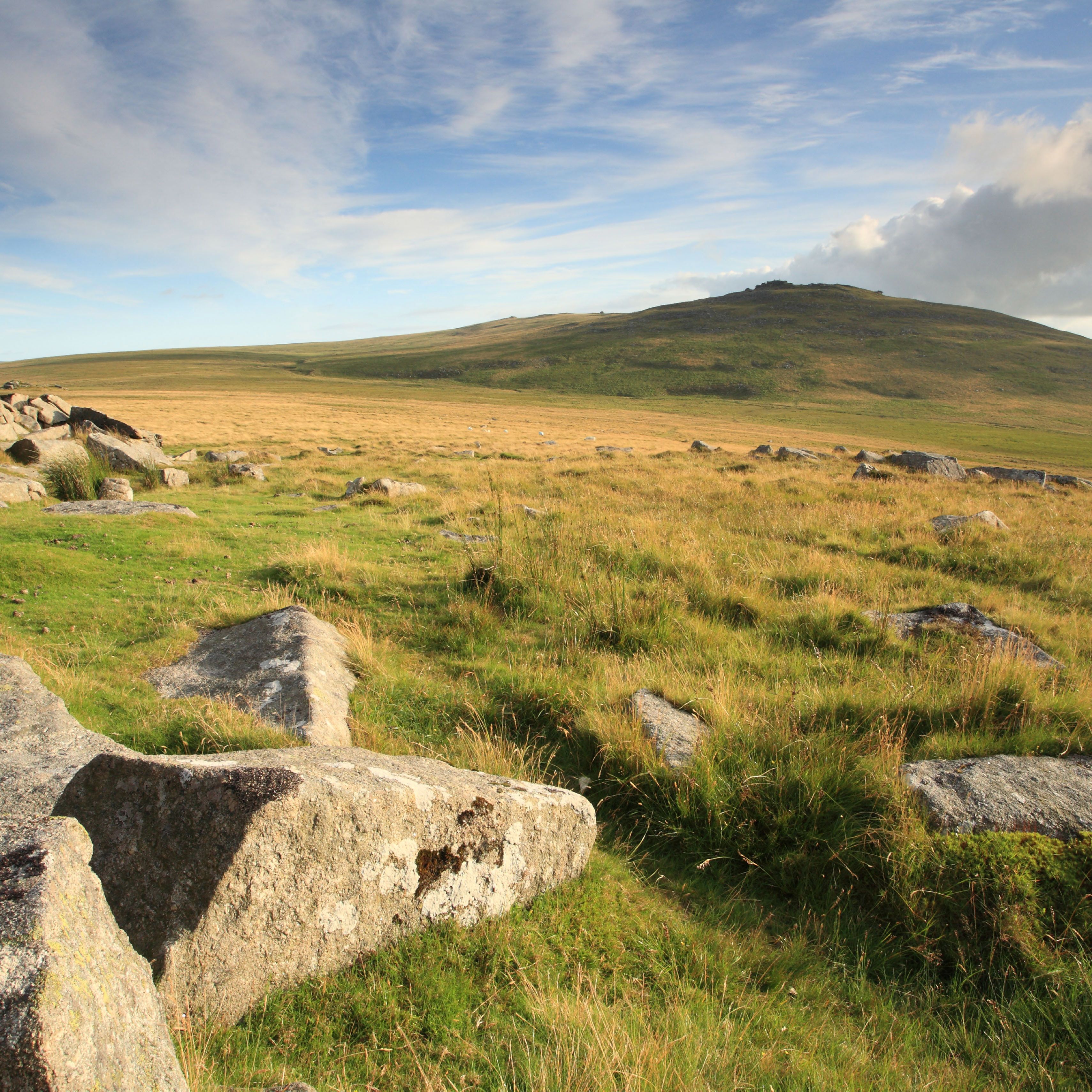
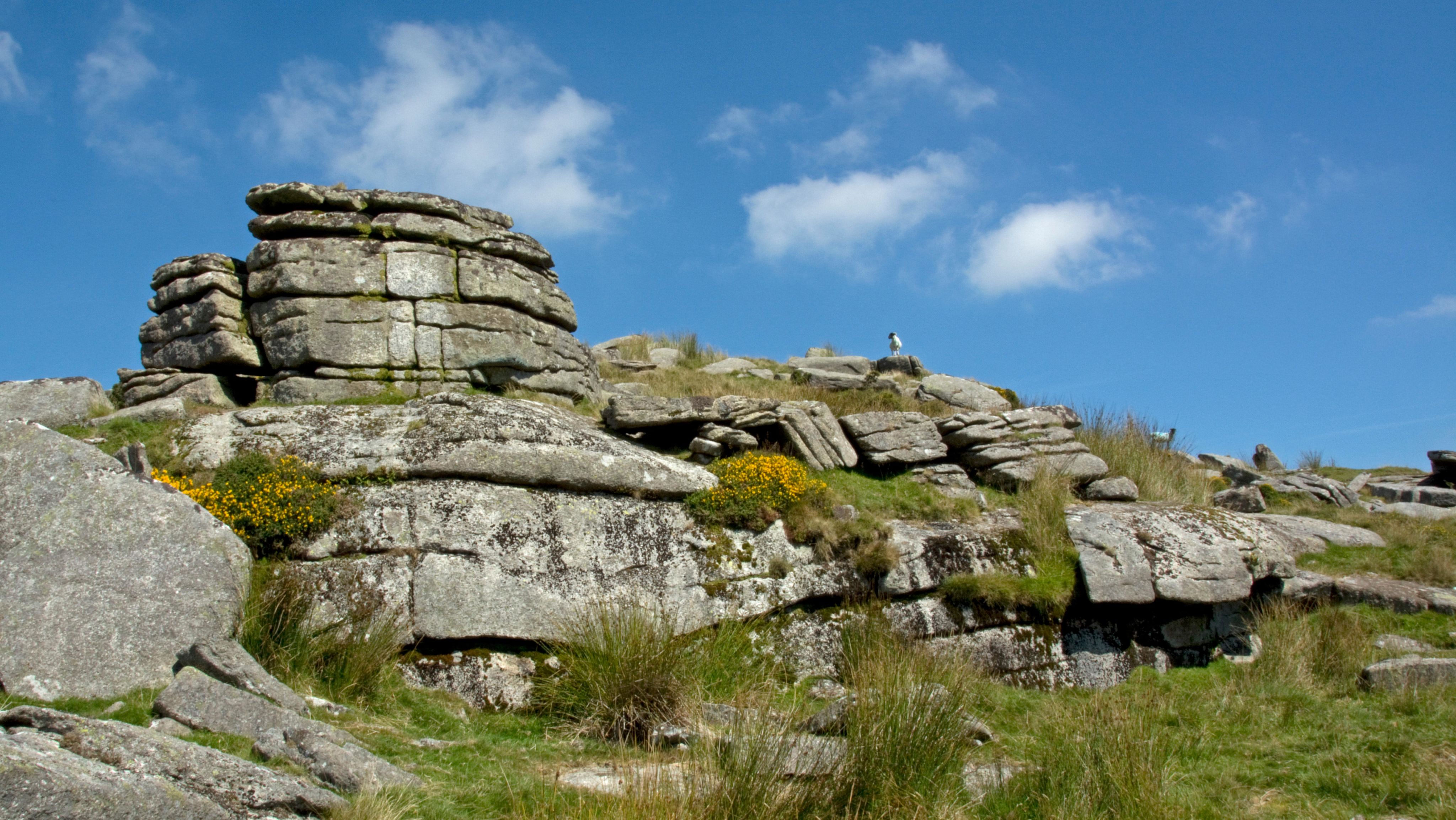
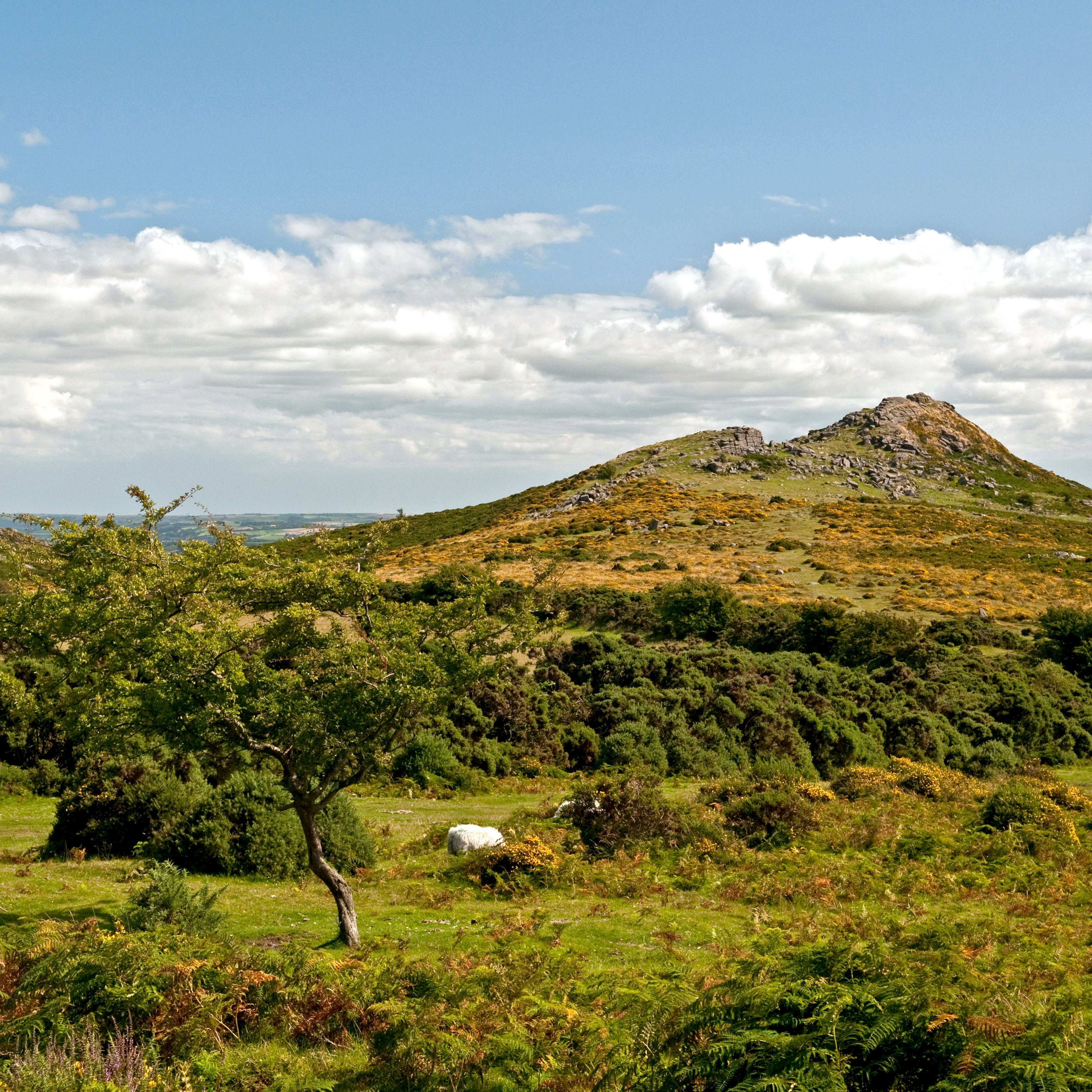
Dominating the skyline are more than 365 tors – towering pancake stacks of exposed granite at the park’s highest points. These include Haytor, famous for its panoramic views; Hound Tor, said to have inspired Arthur Conan Doyle’s Sherlock Holmes novel The Hound of the Baskervilles; and High Willhays, the highest point in southern England at 621m/2,039ft above sea level.
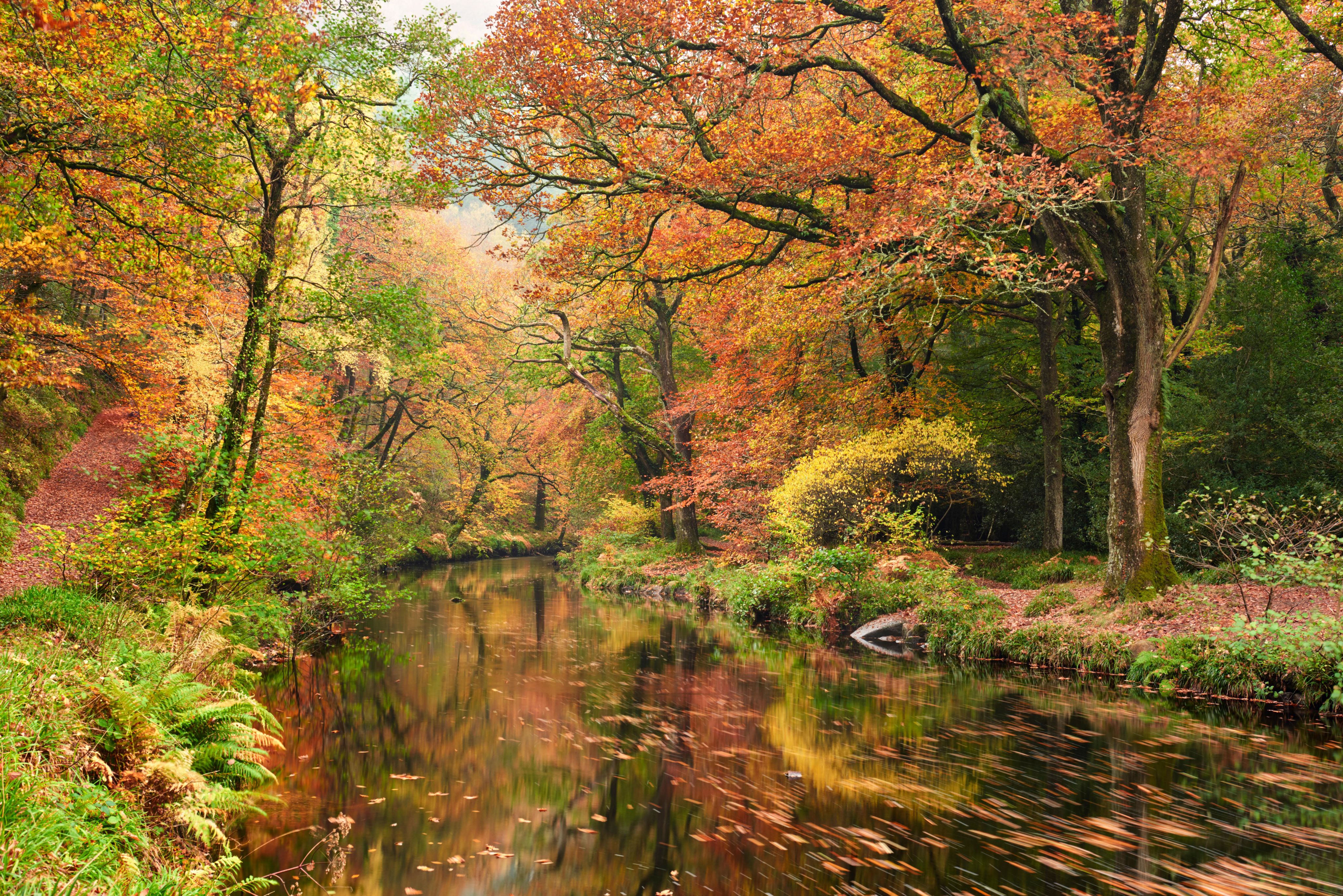
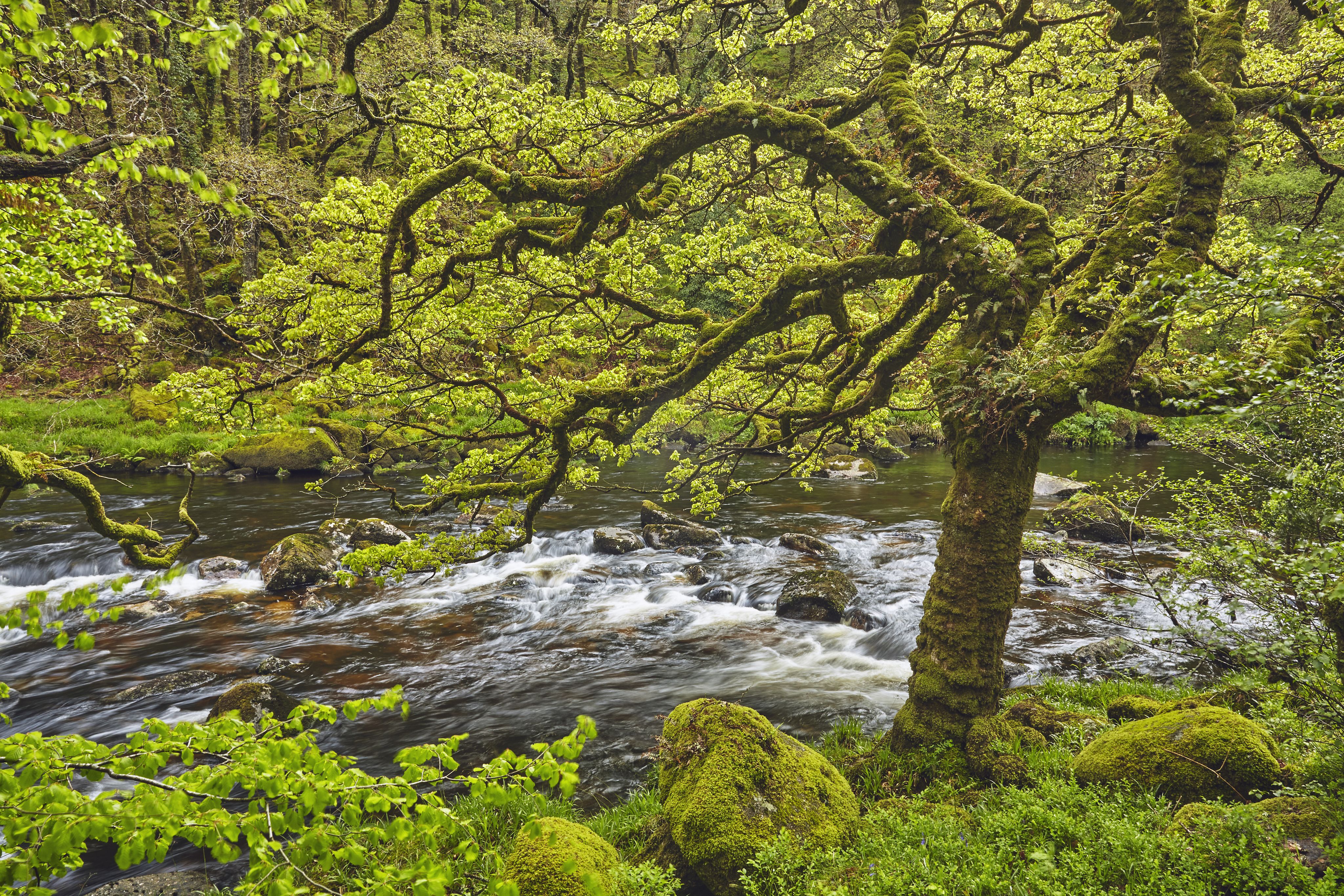
Dartmoor is also known for its unique wildlife, including the semi-wild ponies that have roamed freely for millennia, ground-nesting birds such as skylark and snipe, and the rare marsh fritillary butterfly. And its rivers provide special habitats for the migratory salmon and sea trout that come to spawn here, along with the dippers, kingfishers and otters that patrol the banks.
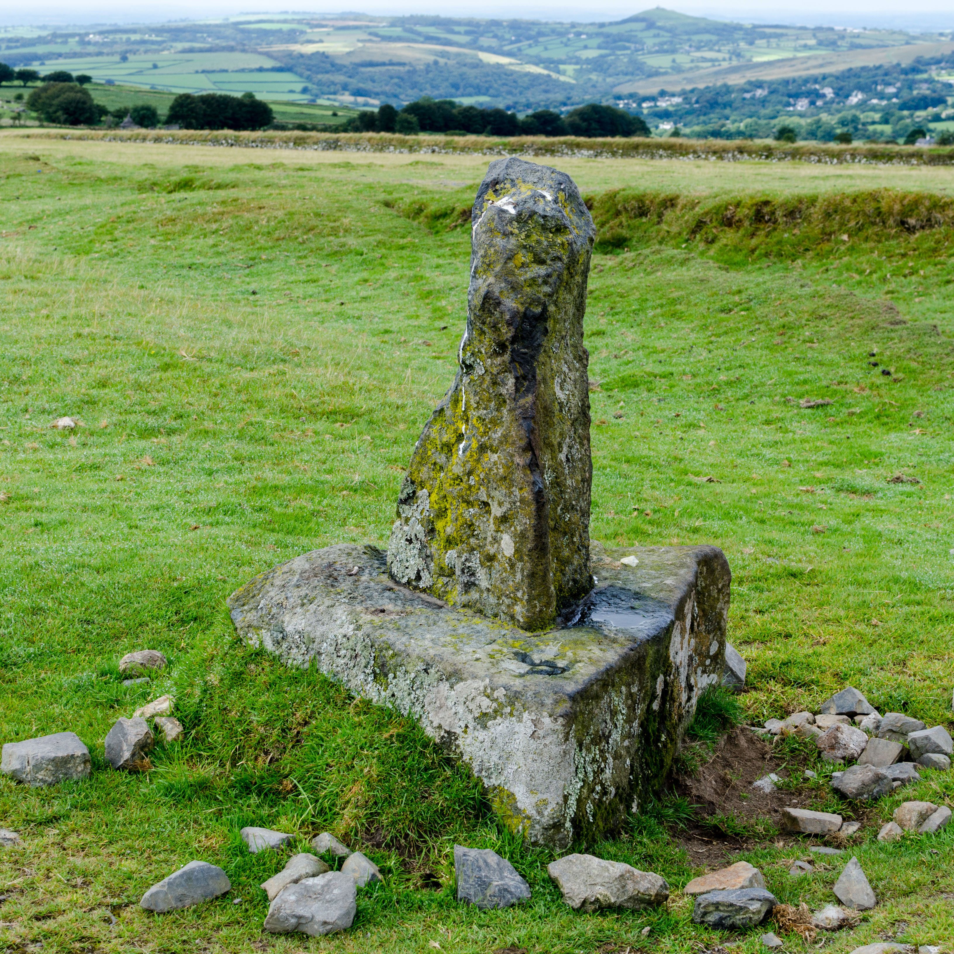
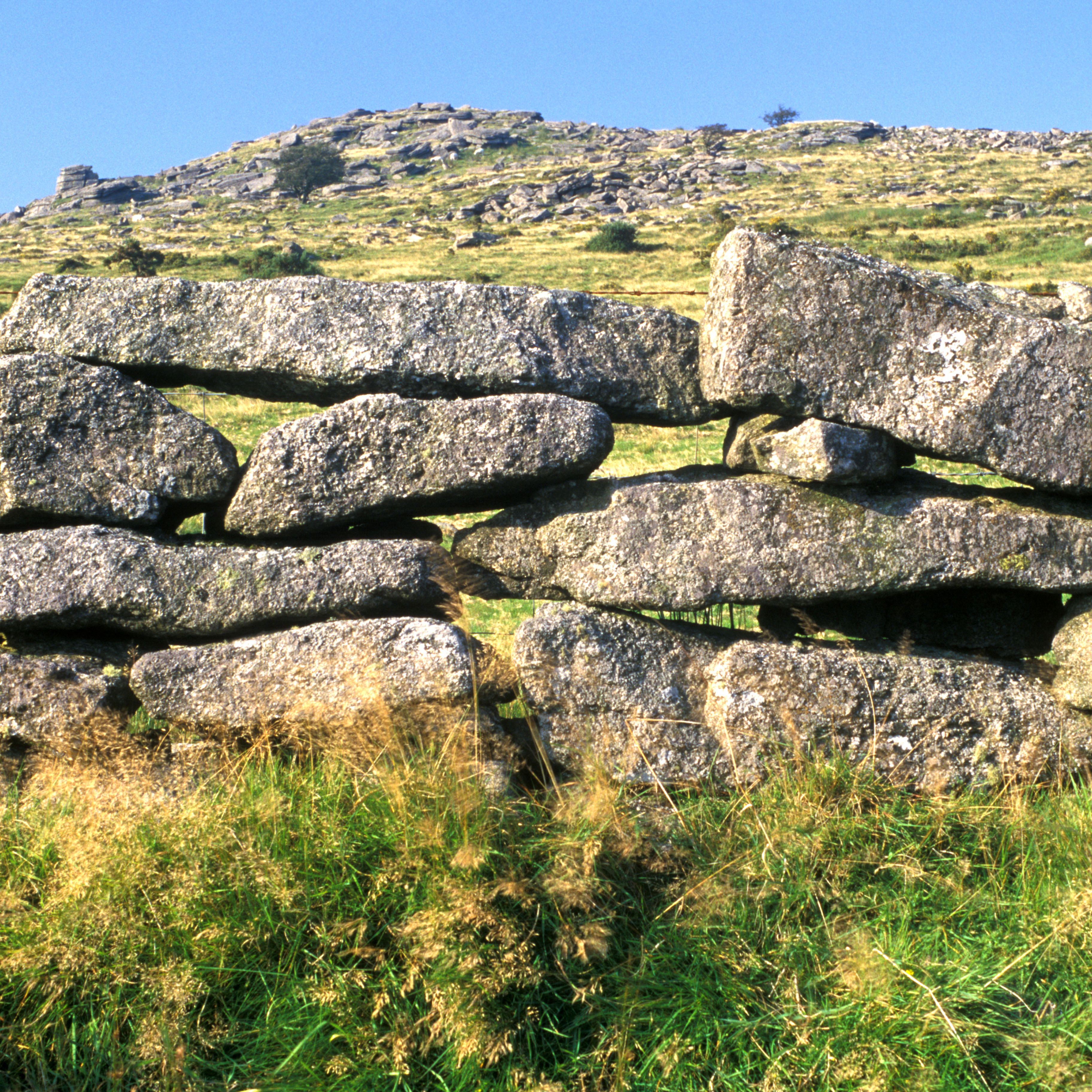
Shaped over the centuries by the people who lived and worked here, the Dartmoor landscape is littered with relics of its past. These include everything from prehistoric stone circles, Bronze Age settlements and Iron Age hillforts to an abandoned medieval village and the Haytor Granite Tramway, used to transport quarried stone in the 19th century.


Dartmoor National Park
With 954 square kilometres, Dartmoor offers spectacular walking routes for all
1
Historic Haytor circular walk
2
Bellever Forest to Yar Tor and Dartmeet
3
Great Staple Tor and White Tor circular
4
Hound Tor and Bowerman’s Nose
5
Princetown to Leather Tor circular
6
Belstone and the wild north moors
7
Meldon Reservoir to High Willhays
8
Tor bagging from Two Bridges
9
Castle Drogo and the Teign Gorge
10
Hexworthy to Holne and back
Dartmoor National Park
With 954 square kilometres, Dartmoor offers spectacular walking routes for all


1
Historic Haytor circular walk


2
Bellever Forest to Yar Tor and Dartmeet

3
Great Staple Tor and White Tor circular


4
Hound Tor and Bowerman’s Nose


5
Princetown to Leather Tor circular

6
Belstone and the wild north moors

7
Meldon Reservoir to High Willhays


8
Tor bagging from Two Bridges

9
Castle Drogo and the Teign Gorge

10
Hexworthy to Holne and back
Getting there
The closest mainline train stations are Exeter, Newton Abbot, Totnes, Ivybridge and Plymouth, all serviced by Great Western Railway. From Exeter it’s also possible to travel to Okehampton at the national park’s northern boundary on The Dartmoor Line. This was reinstated in 2021, with a new station, Okehampton Interchange, due to open in 2026.
If you’re looking to travel by bus, there are regular connections from Exeter, Newton Abbot and Plymouth. These include the Country Bus services 171 and 172 between Newton Abbot and Tavistock, and the Haytor Hoppa to Haytor and Widecombe.

By car, Dartmoor is within easy reach of the M5 motorway, via the A30 or the A38. It’s about a half-hour drive from its neighbouring cities of Exeter in the north-east and Plymouth to the south-west. On arrival, keep your speed below 40 miles per hour on the moorland roads – where ponies, sheep and cattle graze along the verges – before starting your walk from one of the many small car parks dotted across the national park.
If you want to combine a walk with a bike ride along one of Dartmoor’s popular cycling routes – such as the Dartmoor Way or the Granite Way – there are several local cycle hire centres to choose from.
Planning a walk
One of Dartmoor’s unique appeals is the open access to its commons – about 35,000 hectares of open countryside – meaning you can explore without needing to stick to the paths. There are also about 730km/449 miles of public footpaths, bridleways and byways, along with permissive paths and tracks through privately owned land.
Before embarking on a walk, it’s important to check the weather forecast – the conditions can change in minutes on Dartmoor. You should pack clothes for all conditions, and avoid river crossings after heavy downpours.
If you’re planning a walk through any of the military training areas, you’ll need to check the firing times, and pay attention to signs and warning signals. It’s ground-nesting bird season from the beginning of March to the end of July, when it’s important to avoid the park’s rare bird nesting sites.
Finally, to protect this wild and historic landscape and keep it special for everyone, the Dartmoor National Park Authority has created the Ranger Code. This includes rules such as keeping dogs on a lead, taking litter home, checking where you can camp, not feeding the ponies, sharing the roads and bridleways with other visitors and wildlife, and not lighting any fires.

Ready to plan your walk? To get you started, we’ve shared ten of our own favourite Dartmoor rambles. The National Park Authority also has a selection of routes on its website, including a series of stile-free options called Miles without Stiles, suitable if you have limited mobility.
Getting there
The closest mainline train stations are Exeter, Newton Abbot, Totnes, Ivybridge and Plymouth, all serviced by Great Western Railway. From Exeter it’s also possible to travel to Okehampton at the national park’s northern boundary on The Dartmoor Line. This was reinstated in 2021, with a new station, Okehampton Interchange, due to open in 2026.
If you’re looking to travel by bus, there are regular connections from Exeter, Newton Abbot and Plymouth. These include the Country Bus services 171 and 172 between Newton Abbot and Tavistock, and the Haytor Hoppa to Haytor and Widecombe.
By car, Dartmoor is within easy reach of the M5 motorway, via the A30 or the A38. It’s about a half-hour drive from its neighbouring cities of Exeter in the north-east and Plymouth to the south-west. On arrival, keep your speed below 40 miles per hour on the moorland roads – where ponies, sheep and cattle graze along the verges – before starting your walk from one of the many small car parks dotted across the national park.
If you want to combine a walk with a bike ride along one of Dartmoor’s popular cycling routes – such as the Dartmoor Way or the Granite Way – there are several local cycle hire centres to choose from.
Planning a walk
One of Dartmoor’s unique appeals is the open access to its commons – about 35,000 hectares of open countryside – meaning you can explore without needing to stick to the paths. There are also about 730km/449 miles of public footpaths, bridleways and byways, along with permissive paths and tracks through privately owned land.
Before embarking on a walk, it’s important to check the weather forecast – the conditions can change in minutes on Dartmoor. You should pack clothes for all conditions, and avoid river crossings after heavy downpours.
If you’re planning a walk through any of the military training areas, you’ll need to check the firing times, and pay attention to signs and warning signals. It’s ground-nesting bird season from the beginning of March to the end of July, when it’s important to avoid the park’s rare bird nesting sites.
Finally, to protect this wild and historic landscape and keep it special for everyone, the Dartmoor National Park Authority has created the Ranger Code. This includes rules such as keeping dogs on a lead, taking litter home, checking where you can camp, not feeding the ponies, sharing the roads and bridleways with other visitors and wildlife, and not lighting any fires.
Ready to plan your walk? To get you started, we’ve shared ten of our own favourite Dartmoor rambles. The National Park Authority also has a selection of routes on its website, including a series of stile-free options called Miles without Stiles, suitable if you have limited mobility.
1
Historic Haytor circular

DISTANCE: 5.6 km/3½ miles
DIFFICULTY: Leisurely
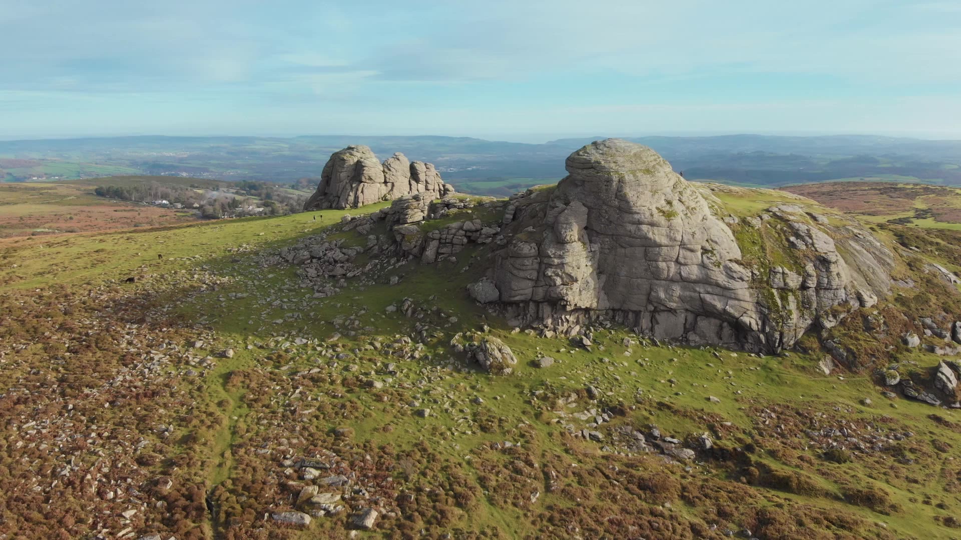
This circular route will take you to the summit of Haytor – one of Dartmoor’s most photographed tors – and past a series of historical landmarks, transporting you from the Bronze Age to the Victorian industrial era.
Starting at the Dartmoor National Park Information Centre, you’ll follow a steep grassy path up to Haytor Rocks, where you can enjoy spectacular views of the surrounding tors and rolling valleys towards Teignmouth.
From here, you’ll go down to the former Haytor Quarries, where in the 19th century Dartmoor granite was extracted to supply stone for major UK buildings, including London Bridge. This was transported down to the Stover Canal for onward shipment to Teignmouth Docks on the Haytor Granite Tramway – a track formed of granite sections shaped to guide the wheels of horse-drawn trucks, which could each carry up to three tons of granite.
Leaving the quarry, you’ll follow a broad path to Smallacombe Rocks. Here you’ll discover the remains of a Bronze Age field system and a settlement of four roundhouses, before joining a section of the Templer Way – which follows the old tramway – on your route back to the information centre


View from Smallacombe Rocks towards Hound Tor (above); Haytor Granite Tramway (top)
View from Smallacombe Rocks towards Hound Tor (above); Haytor Granite Tramway (top)
Haytor Granite Tramway
Haytor Granite Tramway
DISTANCE: 5.6 km/3½ miles
DIFFICULTY: Leisurely
This circular route will take you to the summit of Haytor – one of Dartmoor’s most photographed tors – and past a series of historical landmarks, transporting you from the Bronze Age to the Victorian industrial era.
Starting at the Dartmoor National Park Information Centre, you’ll follow a steep grassy path up to Haytor Rocks, where you can enjoy spectacular views of the surrounding tors and rolling valleys towards Teignmouth.
View from Smallacombe Rocks towards Hound Tor
View from Smallacombe Rocks towards Hound Tor
From here, you’ll go down to the former Haytor Quarries, where in the 19th century Dartmoor granite was extracted to supply stone for major UK buildings, including London Bridge. This was transported down to the Stover Canal for onward shipment to Teignmouth Docks on the Haytor Granite Tramway – a track formed of granite sections shaped to guide the wheels of horse-drawn trucks, which could each carry up to three tons of granite.
Leaving the quarry, you’ll follow a broad path to Smallacombe Rocks. Here you’ll discover the remains of a Bronze Age field system and a settlement of four roundhouses, before joining a section of the Templer Way – which follows the old tramway – on your route back to the information centre
2
Bellever Forest to Yar Tor and Dartmeet


Dartmoor ponies on Yar Tor (above); Bellever Bridge (top)
Dartmoor ponies on Yar Tor (above); Bellever Bridge (top)
DISTANCE: 16.8km/10½ miles
DIFFICULTY: Moderate
You’ll discover ancient woodland, deep river valleys and epic views on this circular walk beginning on the edge of Bellever Forest.
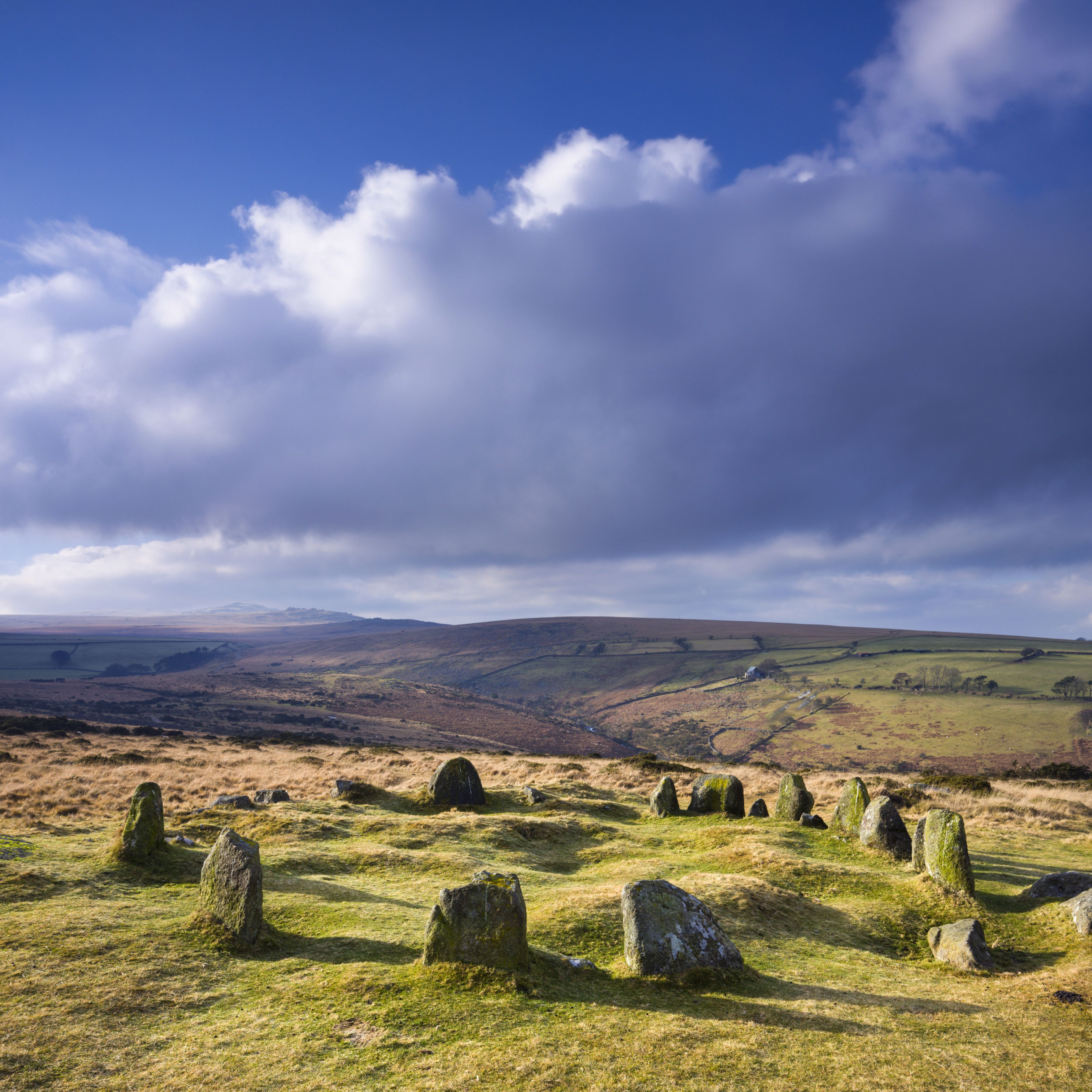
After leaving the forest via Bellever Bridge, you’ll pass through the tiny hamlet of Pizwell, before entering Soussons Down, a woodland hiding a series of Bronze Age monuments among the trees, including a stone circle and four round barrows.
From here, you’ll pass Ephraim’s Pinch – a hill that’s said to be named after a man who died attempting to carry a heavy load of wheat to win the hand of a local farmer’s daughter.
After following the road onto Cordon Down, you’ll then climb to Corndon Tor and Yar Tor, with their far-reaching moorland views, before descending to Dartmeet, a local beauty spot at the confluence of the East and West Dart rivers. Heading north, the East Dart guides you back to the start.
Bellever Bridge
Bellever Bridge
DISTANCE: 16.8km/10½ miles
DIFFICULTY: Moderate
You’ll discover ancient woodland, deep river valleys and epic views on this circular walk beginning on the edge of Bellever Forest.
After leaving the forest via Bellever Bridge, you’ll pass through the tiny hamlet of Pizwell, before entering Soussons Down, a woodland hiding a series of Bronze Age monuments among the trees, including a stone circle and four round barrows.
Dartmoor ponies on Yar Tor
Dartmoor ponies on Yar Tor
From here, you’ll pass Ephraim’s Pinch – a hill that’s said to be named after a man who died attempting to carry a heavy load of wheat to win the hand of a local farmer’s daughter.
After following the road onto Cordon Down, you’ll then climb to Corndon Tor and Yar Tor, with their far-reaching moorland views, before descending to Dartmeet, a local beauty spot at the confluence of the East and West Dart rivers. Heading north, the East Dart guides you back to the start.
3
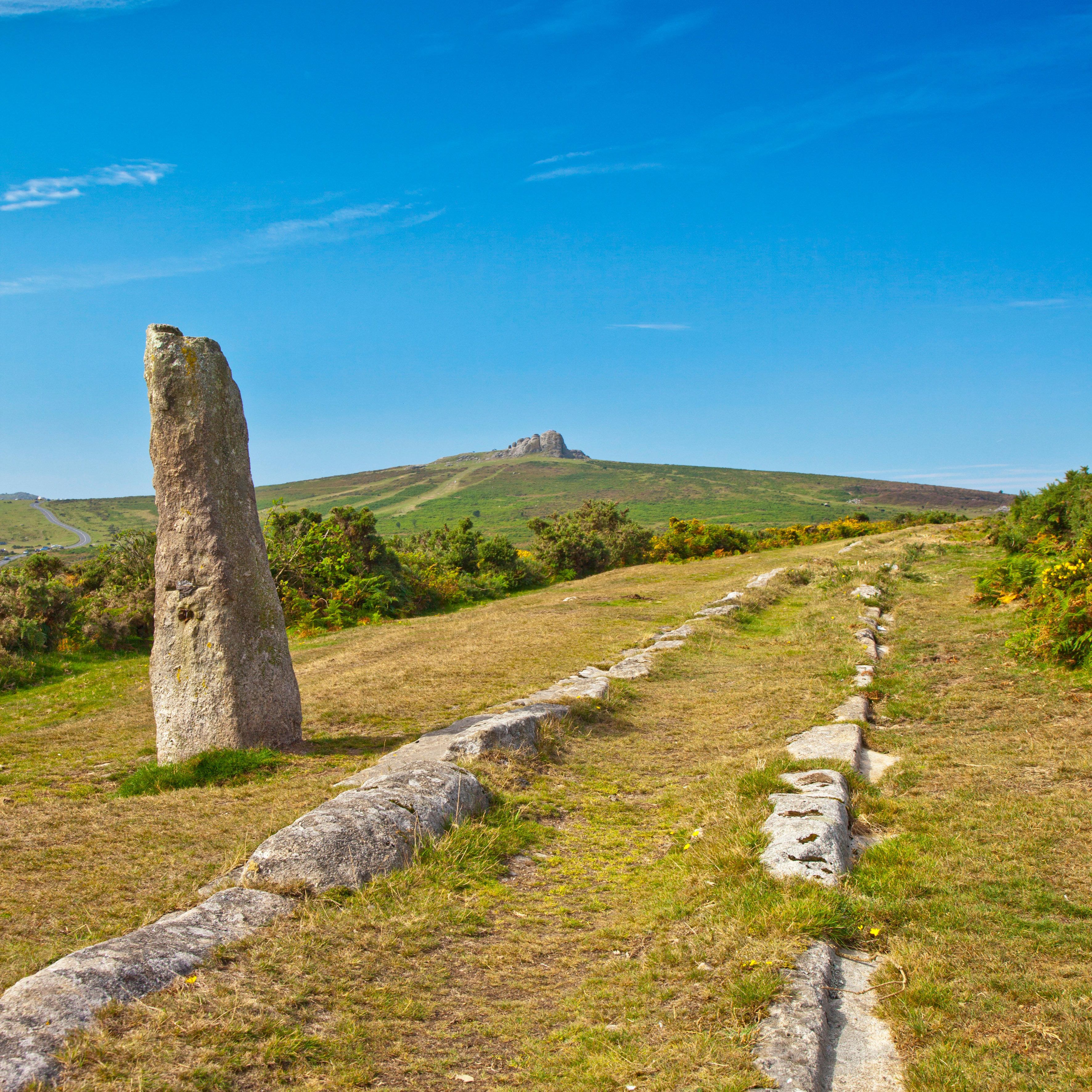
Great Staple Tor and White Tor circular


DISTANCE: 10.3km/6½ miles
DIFFICULTY: Moderate/strenuous
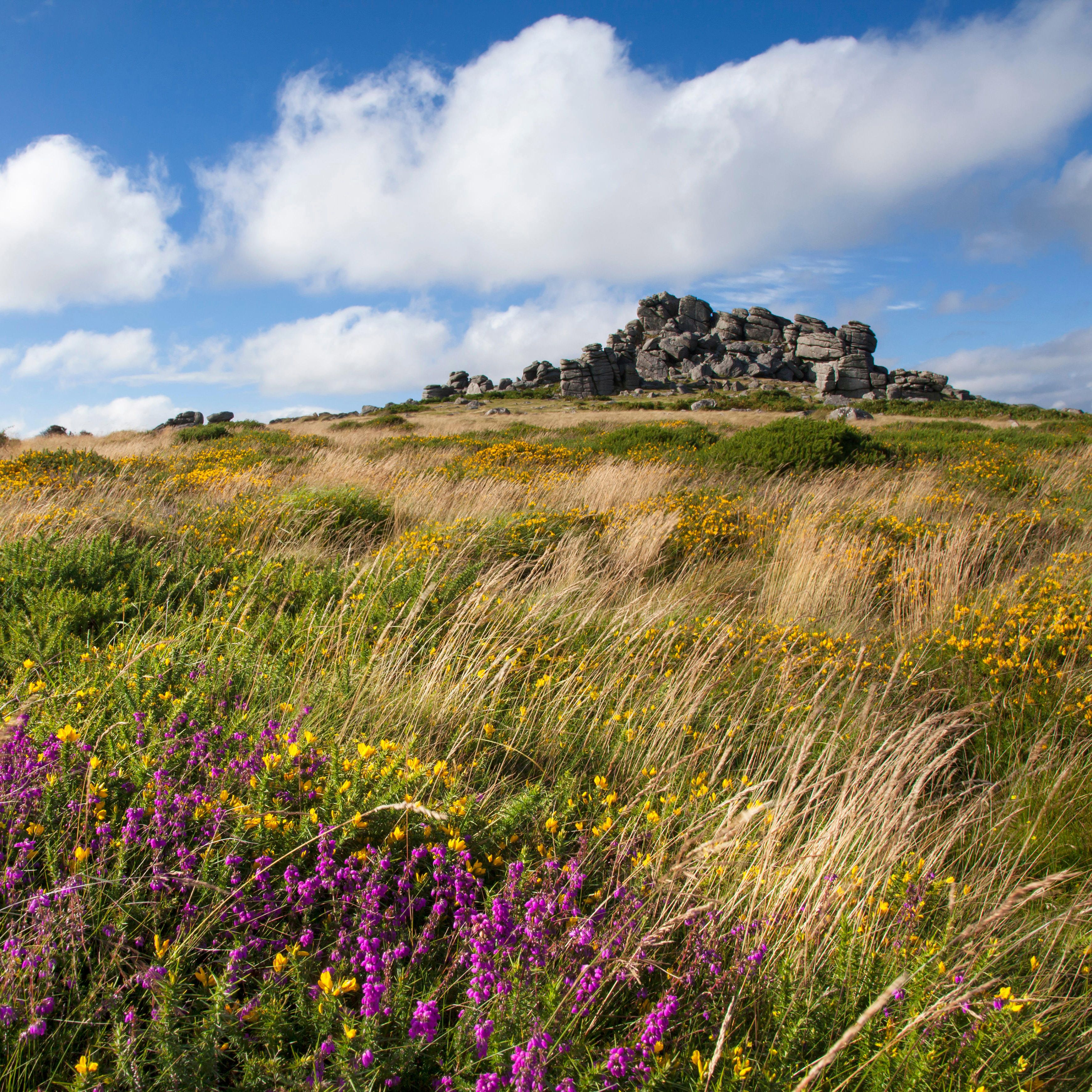
Prepare to tick off a selection of Dartmoor’s famous tors on this challenging circular route, passing standing stones and prehistoric settlements between summits.
From the Pork Hill car park on the B3357, the first stop is Great Staple Tor, with its distinctive, pancake-stack granite towers, followed by nearby Roos Tor and the wind-whipped Langstone Moor Stone Circle. Nearby is the Langstone menhir, another prehistoric standing stone that is pockmarked by shell holes left by the military, which once used it for target practice.
From here it’s a scramble to the summit of White Tor, which offers expansive views across the Tavy Valley, and as far as Bodmin Moor and Plymouth Sound.
The walk back to the car park then takes you past the slopes of Cox Tor, via Stephen’s Grave – a weathered stone marked with a simple letter S. This is where George Stephens from nearby Peter Tavy was buried, having taken his own life after a girl was unfaithful to him. According to local legend, linen hanging out to dry at nearby Higher Godsworthy was caught in a freak gust of wind at the very moment he was buried, and was never seen again.


Stephen's Grave (above); Langstone Moor Stone Circle (top)
Stephen's Grave (above); Langstone Moor Stone Circle (top)
Langstone Moor Stone Circle
Langstone Moor Stone Circle
DISTANCE: 10.3km/6½ miles
DIFFICULTY: Moderate/strenuous
Prepare to tick off a selection of Dartmoor’s famous tors on this challenging circular route, passing standing stones and prehistoric settlements between summits.
From the Pork Hill car park on the B3357, the first stop is Great Staple Tor, with its distinctive, pancake-stack granite towers, followed by nearby Roos Tor and the wind-whipped Langstone Moor Stone Circle. Nearby is the Langstone menhir, another prehistoric standing stone that is pockmarked by shell holes left by the military, which once used it for target practice.
Stephen's Grave
Stephen's Grave
From here it’s a scramble to the summit of White Tor, which offers expansive views across the Tavy Valley, and as far as Bodmin Moor and Plymouth Sound.
The walk back to the car park then takes you past the slopes of Cox Tor, via Stephen’s Grave – a weathered stone marked with a simple letter S. This is where George Stephens from nearby Peter Tavy was buried, having taken his own life after a girl was unfaithful to him. According to local legend, linen hanging out to dry at nearby Higher Godsworthy was caught in a freak gust of wind at the very moment he was buried, and was never seen again.
4
Hound Tor and Bowerman’s Nose


Hound Tor (above); Widecome-in-the-Moor (top)
Hound Tor (above); Widecome-in-the-Moor (top)
DISTANCE: 16.2km/10 miles
DIFFICULTY: Moderate
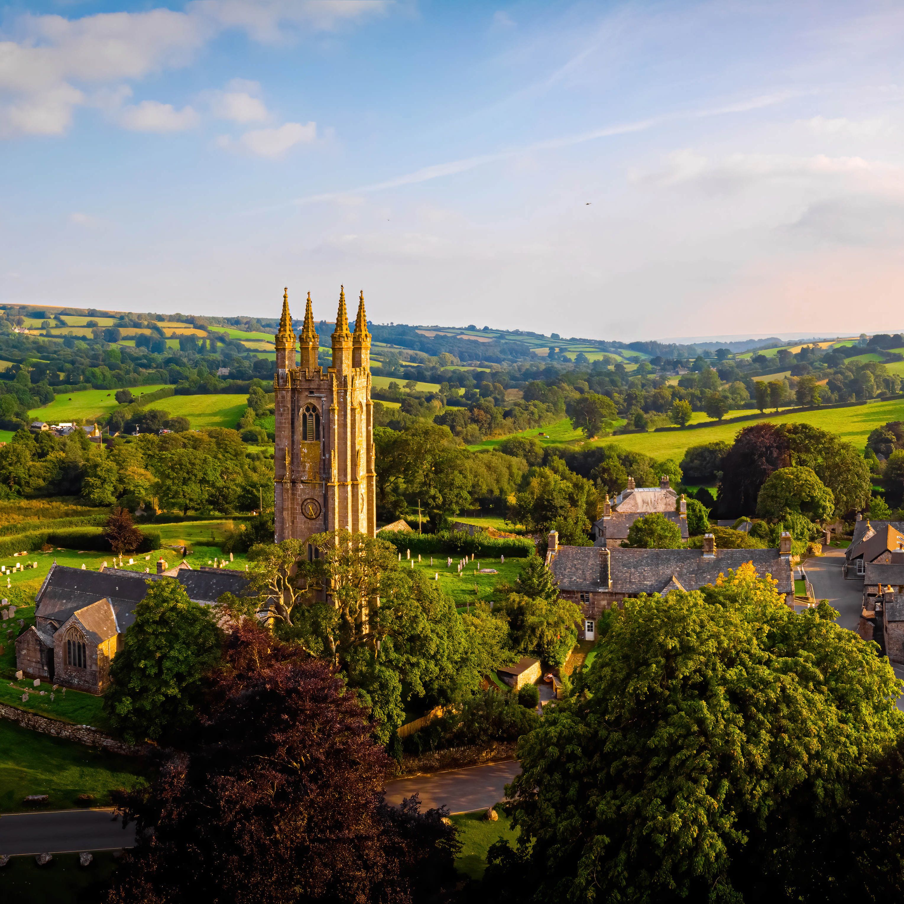
Starting in the pretty Dartmoor village of Widecombe-in-the-Moor, this circular walk passes ruined ancient settlements and rocky tors that have inspired local folklore.
The first of these is Hound Tor, a striking granite formation that’s said to have played a part in inspiring Arthur Conan Doyle to set his 1902 murder mystery The Hound of the Baskervilles on Dartmoor. Nearby are the extensive, atmospheric remains of Hound Tor Deserted Medieval Village – a cluster of 13th-century stone longhouses, on land that was originally farmed in the Bronze Age.
To the north of Hound Tor, on Hayne Down, is Bowerman’s Nose, a 6.6m/21.5ft rock formation with a profile that resembles a man in a flat cap. Local legend has it that Bowerman was a hunter, turned to stone by a coven of witches after he mistakenly knocked over their cauldron.
A highlight of the walk back to Widecombe-in-the-Moor is Grimspound, Dartmoor’s best-known prehistoric settlement, probably dating from the late Bronze Age. Here you’ll find the remains of 24 houses within a circular boundary wall about 150m/490ft in diameter.
Widecome-in-the-Moor
Widecome-in-the-Moor
DISTANCE: 16.2km/10 miles
DIFFICULTY: Moderate
Starting in the pretty Dartmoor village of Widecombe-in-the-Moor, this circular walk passes ruined ancient settlements and rocky tors that have inspired local folklore.
The first of these is Hound Tor, a striking granite formation that’s said to have played a part in inspiring Arthur Conan Doyle to set his 1902 murder mystery The Hound of the Baskervilles on Dartmoor. Nearby are the extensive, atmospheric remains of Hound Tor Deserted Medieval Village – a cluster of 13th-century stone longhouses, on land that was originally farmed in the Bronze Age.
Hound Tor
Hound Tor
To the north of Hound Tor, on Hayne Down, is Bowerman’s Nose, a 6.6m/21.5ft rock formation with a profile that resembles a man in a flat cap. Local legend has it that Bowerman was a hunter, turned to stone by a coven of witches after he mistakenly knocked over their cauldron.
A highlight of the walk back to Widecombe-in-the-Moor is Grimspound, Dartmoor’s best-known prehistoric settlement, probably dating from the late Bronze Age. Here you’ll find the remains of 24 houses within a circular boundary wall about 150m/490ft in diameter.
5
Princetown to Leather Tor circular

DISTANCE: 15.5km/9½ miles
DIFFICULTY: Moderate
This classic Dartmoor loop features a range of scenery, including soaring tors, open moorland and dense woodland.
From Princetown, you’ll follow a well-made track path along the route of the abandoned Princetown Railway line, which once transported quarried granite to a wharf on the River Plym near Plymouth. The line was constructed in 1823, with horse-drawn cars, then upgraded to support locomotives in 1878, and it was in use until 1956.
Heading south, you’ll then make the climb up Sharpitor and on to Leather Tor, before descending into peaceful woodland near the northern edge of Burrator Reservoir (constructed in the 1890s to provide drinking water for Plymouth).
Leaving the woods, you’ll follow bridleway all the way back to Princetown via South Hessary Tor, crossing open moorland with expansive views.
6
Belstone and the wild north moors


Nine Maidens Stone Circle (above); Irishman's Wall (top)
Nine Maidens Stone Circle (above); Irishman's Wall (top)
DISTANCE: 8.8km/5½ miles
DIFFICULTY: Moderate
Dartmoor’s northern tors, moors and Taw river are the stars of this remote ramble, best enjoyed in the early hours as the skylarks welcome the dawn.
The circular route takes you from the village of Belstone onto the moor, where the track passes below the Nine Maidens Stone Circle, followed by Irishman’s Wall – a dry-stone wall that’s said to have been built by Irish workers, in an attempt to enclose the land and claim it as their own. Unsurprisingly, the locals were having none of it and sections were pushed down, leading to the project being abandoned.
After passing below Winter Tor (or over the top if you fancy an additional climb), you’ll cross a (usually) shallow ford on the River Taw before heading uphill to the east.
On your way back to Belstone, you’ll pass Cosdon Hill (also known as Cosdon Beacon or Cawsand Beacon) – one of the highest hills in Dartmoor, it’s well worth taking a detour up for the views. Traces of prehistoric occupation are all around, with the remnants of nine Bronze Age settlements to the west and a large cairn on the summit, which may have been the site of a beacon.
After heading downhill and west, a footbridge over the River Taw leads back into the village, where you can rest and refuel at The Tors, a welcoming pub that sits some 300m/1,000ft above sea level.
Irishman's Wall
Irishman's Wall
DISTANCE: 8.8km/5½ miles
DIFFICULTY: Moderate
Dartmoor’s northern tors, moors and Taw river are the stars of this remote ramble, best enjoyed in the early hours as the skylarks welcome the dawn.
The circular route takes you from the village of Belstone onto the moor, where the track passes below the Nine Maidens Stone Circle, followed by Irishman’s Wall – a dry-stone wall that’s said to have been built by Irish workers, in an attempt to enclose the land and claim it as their own. Unsurprisingly, the locals were having none of it and sections were pushed down, leading to the project being abandoned.
After passing below Winter Tor (or over the top if you fancy an additional climb), you’ll cross a (usually) shallow ford on the River Taw before heading uphill to the east.
Nine Maidens Stone Circle
Nine Maidens Stone Circle
On your way back to Belstone, you’ll pass Cosdon Hill (also known as Cosdon Beacon or Cawsand Beacon) – one of the highest hills in Dartmoor, it’s well worth taking a detour up for the views. Traces of prehistoric occupation are all around, with the remnants of nine Bronze Age settlements to the west and a large cairn on the summit, which may have been the site of a beacon.
After heading downhill and west, a footbridge over the River Taw leads back into the village, where you can rest and refuel at The Tors, a welcoming pub that sits some 300m/1,000ft above sea level.
7
Meldon Reservoir to High Willhays

DISTANCE: 9.8km/6 miles
DIFFICULTY: Moderate
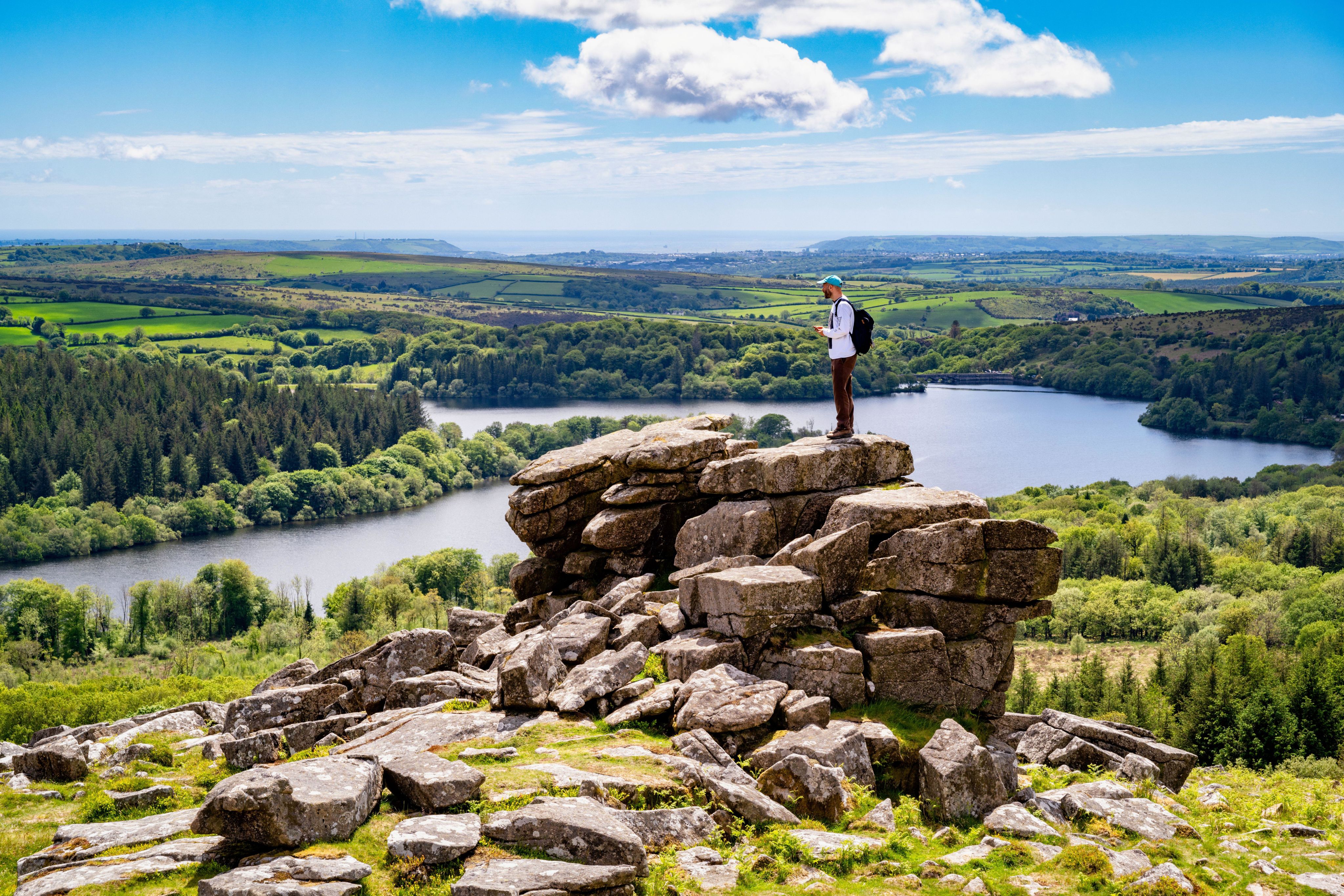
Starting on the banks of the Meldon Reservoir near Okehampton, this 6-mile loop will take you out onto the north moors and Dartmoor’s two highest tors, where you can catch your breath while taking in some of the national park’s finest views. Be sure to wear sturdy, waterproof walking boots, as this route can get boggy.
The last of eight reservoirs to be built in Dartmoor, Meldon Reservoir was completed in 1972 to dam the West Okement River and supply water to North Devon. After parking in the reservoir car park and crossing the dam, you’ll follow first the edge of the reservoir and then the West Okement River to reach Black-a-Tor Copse National Nature Reserve – one of three high-altitude oak woodlands on Dartmoor, it sits about 365m/1,200ft above sea level.
From here, you walk south-east over the top of Black Tor before continuing your ascent to the summit of High Willhays – the highest point on Dartmoor, at 621m/2,039ft above sea level.
Continuing north along the ridge on an old stone track, you’ll arrive at the summit of neighbouring Yes Tor, marked by a trig point and a military flagpole for firing warnings, before heading down a steep slope towards Longstone Hill and the reservoir beyond.


The view towards Yes Tor (above); Meldon Reservoir (top)
The view towards Yes Tor (above); Meldon Reservoir (top)
Meldon Reservoir
Meldon Reservoir
DISTANCE: 9.8km/6 miles
DIFFICULTY: Moderate
Starting on the banks of the Meldon Reservoir near Okehampton, this 6-mile loop will take you out onto the north moors and Dartmoor’s two highest tors, where you can catch your breath while taking in some of the national park’s finest views. Be sure to wear sturdy, waterproof walking boots, as this route can get boggy.
The last of eight reservoirs to be built in Dartmoor, Meldon Reservoir was completed in 1972 to dam the West Okement River and supply water to North Devon. After parking in the reservoir car park and crossing the dam, you’ll follow first the edge of the reservoir and then the West Okement River to reach Black-a-Tor Copse National Nature Reserve – one of three high-altitude oak woodlands on Dartmoor, it sits about 365m/1,200ft above sea level.
The view towards Yes Tor
The view towards Yes Tor
From here, you walk south-east over the top of Black Tor before continuing your ascent to the summit of High Willhays – the highest point on Dartmoor, at 621m/2,039ft above sea level.
Continuing north along the ridge on an old stone track, you’ll arrive at the summit of neighbouring Yes Tor, marked by a trig point and a military flagpole for firing warnings, before heading down a steep slope towards Longstone Hill and the reservoir beyond.
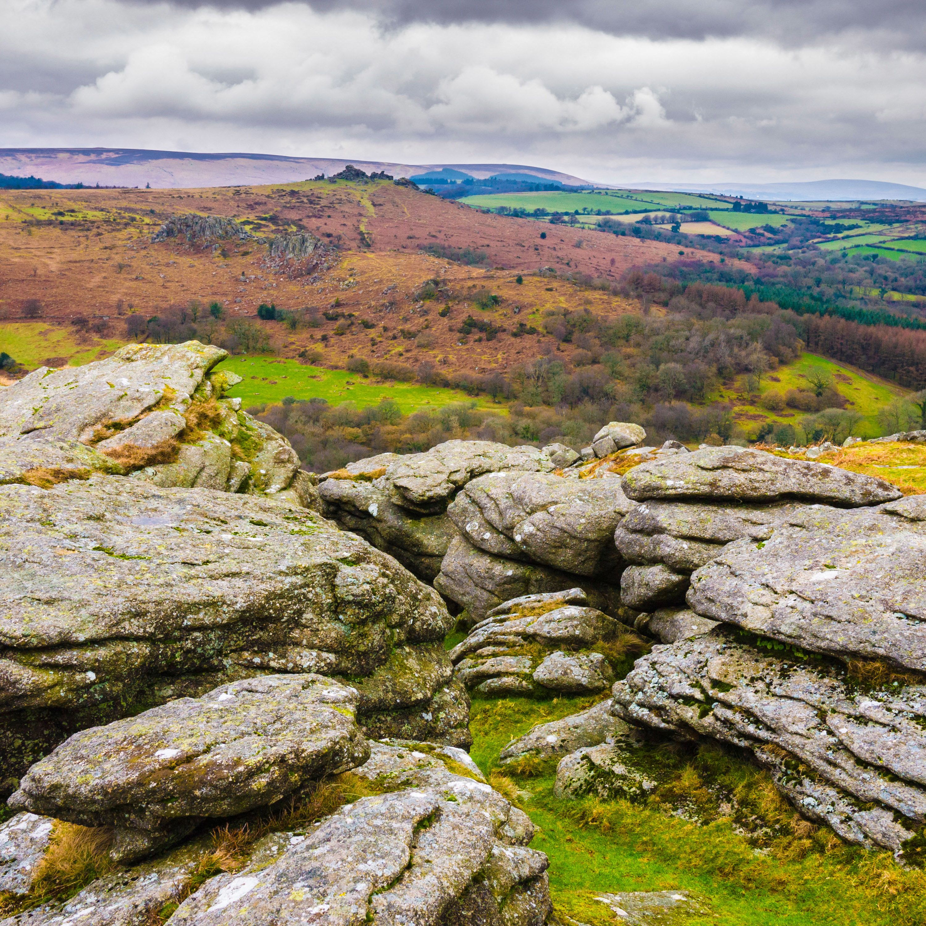
8
Tor bagging from Two Bridges


Crockern Tor (above); Littaford Tor (top)
Crockern Tor (above); Littaford Tor (top)
DISTANCE: 11.1km/7 miles
DIFFICULTY: Moderate
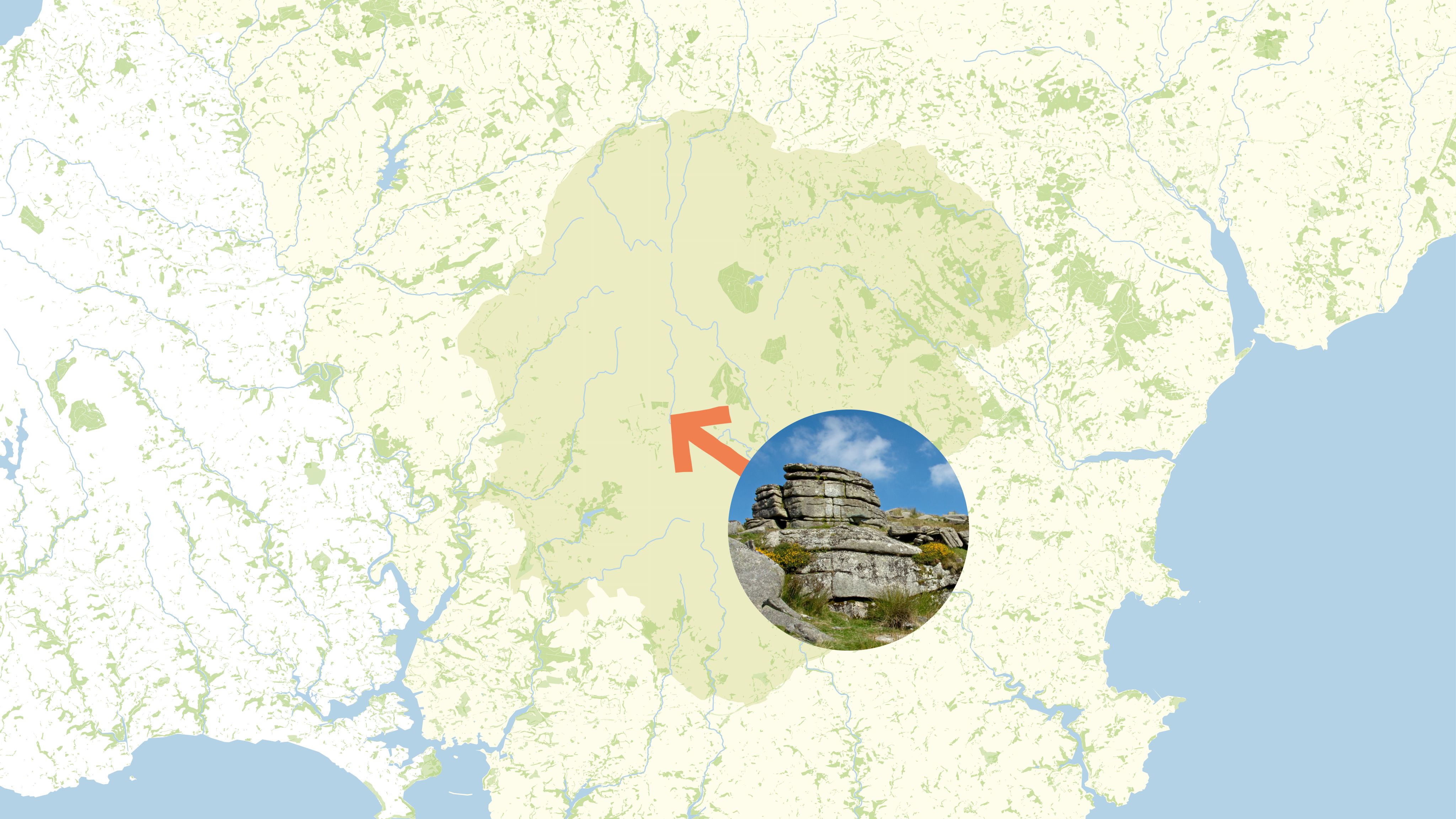
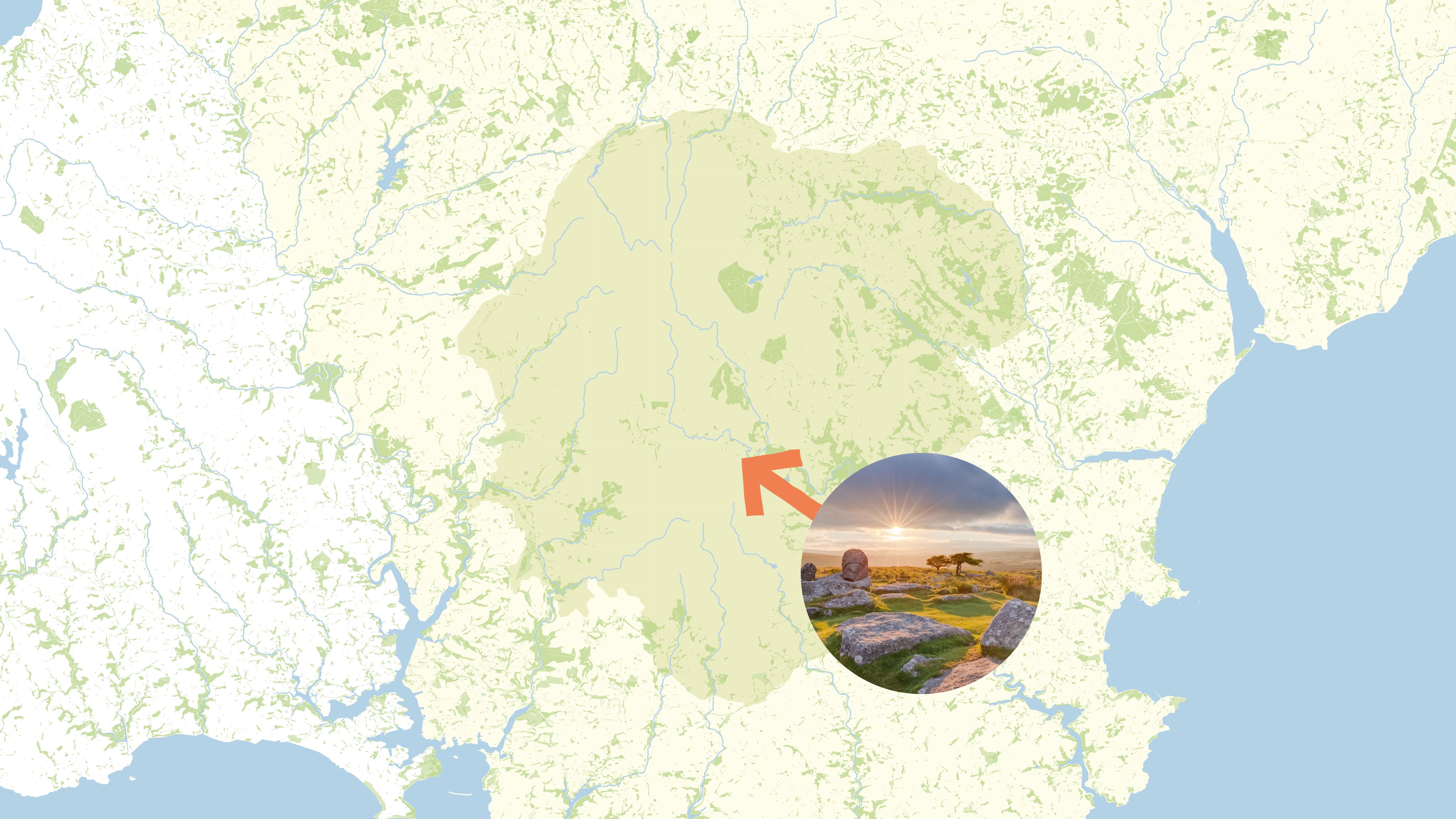
If your motivation is ticking off as many tors as possible – known locally as ‘tor bagging’ – this scenic loop in the heart of the national park is hard to beat.
Starting your ascent from the car park opposite the Two Bridges Hotel, the first stop is Crockern Tor. This once served as the open-air meeting place of Dartmoor’s Stannary Parliament – the governing body for local tin miners – who gathered here between the 15th and 18th centuries to make laws for the industry. Among the notable Lord Wardens of the Stannaries was Sir Walter Raleigh, who presided over a court at Crockern Tor on 27 October 1600.
Next up is Littaford Tor, shortly followed by Longaford Tor, with views of Beardown Tors to the west and the road to Postbridge to the east.
A further climb takes you to the highest point of the walk – Higher White Tor, at an altitude of about 527m/1,729ft – before descending to Lower White Tor. From here, you can see Rough Tor, just under a mile to the west, along with the television mast at North Hessary Tor in the south.
Walking south across open moorland, you’ll reach the West Dart River, which you cross to follow the banks of the Devonport Leat to Beardown Farm, before joining a wooded path back to Two Bridges.
Littaford Tor
Littaford Tor
DISTANCE: 11.1km/7 miles
DIFFICULTY: Moderate
If your motivation is ticking off as many tors as possible – known locally as ‘tor bagging’ – this scenic loop in the heart of the national park is hard to beat.
Starting your ascent from the car park opposite the Two Bridges Hotel, the first stop is Crockern Tor. This once served as the open-air meeting place of Dartmoor’s Stannary Parliament – the governing body for local tin miners – who gathered here between the 15th and 18th centuries to make laws for the industry. Among the notable Lord Wardens of the Stannaries was Sir Walter Raleigh, who presided over a court at Crockern Tor on 27 October 1600.
Crockern Tor
Crockern Tor
Next up is Littaford Tor, shortly followed by Longaford Tor, with views of Beardown Tors to the west and the road to Postbridge to the east.
A further climb takes you to the highest point of the walk – Higher White Tor, at an altitude of about 527m/1,729ft – before descending to Lower White Tor. From here, you can see Rough Tor, just under a mile to the west, along with the television mast at North Hessary Tor in the south.
Walking south across open moorland, you’ll reach the West Dart River, which you cross to follow the banks of the Devonport Leat to Beardown Farm, before joining a wooded path back to Two Bridges.
9
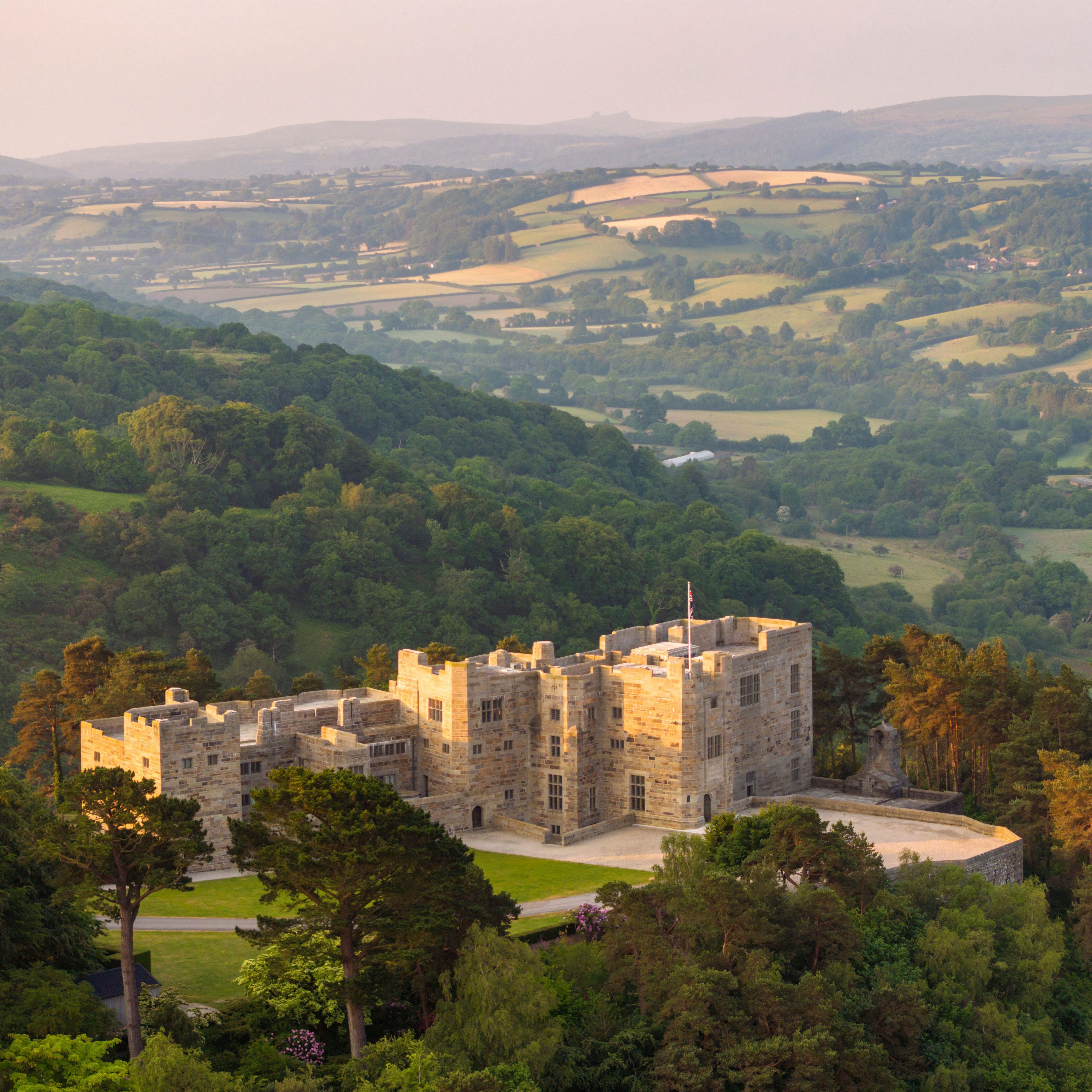
Castle Drogo and the Teign Gorge


DISTANCE: 6.9km/4¼ miles
DIFFICULTY: Moderate
Enjoy history, stunning valley views and ancient woodlands on this circular walk through the Teign Valley on the northern fringes of Dartmoor National Park.
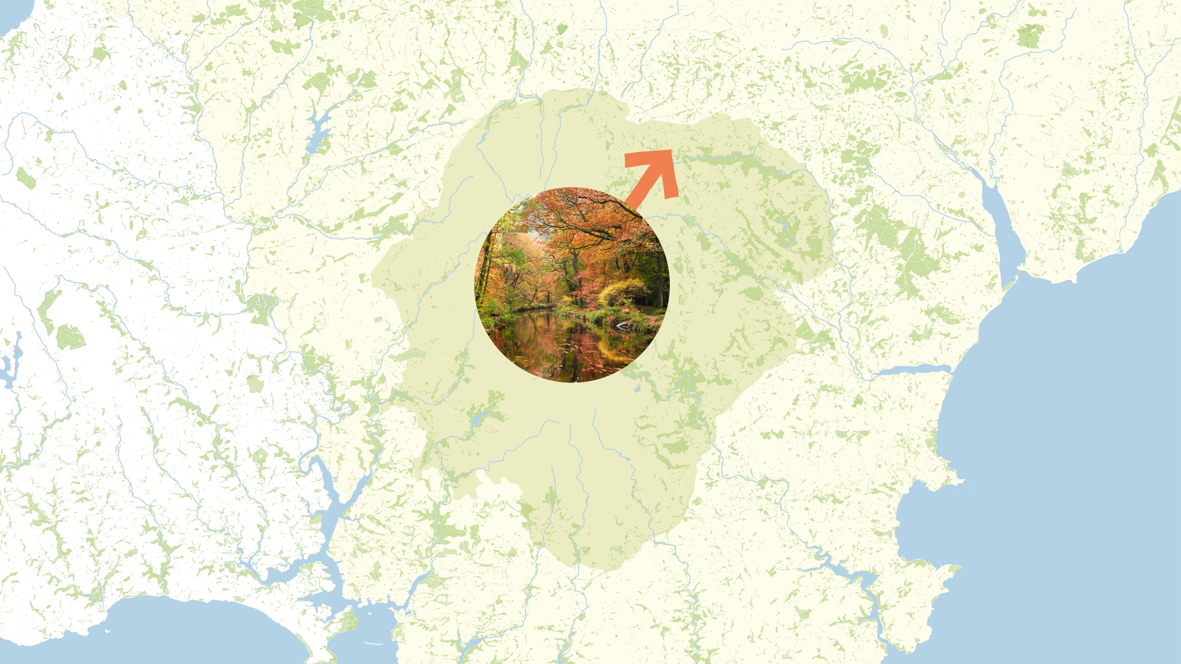
The route starts near the village of Drewsteignton, at Castle Drogo. Although the name might conjure images of a medieval fortress, it’s actually England’s youngest castle, completed in 1930. Designed by architect Edwin Lutyens, it was the grand family home of Julius Drewe, founder of the Home and Colonial Stores, once one of the UK’s largest retail chains.
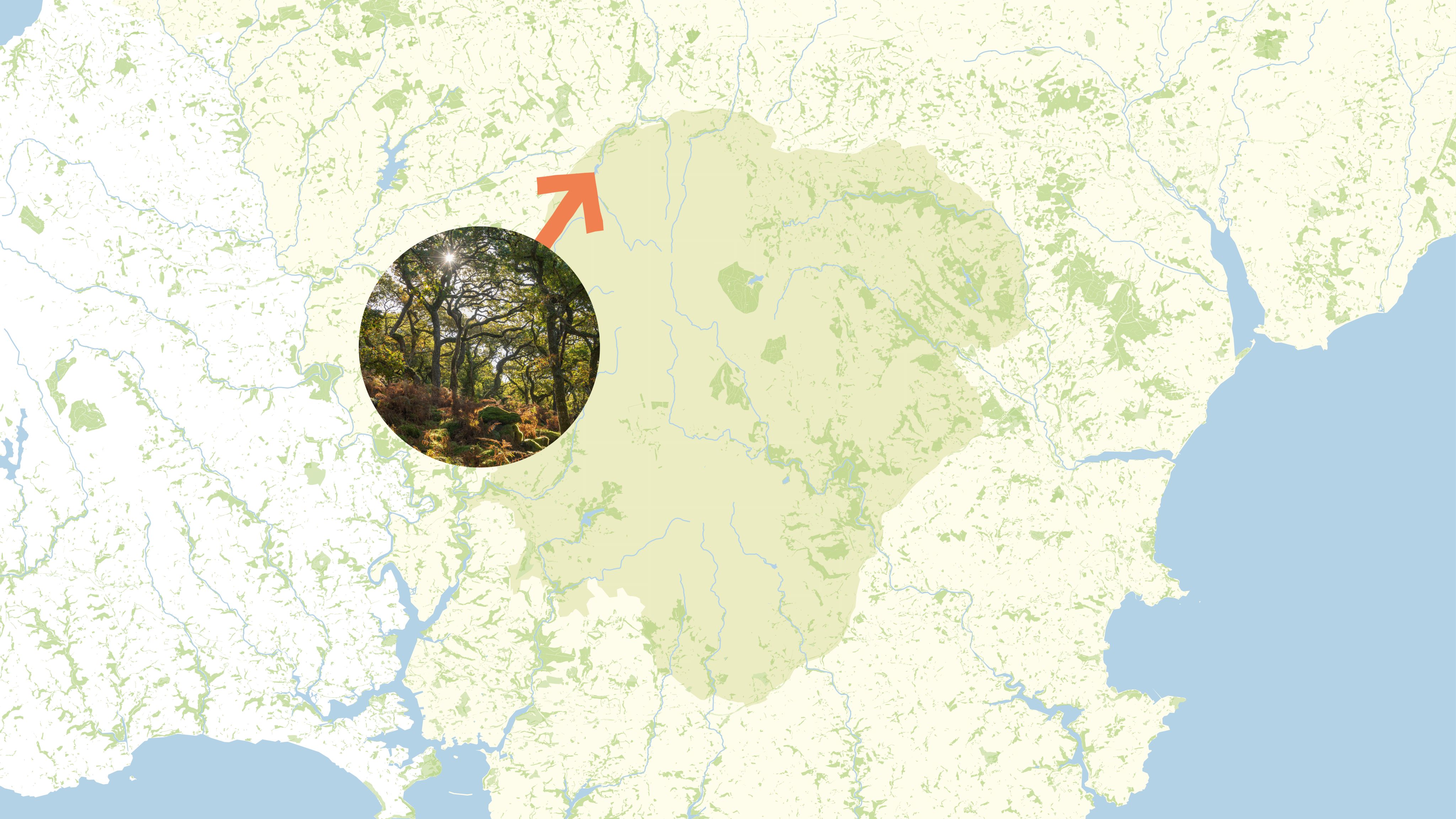
After exploring the castle (now run by the National Trust), you can follow a path along the top of the Teign Gorge, crossing the wonderfully named Piddledown Common on the way to the summit of Sharp Tor. From here, you can enjoy spectacular views across the valley to Whiddon Wood – an ancient woodland that’s the focus of one of England’s largest woodland restoration projects.
After traversing the valley and crossing the River Teign at the 17th-century stone-arch Fingle Bridge, you’ll follow a riverside path that takes you through Hannicombe Wood, Whiddon Wood and the boundary of Whiddon Deer Park on your way back to the castle.

Sharp Tor (above); Castle Drogo (top)
Sharp Tor (above); Castle Drogo (top)
Castle Drogo
Castle Drogo
DISTANCE: 6.9km/4¼ miles
DIFFICULTY: Moderate
Enjoy history, stunning valley views and ancient woodlands on this circular walk through the Teign Valley on the northern fringes of Dartmoor National Park.
The route starts near the village of Drewsteignton, at Castle Drogo. Although the name might conjure images of a medieval fortress, it’s actually England’s youngest castle, completed in 1930. Designed by architect Edwin Lutyens, it was the grand family home of Julius Drewe, founder of the Home and Colonial Stores, once one of the UK’s largest retail chains.
Sharp Tor
Sharp Tor
After exploring the castle (now run by the National Trust), you can follow a path along the top of the Teign Gorge, crossing the wonderfully named Piddledown Common on the way to the summit of Sharp Tor. From here, you can enjoy spectacular views across the valley to Whiddon Wood – an ancient woodland that’s the focus of one of England’s largest woodland restoration projects.
After traversing the valley and crossing the River Teign at the 17th-century stone-arch Fingle Bridge, you’ll follow a riverside path that takes you through Hannicombe Wood, Whiddon Wood and the boundary of Whiddon Deer Park on your way back to the castle.
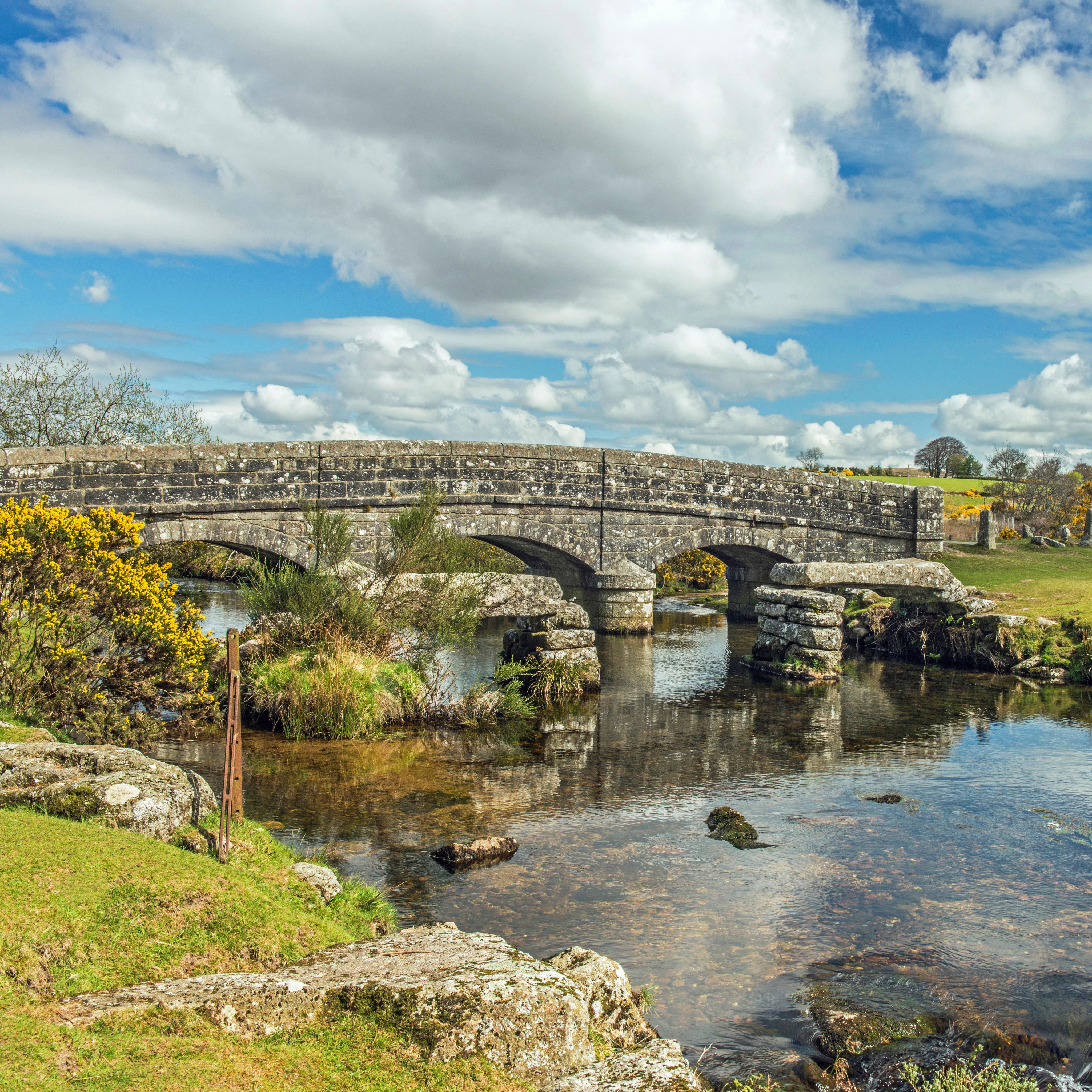
10
Hexworthy to Holne and back


Medieval Newbridge (above); Dartmeet, where the East and West Dart rivers converge (top)
Medieval Newbridge (above); Dartmeet, where the East and West Dart rivers converge (top)
DISTANCE: 18.2km/11¼ miles
DIFFICULTY: Strenuous
It might be hard going, but this 11-mile circuit that winds its way around the Dart Valley is well worth the effort. The steep ascents are rewarded with some of Dartmoor’s finest views. Be warned, though: it can be muddy after rain and should be tackled on a clear day, when the final stretch over open moorland is easier to follow.
Starting at Hexworthy Bridge car park, you’ll pass through Dartmeet, where the East and West Dart rivers converge, on your way up to Sharp Tor, where a steady climb to the top is rewarded with splendid views.
Shortly after, you’ll join a section of the Two Moors Way, following a fine ridge-top track high above the wooded valley on your way to Newbridge – a medieval bridge over the river – and Holne, where you can visit the 13th-century church of St Mary the Virgin.
The return leg crosses the open moor (careful navigation required) to Combestone Tor, with expansive views over the Dart, before delivering you back to Hexworthy.
Dartmeet, where the East and West Dart rivers converge
Dartmeet, where the East and West Dart rivers converge
DISTANCE: 18.2km/11¼ miles
DIFFICULTY: Strenuous
It might be hard going, but this 11-mile circuit that winds its way around the Dart Valley is well worth the effort. The steep ascents are rewarded with some of Dartmoor’s finest views. Be warned, though: it can be muddy after rain and should be tackled on a clear day, when the final stretch over open moorland is easier to follow.
Starting at Hexworthy Bridge car park, you’ll pass through Dartmeet, where the East and West Dart rivers converge, on your way up to Sharp Tor, where a steady climb to the top is rewarded with splendid views.
Medieval Newbridge
Medieval Newbridge
Shortly after, you’ll join a section of the Two Moors Way, following a fine ridge-top track high above the wooded valley on your way to Newbridge – a medieval bridge over the river – and Holne, where you can visit the 13th-century church of St Mary the Virgin.
The return leg crosses the open moor (careful navigation required) to Combestone Tor, with expansive views over the Dart, before delivering you back to Hexworthy.
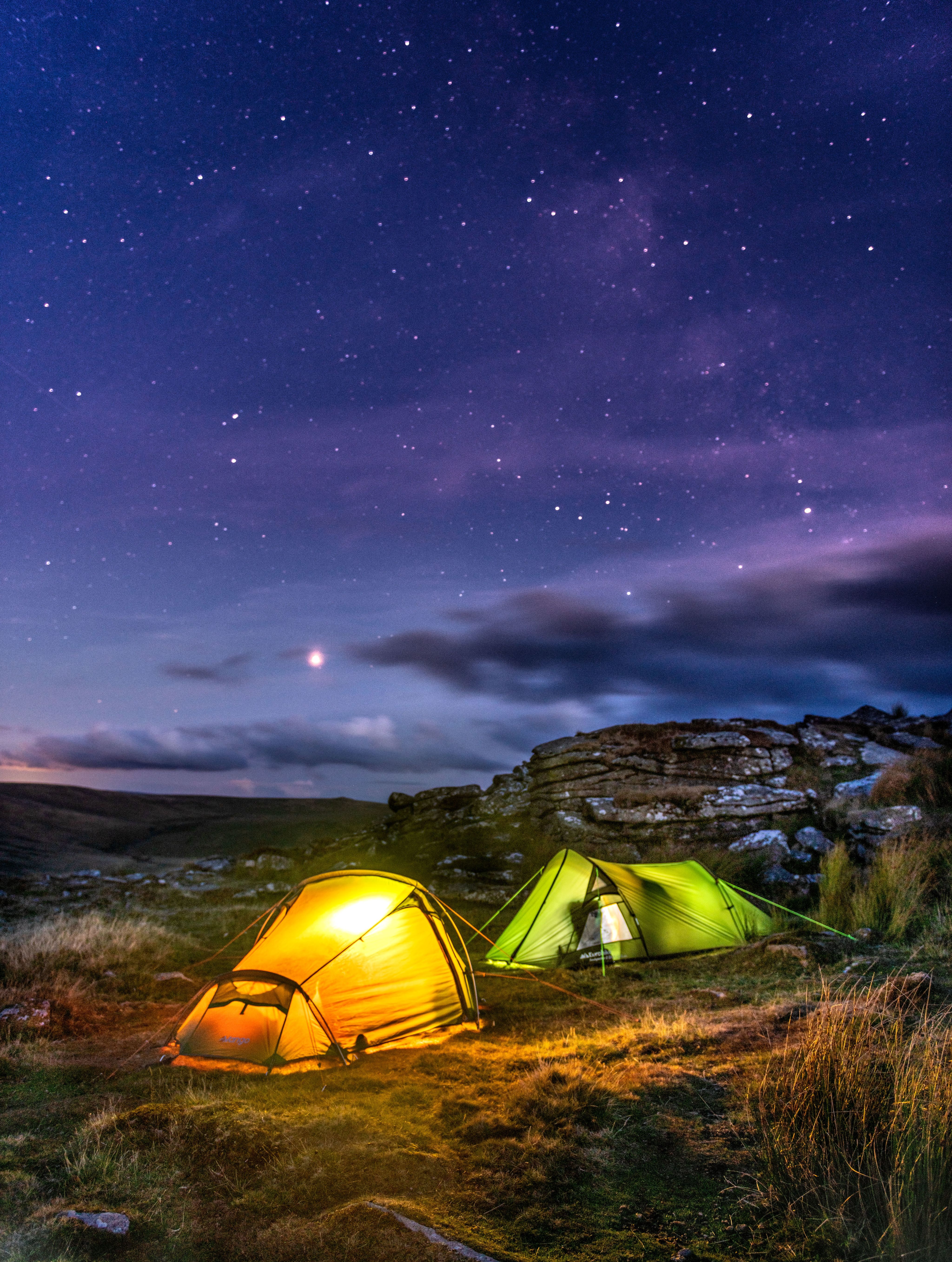
Wild camping on Dartmoor
For a unique experience, come equipped for a stay under the stars
Dartmoor is the only place in England where it’s legal to wild camp without needing approval from a landowner. This means you can extend your visit by spending a night or two in the national park, as long as you can carry everything you need in a backpack. (No overnight stays in vehicles are allowed.)
Wild camping on Dartmoor offers a rare opportunity to enjoy a night in blissful isolation and, with very little light pollution, it’s one of the best places in the country for stargazing on a clear night.
If you’re interested, you should start by checking the park authority’s interactive map, which shows where you can camp. It’s also important to avoid any of the park’s Military Training Areas while they’re in use for live firing. The boundaries of these ranges are marked on the ground by a series of red and white posts with warning notices.

To help protect Dartmoor’s fragile moorland environment, all wild campers should follow the Backpack Camping code. This requires you to travel light with a small tent, stay one or two nights only, keep out of sight of roads and buildings, travel in groups of no more than six, and leave no trace of your visit by burying your poo (don’t forget a trowel) and taking all your rubbish home with you.
Photography and video: Alamy, AWL, Justin Foulkes/4Corners, Getty Images, Shutterstock

We are the Ramblers, Britain’s walking charity. We open the way for everyone to enjoy the simple pleasures of walking. And we step up to protect the places we all love to wander. Click to find out more.

The Ramblers’ Association is a company limited by guarantee, registered in England and Wales. Company registration no. 4458492. Registered charity, England & Wales no. 1093577, Scotland no. SCO39799.
© Ramblers 2026